 |
|
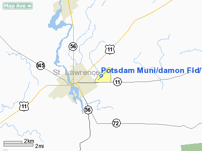
Potsdam Muni/damon Fld/ Airport |
Potsdam Municipal Airport
Damon Field |
| IATA: none – ICAO: KPTD – FAA LID: PTD |
| Summary |
| Airport type |
Public |
| Owner |
Village of Potsdam |
| Serves |
Potsdam, New York |
| Elevation AMSL |
474 ft / 144 m |
| Coordinates |
44°40′36″N 074°56′54″W / 44.67667°N 74.94833°W / 44.67667; -74.94833 |
| Runways |
| Direction |
Length |
Surface |
| ft |
m |
| 6/24 |
3,705 |
1,129 |
Asphalt |
| Statistics (2007) |
| Aircraft operations |
6,000 |
| Based aircraft |
15 |
| Source: Federal Aviation Administration |
Potsdam Municipal Airport (ICAO: KPTD, FAA LID: PTD), also known as Damon Field, is a village-owned, public-use airport located two nautical miles (3.7 km) east of the central business district of Potsdam, a village in St. Lawrence County, New York, United States. According to the FAA's National Plan of Integrated Airport Systems for 2009–2013, it is classified as a general aviation airport. The airport does not have any scheduled commercial service.
Although many U.S. airports use the same three-letter location identifier for the FAA and IATA, this airport is assigned PTD by the FAA but has no designation from the IATA (which assigned PTD to Port Alexander Seaplane Base in Port Alexander, Alaska).
Facilities and aircraft
Potsdam Municipal Airport covers an area of 168 acres (68 ha) at an elevation of 474 feet (144 m) above mean sea level. It has one runway designated 6/24 with an asphalt surface measuring 3,705 by 60 feet (1,129 x 18 m).
For the 12-month period ending December 6, 2007, the airport had 6,000 aircraft operations, an average of 16 per day: 92% general aviation, 5% military and 3% air taxi. At that time there were 15 aircraft based at this airport: 93% single-engine and 7% ultralight.
The above content comes from Wikipedia and is published under free licenses – click here to read more.
Location & QuickFacts
| FAA Information Effective: | 2008-09-25 |
| Airport Identifier: | PTD |
| Airport Status: | Operational |
| Longitude/Latitude: | 074-56-54.4070W/44-40-36.0090N
-74.948446/44.676669 (Estimated) |
| Elevation: | 474 ft / 144.48 m (Estimated) |
| Land: | 168 acres |
| From nearest city: | 2 nautical miles E of Potsdam, NY |
| Location: | St Lawrence County, NY |
| Magnetic Variation: | 14W (1970) |
Owner & Manager
| Ownership: | Publicly owned |
| Owner: | Village Of Potsdam |
| Address: | Civic Center, Po Box 5168
Potsdam, NY 13676 |
| Phone number: | 315-265-7480 |
| Manager: | Brad Clements |
| Address: | Civic Center, Po Box 5168
Potsdam, NY 13676 |
| Phone number: | 315-268-1000
HOME 315-268-8839. |
Airport Operations and Facilities
| Airport Use: | Open to public |
| Wind indicator: | Yes |
| Segmented Circle: | Yes |
| Control Tower: | No |
| Lighting Schedule: | DUSK-DAWN
ACTVT MIRL RY 06/24; REIL RYS 06 & 24; PAPI RYS 06 & 24 & TWY LGTS - CTAF. |
| Beacon Color: | Clear-Green (lighted land airport) |
| Landing fee charge: | No |
| Sectional chart: | Montreal |
| Region: | AEA - Eastern |
| Traffic Pattern Alt: | 800 ft |
| Boundary ARTCC: | ZBW - Boston |
| Tie-in FSS: | BTV - Burlington |
| FSS on Airport: | No |
| FSS Toll Free: | 1-800-WX-BRIEF |
| NOTAMs Facility: | PTD (NOTAM-d service avaliable) |
| Federal Agreements: | NGY |
Airport Communications
| CTAF: | 122.800 |
| Unicom: | 122.800 |
Airport Services
| Fuel available: | 100LL
24 HR SELF-SERVE |
| Airframe Repair: | MAJOR |
| Power Plant Repair: | MAJOR |
| Bottled Oxygen: | NONE |
| Bulk Oxygen: | NONE |
Runway Information
Runway 06/24
| Dimension: | 3705 x 60 ft / 1129.3 x 18.3 m |
| Surface: | ASPH, Good Condition |
| Weight Limit: | Single wheel: 30000 lbs. |
| Edge Lights: | Medium |
| |
Runway 06 |
Runway 24 |
| Longitude: | 074-57-12.2130W | 074-56-36.5460W |
| Latitude: | 44-40-22.8750N | 44-40-49.1320N |
| Elevation: | 471.00 ft | 468.00 ft |
| Alignment: | 44 | 127 |
| Traffic Pattern: | Left | Left |
| Markings: | Basic, Good Condition | Non-precision instrument, Good Condition |
| Crossing Height: | 45.00 ft | 45.00 ft |
| VASI: | 2-light PAPI on left side | 2-light PAPI on left side |
| Visual Glide Angle: | 3.00° | 3.00° |
| Runway End Identifier: | Yes | Yes |
| Obstruction: | 35 ft tree, 1302.0 ft from runway, 310 ft right of centerline, 31:1 slope to clear | 64 ft tree, 1260.0 ft from runway, 157 ft right of centerline, 16:1 slope to clear |
|
Radio Navigation Aids
| ID |
Type |
Name |
Ch |
Freq |
Var |
Dist |
| PTD | NDB | Potsdam | | 400.00 | 14W | 4.0 nm |
| YUP | NDB | Uplands | | 352.00 | 14W | 40.5 nm |
| YRR | NDB | Greely | | 377.00 | 14W | 44.4 nm |
| YSH | NDB | Smiths Falls | | 334.00 | 13W | 47.3 nm |
| OW | NDB | Ottawa | | 236.00 | 14W | 48.6 nm |
| O | NDB | Oscar | | 344.00 | 14W | 49.7 nm |
| GTB | NDB | Drum | | 257.00 | 13W | 49.8 nm |
| UUP | TACAN | Uplands | 025X | | 14W | 49.3 nm |
| SLK | VOR/DME | Saranac Lake | 029X | 109.20 | 14W | 36.4 nm |
| MSS | VORTAC | Massena | 088X | 114.10 | 14W | 17.2 nm |
Remarks
- NDB LCTD 3 MILES OUT ON RWY 24 C/L XTDD.
- RY COND NOT MONITORED; RCMD VISUAL INSPECTION PRIOR TO USE.
- DEER ON & INVOF ARPT.
- EXPECT FLIGHT TRAINING OPS INV OF ARPT.
- NOISE ABATEMENT PROCEDURES IN EFFECT, CALL AMGR FOR FOR DETAILS AT 315-268-1000.
- EXISTED PRIOR TO 1959.
Images and information placed above are from
http://www.airport-data.com/airport/PTD/
We thank them for the data!
| General Info
|
| Country |
United States
|
| State |
NEW YORK
|
| FAA ID |
PTD
|
| Latitude |
44-40-36.009N
|
| Longitude |
074-56-54.407W
|
| Elevation |
474 feet
|
| Near City |
POTSDAM
|
We don't guarantee the information is fresh and accurate. The data may
be wrong or outdated.
For more up-to-date information please refer to other sources.
|
|


