 |
|
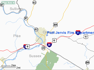
Port Jervis Fire Department Heliport |
Location & QuickFacts
| FAA Information Effective: | 2008-09-25 |
| Airport Identifier: | NY08 |
| Airport Status: | Operational |
| Longitude/Latitude: | 074-40-33.5850W/41-22-37.3370N
-74.675996/41.377038 (Estimated) |
| Elevation: | 420 ft / 128.02 m (Estimated) |
| Land: | 3 acres |
| From nearest city: | 1 nautical miles E of Port Jervis, NY |
| Location: | Orange County, NY |
| Magnetic Variation: | 13W (1985) |
Owner & Manager
| Ownership: | Publicly owned |
| Owner: | Port Jervis Fire Department |
| Address: | 20 Hammond St
Port Jervis, NY 12771 |
| Phone number: | 914-858-4099 |
| Manager: | Chief, Port Jervis Fire Dept |
| Address: | 20 Hammond St
Port Jervis, NY 12771 |
| Phone number: | 914-856-1100 |
Airport Operations and Facilities
| Airport Use: | Private |
| Segmented Circle: | No |
| Control Tower: | No |
| Lighting Schedule: | PHONE REQ
FOR HELIPAD LGTS CALL FIRE DEPT DISPATCHER 914-856-1100. |
| Landing fee charge: | No |
| Sectional chart: | New York |
| Region: | AEA - Eastern |
| Boundary ARTCC: | ZNY - New York |
| Tie-in FSS: | ISP - New York |
| FSS on Airport: | No |
| FSS Toll Free: | 1-800-WX-BRIEF |
Runway Information
Helipad H1
| Dimension: | 100 x 90 ft / 30.5 x 27.4 m |
| Surface: | ASPH, Poor Condition |
| |
Runway H1 |
Runway |
| Traffic Pattern: | Left | Left |
|
Radio Navigation Aids
| ID |
Type |
Name |
Ch |
Freq |
Var |
Dist |
| SKU | FAN MARKER | Stanwyck | | | 12W | 29.8 nm |
| EWR | FAN MARKER | Maryann | | | 11W | 46.2 nm |
| SW | NDB | Neely | | 335.00 | 14W | 21.2 nm |
| MS | NDB | Monga | | 359.00 | 12W | 24.8 nm |
| SKU | NDB | Stanwyck | | 261.00 | 12W | 29.8 nm |
| PO | NDB | Meier | | 403.00 | 12W | 34.2 nm |
| PNJ | NDB | Paterson | | 347.00 | 12W | 35.1 nm |
| CAT | NDB | Chatham | | 254.00 | 11W | 39.8 nm |
| HUO | VOR/DME | Huguenot | 108X | 116.10 | 11W | 4.3 nm |
| STW | VOR/DME | Stillwater | 033X | 109.60 | 11W | 24.5 nm |
| BWZ | VOR/DME | Broadway | 089X | 114.20 | 11W | 35.4 nm |
| IGN | VOR/DME | Kingston | 123X | 117.60 | 12W | 42.1 nm |
| TEB | VOR/DME | Teterboro | 021X | 108.40 | 11W | 42.2 nm |
| SBJ | VOR/DME | Solberg | 076X | 112.90 | 10W | 47.8 nm |
| CMK | VOR/DME | Carmel | 113X | 116.60 | 12W | 49.8 nm |
| DNY | VOR/DME | De Lancey | 058X | 112.10 | 11W | 49.8 nm |
| SAX | VORTAC | Sparta | 104X | 115.70 | 11W | 19.6 nm |
| LHY | VORTAC | Lake Henry | 045X | 110.80 | 10W | 36.8 nm |
| LVZ | VORTAC | Wilkes-barre | 053X | 111.60 | 10W | 46.2 nm |
Remarks
Images and information placed above are from
http://www.airport-data.com/airport/NY08/
We thank them for the data!
| General Info
|
| Country |
United States
|
| State |
NEW YORK
|
| FAA ID |
NY08
|
| Latitude |
41-22-37.337N
|
| Longitude |
074-40-33.585W
|
| Elevation |
420 feet
|
| Near City |
PORT JERVIS
|
We don't guarantee the information is fresh and accurate. The data may
be wrong or outdated.
For more up-to-date information please refer to other sources.
|
|


