 |
|
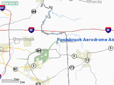
Poolsbrook Aerodrome Airport |
Location & QuickFacts
| FAA Information Effective: | 2008-09-25 |
| Airport Identifier: | NY72 |
| Airport Status: | Operational |
| Longitude/Latitude: | 075-56-18.7000W/43-04-20.2410N
-75.938528/43.072289 (Estimated) |
| Elevation: | 500 ft / 152.40 m (Estimated) |
| Land: | 0 acres |
| From nearest city: | 6 nautical miles N of Manlius, NY |
| Location: | Onondaga County, NY |
| Magnetic Variation: | 12W (1985) |
Owner & Manager
| Ownership: | Privately owned |
| Owner: | Mark Laurin |
| Address: | 6229 Poolsbrook Rd
Kirkville, NY 13082 |
| Phone number: | 315-687-9506 |
| Manager: | Mark Laurin |
| Address: | 6229 Poolsbrook Rd
Kirkville, NY 13082 |
| Phone number: | 315-687-9506 |
Airport Operations and Facilities
| Airport Use: | Private |
| Wind indicator: | Yes |
| Segmented Circle: | No |
| Control Tower: | No |
| Sectional chart: | New York |
| Region: | AEA - Eastern |
| Boundary ARTCC: | ZBW - Boston |
| Tie-in FSS: | BUF - Buffalo |
| FSS on Airport: | No |
| FSS Toll Free: | 1-800-WX-BRIEF |
Runway Information
Runway 09/27
| Dimension: | 1400 x 80 ft / 426.7 x 24.4 m |
| Surface: | TURF, |
| |
Runway 09 |
Runway 27 |
| Traffic Pattern: | Left | Left |
|
Radio Navigation Aids
| ID |
Type |
Name |
Ch |
Freq |
Var |
Dist |
| BK | NDB | Plein | | 329.00 | 12W | 21.9 nm |
| CJY | NDB | Clay | | 275.00 | 12W | 29.6 nm |
| GSS | TACAN | Griffiss | 057X | | 12W | 25.0 nm |
| ITH | VOR/DME | Ithaca | 055X | 111.80 | 10W | 41.6 nm |
| RKA | VOR/DME | Rockdale | 073X | 112.60 | 11W | 47.7 nm |
| SYR | VORTAC | Syracuse | 117X | 117.00 | 11W | 12.8 nm |
| GGT | VORTAC | Georgetown | 125X | 117.80 | 11W | 17.7 nm |
| UCA | VORTAC | Utica | 049X | 111.20 | 12W | 34.1 nm |
Remarks
- RWY 08 IS RENUMBERED RWY 10; RWY 10 THRESHOLD IS DSPLCD 150' TO ENSURE 20:1 AND MARKED; CONTACT MGR SYRCAUSE ATCT ON ESTBLISHED OPERATING PROCEDURES IN ARSA.
Images and information placed above are from
http://www.airport-data.com/airport/NY72/
We thank them for the data!
| General Info
|
| Country |
United States
|
| State |
NEW YORK
|
| FAA ID |
NY72
|
| Latitude |
43-04-20.241N
|
| Longitude |
075-56-18.700W
|
| Elevation |
500 feet
|
| Near City |
MANLIUS
|
We don't guarantee the information is fresh and accurate. The data may
be wrong or outdated.
For more up-to-date information please refer to other sources.
|
|


