 |
|
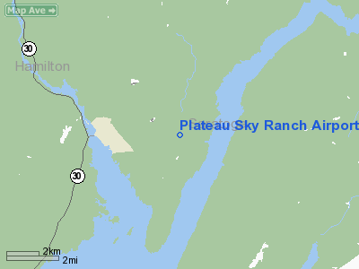
Plateau Sky Ranch Airport |
Location & QuickFacts
| FAA Information Effective: | 2008-09-25 |
| Airport Identifier: | 1F2 |
| Airport Status: | Operational |
| Longitude/Latitude: | 074-06-53.4700W/43-13-30.2590N
-74.114853/43.225072 (Estimated) |
| Elevation: | 1070 ft / 326.14 m (Surveyed) |
| Land: | 125 acres |
| From nearest city: | 1 nautical miles NW of Edinburg, NY |
| Location: | Saratoga County, NY |
| Magnetic Variation: | 14W (1985) |
Owner & Manager
| Ownership: | Privately owned |
| Owner: | Bruce Brownell |
| Address: | 98 Northville Road
Edinburg, NY 12134 |
| Phone number: | 518-863-4338 |
| Manager: | Bruce R. Brownell |
| Address: | 98 Northville Road
Edinburg, NY 12134 |
| Phone number: | 518-863-4338 |
Airport Operations and Facilities
| Airport Use: | Open to public |
| Wind indicator: | Yes |
| Segmented Circle: | Yes |
| Control Tower: | No |
| Landing fee charge: | No |
| Sectional chart: | New York |
| Region: | AEA - Eastern |
| Boundary ARTCC: | ZBW - Boston |
| Tie-in FSS: | BTV - Burlington |
| FSS on Airport: | No |
| FSS Toll Free: | 1-800-WX-BRIEF |
| NOTAMs Facility: | BTV (NOTAM-d service avaliable) |
Airport Communications
| CTAF: | 122.800 |
| Unicom: | 122.800 |
Airport Services
| Airframe Repair: | NONE |
| Power Plant Repair: | NONE |
Runway Information
Runway 01/19
| Dimension: | 2000 x 100 ft / 609.6 x 30.5 m
RWY WIDTH EDGE MARKED WITH RED CONES ALL SEASONS EXCEPT WINTER
RWY WIDTH EDGE MARKED WITH RED CONES ALL SEASONS EXCEPT WINTER |
| Surface: | TURF, Good Condition |
| |
Runway 01 |
Runway 19 |
| Traffic Pattern: | Left | Left |
| Obstruction: | 10 ft road | 15 ft road, 0.0 ft from runway, 48 ft right of centerline |
|
Runway 06/24
| Dimension: | 2400 x 100 ft / 731.5 x 30.5 m
RWY WIDTH EDGE MARKED WITH RED CONES ALL SEASONS EXCEPT WINTER
RWY WIDTH EDGE MARKED WITH RED CONES ALL SEASONS EXCEPT WINTER |
| Surface: | TURF, Good Condition |
| |
Runway 06 |
Runway 24 |
| Traffic Pattern: | Left | Left |
| Obstruction: | 15 ft road, 76 ft left of centerline | 15 ft trees, 6.0 ft from runway, 48 ft left of centerline |
|
Radio Navigation Aids
| ID |
Type |
Name |
Ch |
Freq |
Var |
Dist |
| JJH | NDB | Johnstown | | 523.00 | 14W | 16.6 nm |
| HEU | NDB | Hunter | | 356.00 | 14W | 23.7 nm |
| CAM | VOR/DME | Cambridge | 097X | 115.00 | 14W | 36.6 nm |
| GFL | VORTAC | Glens Falls | 039X | 110.20 | 14W | 23.1 nm |
| ALB | VORTAC | Albany | 100X | 115.30 | 13W | 31.8 nm |
| UCA | VORTAC | Utica | 049X | 111.20 | 12W | 47.6 nm |
| ALB | VOT | Albany County | | 108.20 | | 31.7 nm |
Remarks
- ULTRALGT ACFT ON & INVOF ARPT.
- TRAP & SKEET SHOOTING BTN RYS 1 & 6.
- ACFT PARKED/HANGARED ON NON ARPT LAND. CROSS PUBLIC ROAD TO/FM ARPT.
- RY 24 HAS +15 ROAD, 11 FT FM RY AER BOTHSIDES.
- ESTABD PRIOR TO 1959
Images and information placed above are from
http://www.airport-data.com/airport/1F2/
We thank them for the data!
| General Info
|
| Country |
United States
|
| State |
NEW YORK
|
| FAA ID |
1F2
|
| Latitude |
43-13-30.259N
|
| Longitude |
074-06-53.470W
|
| Elevation |
1070 feet
|
| Near City |
EDINBURG
|
We don't guarantee the information is fresh and accurate. The data may
be wrong or outdated.
For more up-to-date information please refer to other sources.
|
|


