 |
|
| Piseco Airport |
| IATA: none – ICAO: none – FAA LID: K09 |
| Summary |
| Airport type |
Public |
| Operator |
Town of Arietta |
| Serves |
Piseco, New York |
| Elevation AMSL |
1,703 ft / 519.1 m |
| Coordinates |
43°27′12″N 074°31′04″W / 43.45333°N 74.51778°W / 43.45333; -74.51778 |
| Runways |
| Direction |
Length |
Surface |
| ft |
m |
| 4/22 |
3,100 |
945 |
Asphalt |
| Helipads |
| Number |
Length |
Surface |
| ft |
m |
| H1 |
|
|
Asphalt |
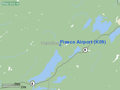
Piseco Airport (FAA LID: K09) is a public airport located one mile (2 km) north of the central business district (CBD) of Piseco, a village in Hamilton County, New York, USA. This general aviation airport, covering an area of 60 acres (240,000 m), has one runway and one helipad. It is operated by the Town of Arietta.
The above content comes from Wikipedia and is published under free licenses – click here to read more.
Location & QuickFacts
| FAA Information Effective: | 2008-09-25 |
| Airport Identifier: | K09 |
| Airport Status: | Operational |
| Longitude/Latitude: | 074-31-03.5430W/43-27-12.2480N
-74.517651/43.453402 (Estimated) |
| Elevation: | 1703 ft / 519.07 m (Surveyed) |
| Land: | 60 acres |
| From nearest city: | 1 nautical miles N of Piseco, NY |
| Location: | Hamilton County, NY |
| Magnetic Variation: | 14W (1985) |
Owner & Manager
| Ownership: | Publicly owned |
| Owner: | Town Of Arietta |
| Address: | Po Box 37
Piseco Lake, NY 12139 |
| Phone number: | 518-548-3415 |
| Manager: | Town Of Arietta (rick Higgins) |
| Address: | Box 37
Piseco Lake, NY 12139 |
| Phone number: | 518-548-8794
AFTER HRS CALL 518-548-6459/5413. |
Airport Operations and Facilities
| Airport Use: | Open to public |
| Wind indicator: | Yes |
| Segmented Circle: | Yes |
| Control Tower: | No |
| Lighting Schedule: | RDO-CTL
ACTVT MIRL RY 04/22; REIL RYS 04 & 22; PAPI RYS 04 & 22 & HELIPAD PERIMETER LGTS - CTAF. RY LIGHTS (ELECTRIC EYE OVER-RIDE). |
| Landing fee charge: | No |
| Sectional chart: | New York |
| Region: | AEA - Eastern |
| Boundary ARTCC: | ZBW - Boston |
| Tie-in FSS: | BUF - Buffalo |
| FSS on Airport: | No |
| FSS Toll Free: | 1-800-WX-BRIEF |
| NOTAMs Facility: | BUF (NOTAM-d service avaliable) |
| Federal Agreements: | NGY |
Airport Communications
| CTAF: | 122.800 |
| Unicom: | 122.800 |
Airport Services
| Fuel available: | 100LL |
| Airframe Repair: | NONE |
| Power Plant Repair: | NONE |
| Bottled Oxygen: | NONE |
| Bulk Oxygen: | NONE |
Runway Information
Runway 04/22
| Dimension: | 3015 x 60 ft / 919.0 x 18.3 m |
| Surface: | ASPH, Good Condition |
| Weight Limit: | Single wheel: 8000 lbs. |
| Edge Lights: | Medium |
| |
Runway 04 |
Runway 22 |
| Longitude: | 074-31-04.4400W | 074-30-43.5800W |
| Latitude: | 43-26-58.9400N | 43-27-24.5500N |
| Traffic Pattern: | Right | Left |
| Markings: | Basic, Good Condition | Basic, Good Condition |
| Crossing Height: | 45.00 ft | 0.00 ft |
| VASI: | 2-light PAPI on left side | 2-light PAPI on right side |
| Visual Glide Angle: | 3.00° | 0.00° |
| Runway End Identifier: | Yes | Yes |
| Centerline Lights: | No | |
| Touchdown Lights: | No | |
| Obstruction: | 3 ft road, 201.0 ft from runway, 122 ft right of centerline
ENTRANCE ROAD | 70 ft trees, 1105.0 ft from runway, 32 ft right of centerline, 12:1 slope to clear |
|
Helipad H1
| Dimension: | 40 x 40 ft / 12.2 x 12.2 m |
| Surface: | ASPH, Good Condition |
| |
Runway H1 |
Runway |
| Traffic Pattern: | Left | Left |
| Approach lights: | LDIN | |
|
Radio Navigation Aids
| ID |
Type |
Name |
Ch |
Freq |
Var |
Dist |
| JJH | NDB | Johnstown | | 523.00 | 14W | 28.5 nm |
| CJY | NDB | Clay | | 275.00 | 12W | 40.6 nm |
| HEU | NDB | Hunter | | 356.00 | 14W | 44.2 nm |
| BK | NDB | Plein | | 329.00 | 12W | 44.4 nm |
| GSS | TACAN | Griffiss | 057X | | 12W | 41.3 nm |
| UCA | VORTAC | Utica | 049X | 111.20 | 12W | 38.2 nm |
| GFL | VORTAC | Glens Falls | 039X | 110.20 | 14W | 40.1 nm |
Remarks
- CTN-MODERATE TURBULANCE IN APCH TO RWY 22.
-
- ACFT DEPARTING RY 22 ARE REQUESTED TO MAINTAIN RY HEADING UNTIL PAST ISLAND CHECKPOINT, PRIOR TO MAKING LEFT TURN. ACFT ARRIVING MAINTAIN RGT DOWNWIND HEADING UNTIL PAST ISLAND CHECKPOINT.
- TWYS HAVE REFLECTIVE MARKERS.
- EXPECT TURBULENCE & DOWNDRAFTS DURG PERIODS OF STRONG CROSSWINDS.
- AREA NOT MAINTAINED FOR SKI EQUIPPED ACFT.
- RY 04/22 MAY BE UNUSBL DUE TO SNOW ACCUMULATION NOV-APR. CHECK NOTAMS OR CALL 518-548-3415/6459/8794 FOR AIRFIELD CONDITIONS.
- FILED FOR RECORD PURPOSES ONLY.
Images and information placed above are from
http://www.airport-data.com/airport/K09/
We thank them for the data!
| General Info
|
| Country |
United States
|
| State |
NEW YORK
|
| FAA ID |
K09
|
| Latitude |
43-27-12.248N
|
| Longitude |
074-31-03.543W
|
| Elevation |
1703 feet
|
| Near City |
PISECO
|
We don't guarantee the information is fresh and accurate. The data may
be wrong or outdated.
For more up-to-date information please refer to other sources.
|
|


