 |
|
Location & QuickFacts
| FAA Information Effective: | 2008-09-25 |
| Airport Identifier: | 6NY7 |
| Airport Status: | Operational |
| Longitude/Latitude: | 074-19-58.5420W/41-51-55.3340N
-74.332928/41.865371 (Estimated) |
| Elevation: | 1060 ft / 323.09 m (Estimated) |
| Land: | 98 acres |
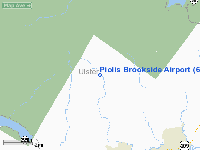
| From nearest city: | 6 nautical miles NW of Kerhonkson, NY |
| Location: | Ulster County, NY |
| Magnetic Variation: | 13W (1985) |
Owner & Manager
| Ownership: | Privately owned |
| Owner: | Lawrence Pioli |
| Address: | Rr 2 Box 640
Kerhonkson, NY 12446 |
| Phone number: | 914-626-7000 |
| Address: |
|
Airport Operations and Facilities
| Airport Use: | Private |
| Wind indicator: | Yes |
| Segmented Circle: | No |
| Control Tower: | No |
| Landing fee charge: | No |
| Sectional chart: | New York |
| Region: | AEA - Eastern |
| Boundary ARTCC: | ZBW - Boston |
| Tie-in FSS: | ISP - New York |
| FSS on Airport: | No |
| FSS Toll Free: | 1-800-WX-BRIEF |
Airport Services
| Airframe Repair: | NONE |
| Power Plant Repair: | NONE |
Runway Information
Runway 14/32
| Dimension: | 2600 x 75 ft / 792.5 x 22.9 m |
| Surface: | TURF, |
| |
Runway 14 |
Runway 32 |
| Traffic Pattern: | Left | Left |
|
Radio Navigation Aids
| ID |
Type |
Name |
Ch |
Freq |
Var |
Dist |
| SKU | FAN MARKER | Stanwyck | | | 12W | 24.0 nm |
| GBR | FAN MARKER | Sheffield | | | 13W | 46.1 nm |
| SW | NDB | Neely | | 335.00 | 14W | 23.3 nm |
| PO | NDB | Meier | | 403.00 | 12W | 24.0 nm |
| SKU | NDB | Stanwyck | | 261.00 | 12W | 24.0 nm |
| MS | NDB | Monga | | 359.00 | 12W | 24.4 nm |
| PFH | NDB | Philmont | | 272.00 | 13W | 35.8 nm |
| GBR | NDB | Great Barrington | | 395.00 | 14W | 45.7 nm |
| IGN | VOR/DME | Kingston | 123X | 117.60 | 12W | 25.9 nm |
| HUO | VOR/DME | Huguenot | 108X | 116.10 | 11W | 29.8 nm |
| PWL | VOR/DME | Pawling | 090X | 114.30 | 12W | 33.3 nm |
| DNY | VOR/DME | De Lancey | 058X | 112.10 | 11W | 33.6 nm |
| HNK | VOR/DME | Hancock | 115X | 116.80 | 11W | 45.5 nm |
| CMK | VOR/DME | Carmel | 113X | 116.60 | 12W | 48.8 nm |
| SAX | VORTAC | Sparta | 104X | 115.70 | 11W | 48.8 nm |
Remarks
- BE ALERT FOR STEEP HILL ON APCH END RY 32.
- VFR USE ONLY.
Images and information placed above are from
http://www.airport-data.com/airport/6NY7/
We thank them for the data!
| General Info
|
| Country |
United States
|
| State |
NEW YORK
|
| FAA ID |
6NY7
|
| Latitude |
41-51-55.334N
|
| Longitude |
074-19-58.542W
|
| Elevation |
1060 feet
|
| Near City |
KERHONKSON
|
We don't guarantee the information is fresh and accurate. The data may
be wrong or outdated.
For more up-to-date information please refer to other sources.
|
|


