|
|
| Pine Hill Airport |
| IATA: none – ICAO: none – FAA LID: 9G6 |
| Summary |
| Airport type |
Public use |
| Owner |
Eugene S. Haines |
| Operator |
Vintage Aircraft Group |
| Serves |
Albion, New York |
| Elevation AMSL |
669 ft / 204 m |
| Coordinates |
43°10′25″N 078°16′29″W / 43.17361°N 78.27472°W / 43.17361; -78.27472 |
| Runways |
| Direction |
Length |
Surface |
| ft |
m |
| 10/28 |
2,659 |
810 |
Asphalt |
| Statistics (2007) |
| Aircraft operations |
6,500 |
| Source: FAA and Vintage Aircraft Group |
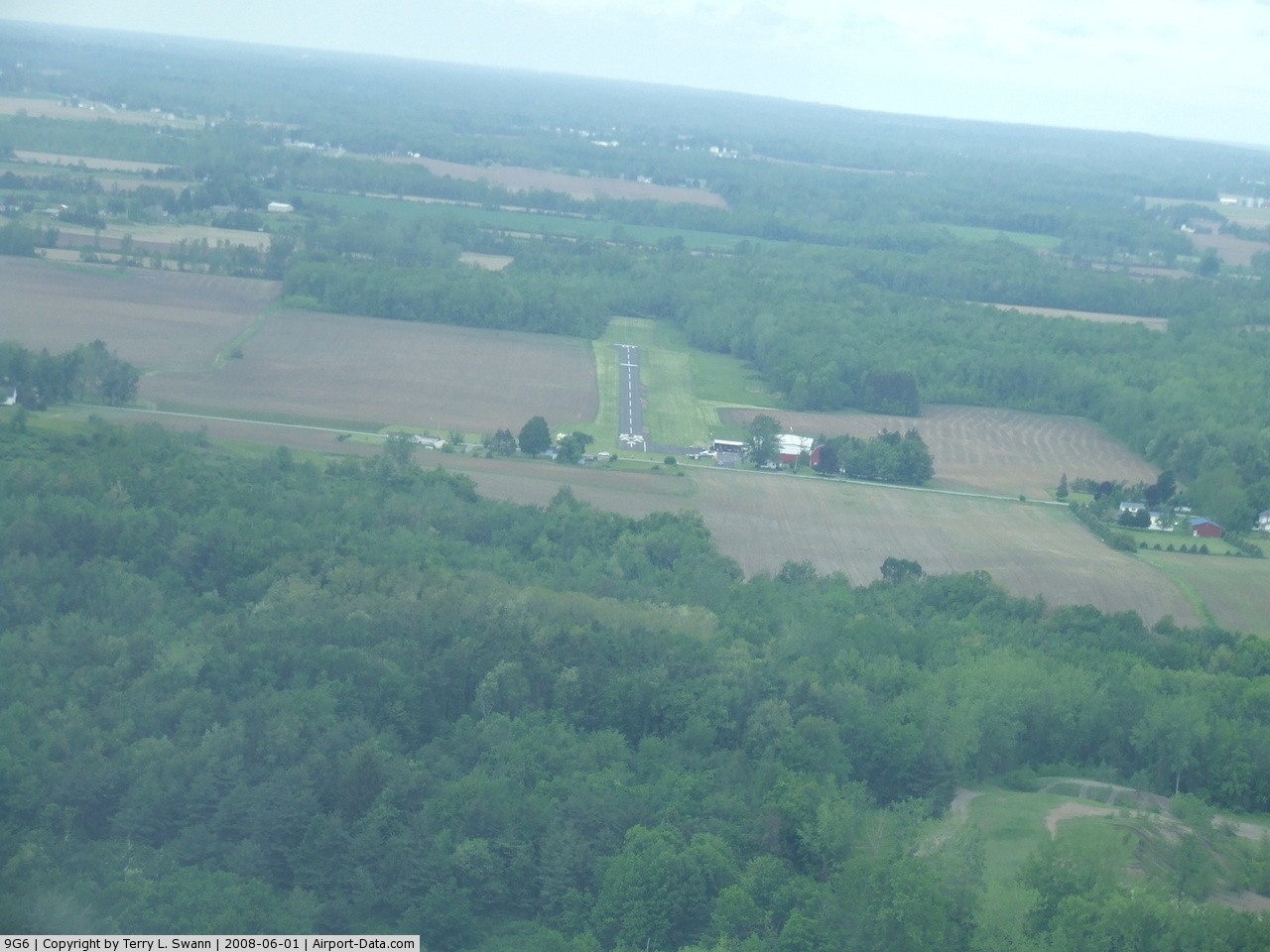
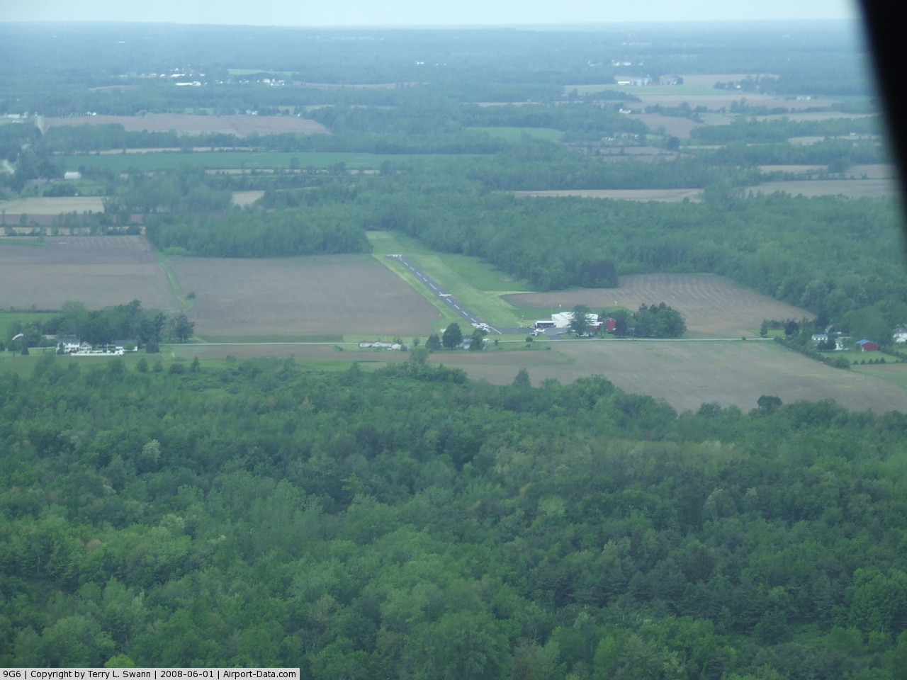
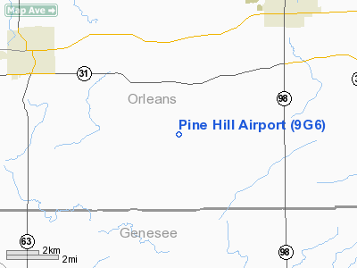
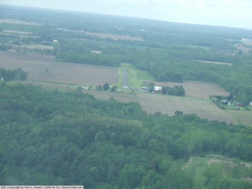
Pine Hill Airport (FAA LID: 9G6) is a public use airport located five nautical miles (9 km) southwest of the central business district of Albion, in Orleans County, New York, United States. The airport property is owned by Eugene Haines and leased by the Vintage Aircraft Group. Facilities and aircraft
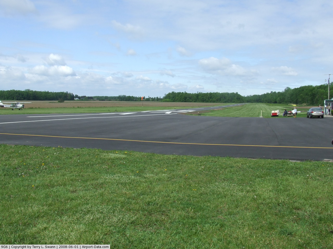
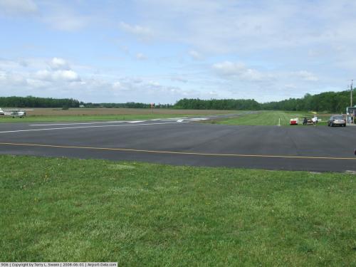
Pine Hill Airport covers an area of 49 acres (20 ha) at an elevation of 669 feet (204 m) above mean sea level. It has one runway designated 10/28 with an asphalt surface measuring 2,659 by 36 feet (810 x 11 m). For the 12-month period ending October 17, 2007, the airport had 6,500 aircraft operations, an average of 17 per day: 92% general aviation and 8% military.
Nearby airports
KGVQ - Genesee County Airport (10 nm SE)
9G3 - Akron Airport (13 nm SW)
7G0 - Ledgedale Airpark (16 nm E)
5G0 - Le Roy Airport (19 nm SE)
0G0 - North Buffalo Suburban Airport (19 nm W)
Source: AirNav
The above content comes from Wikipedia and is published under free licenses – click here to read more.
 |
(Click on the photo to enlarge) |
 |
(Click on the photo to enlarge) |
 |
(Click on the photo to enlarge) |
Location & QuickFacts
| FAA Information Effective: | 2008-09-25 |
| Airport Identifier: | 9G6 |
| Airport Status: | Operational |
| Longitude/Latitude: | 078-16-28.6770W/43-10-24.7110N
-78.274633/43.173531 (Estimated) |
| Elevation: | 669 ft / 203.91 m (Surveyed) |
| Land: | 49 acres |
| From nearest city: | 5 nautical miles SW of Albion, NY |
| Location: | Orleans County, NY |
| Magnetic Variation: | 08W (1965) |
Owner & Manager
| Ownership: | Privately owned |
| Owner: | Eugene S. Haines |
| Address: | 1882 Park Ave
Waterport, NY 14571-9760 |
| Phone number: | 585-682-3279 |
| Manager: | Eugene Haines |
| Address: | 4906 Pine Hill Road
Albion, NY 14411 |
| Phone number: | 585-589-7758
OR CALL 716-589-9904. |
Airport Operations and Facilities
| Airport Use: | Open to public |
| Wind indicator: | Yes |
| Segmented Circle: | No |
| Control Tower: | No |
| Lighting Schedule: | PHONE REQ
ACTIVT RY LIGHTS AT 585-589-7758. |
| Landing fee charge: | No |
| Sectional chart: | Detroit |
| Region: | AEA - Eastern |
| Traffic Pattern Alt: | 1500 ft |
| Boundary ARTCC: | ZOB - Cleveland |
| Tie-in FSS: | BUF - Buffalo |
| FSS on Airport: | No |
| FSS Toll Free: | 1-800-WX-BRIEF |
| NOTAMs Facility: | BUF (NOTAM-d service avaliable) |
Airport Communications
| CTAF: | 123.000 |
| Unicom: | 123.000 |
Airport Services
| Bottled Oxygen: | NONE |
| Bulk Oxygen: | NONE |
Runway Information
Runway 10/28
| Dimension: | 2659 x 36 ft / 810.5 x 11.0 m
200 FT TURF STOPWAY ON EAST END; 1000 FT TURF RY SAFETY AREA ON WEST END. |
| Surface: | ASPH,
RY 10/28 LOCALIZED OPEN SPALLING WITH LOOSE MATERIAL LCTD ONLY AT BEGINING RY 10. |
| Weight Limit: | Single wheel: 12000 lbs. |
| Edge Lights: | Non-standard lighting system
NSTD LIRL FIRST 225 FT EAST END UNLGTD. |
| |
Runway 10 |
Runway 28 |
| Longitude: | 078-16-46.6660W | 078-16-10.7830W |
| Latitude: | 43-10-24.8680N | 43-10-24.5710N |
| Elevation: | 653.00 ft | 669.00 ft |
| Alignment: | 91 | 127 |
| Traffic Pattern: | Left | Left |
| Markings: | Basic, Good Condition | Basic, Good Condition |
| Displaced threshold: | 0.00 ft | 250.00 ft |
| Obstruction: | 20 ft tree, 201.0 ft from runway, 50 ft right of centerline
RY 10 +30 FT TO +60 FT RIGHT OF CTLN AT 80-200 FT FM THLD. | 16 ft road, 201.0 ft from runway
RY 28 APCH SLOPE, 8:1 TO DSPLCD THLD. |
|
Radio Navigation Aids
| ID |
Type |
Name |
Ch |
Freq |
Var |
Dist |
| AVN | NDB | Avon | | 344.00 | 09W | 24.3 nm |
| SN | NDB | St Catherines | | 408.00 | 01E | 43.0 nm |
| IAG | TACAN | Niagara Falls | 047X | | 10W | 30.3 nm |
| BUF | VOR/DME | Buffalo | 111X | 116.40 | 08W | 22.0 nm |
| GEE | VOR/DME | Geneseo | 019X | 108.20 | 09W | 31.4 nm |
| ROC | VORTAC | Rochester | 037X | 110.00 | 09W | 26.5 nm |
| BUF | VOT | Buffalo | | 109.00 | | 24.6 nm |
Remarks
- FOR ARPT CONDS WINTER MONTHS OR LIRL OR REIL RY 10/28 CALL 716-589-7758.
- 930 FT TWR 930 FT SSE APCH END RY 28.
- RWY 10/28 LMTD TO ACFT 12500 LBS.
- 70'-80' TREES 150'LEFT AER 10
Images and information placed above are from
http://www.airport-data.com/airport/9G6/
We thank them for the data!
| General Info
|
| Country |
United States
|
| State |
NEW YORK
|
| FAA ID |
9G6
|
| Latitude |
43-10-24.711N
|
| Longitude |
078-16-28.677W
|
| Elevation |
669 feet
|
| Near City |
ALBION
|
We don't guarantee the information is fresh and accurate. The data may
be wrong or outdated.
For more up-to-date information please refer to other sources.
|
|