 |
|
| Perry-Warsaw Airport |
| IATA: none – ICAO: none – FAA LID: 01G |
| Summary |
| Airport type |
Public |
| Operator |
Towns of Perry and Warsaw |
| Location |
Perry, New York |
| Elevation AMSL |
1,559 ft / 475.2 m |
| Coordinates |
42°44′29″N 078°03′07″W / 42.74139°N 78.05194°W / 42.74139; -78.05194Coordinates: 42°44′29″N 078°03′07″W / 42.74139°N 78.05194°W / 42.74139; -78.05194 |
| Runways |
| Direction |
Length |
Surface |
| ft |
m |
| 10/28 |
3,500 |
1,067 |
Asphalt |
| 4/22 |
1,830 |
558 |
Turf |
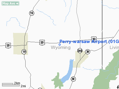
Perry-Warsaw Airport (FAA LID: 01G) is a public airport located three miles (5 km) northwest of the central business district (CBD) of the Village of Perry, in Wyoming County, New York, USA. This general aviation airport covers 158 acres (64 ha) and has two runways. It is operated by the Town of Perry and the Town of Warsaw.
The above content comes from Wikipedia and is published under free licenses – click here to read more.
Location & QuickFacts
| FAA Information Effective: | 2008-09-25 |
| Airport Identifier: | 01G |
| Airport Status: | Operational |
| Longitude/Latitude: | 078-03-07.4900W/42-44-28.8480N
-78.052081/42.741347 (Estimated) |
| Elevation: | 1559 ft / 475.18 m (Surveyed) |
| Land: | 158 acres |
| From nearest city: | 3 nautical miles NW of Perry, NY |
| Location: | Wyoming County, NY |
| Magnetic Variation: | 10W (1985) |
Owner & Manager
| Ownership: | Publicly owned |
| Owner: | Towns Of Perry And Warsaw
MS ANNE C HUMPHREY, SUPERVISOR |
| Address: | 6522 Perry-warsaw Road
Perry, NY 14530 |
| Phone number: | 585-237-9938 |
| Manager: | Charles Bell |
| Address: | 6522 Rt 20a
Perry, NY 11430 |
| Phone number: | 585-237-3790 |
Airport Operations and Facilities
| Airport Use: | Open to public |
| Wind indicator: | Yes |
| Segmented Circle: | No |
| Control Tower: | No |
| Lighting Schedule: | DUSK-DAWN
ACTVT MIRL RY 10/28 & REIL RYS 10 & 28 - CTAF. |
| Beacon Color: | Clear-Green (lighted land airport) |
| Landing fee charge: | No |
| Sectional chart: | Detroit |
| Region: | AEA - Eastern |
| Traffic Pattern Alt: | 793 ft |
| Boundary ARTCC: | ZOB - Cleveland |
| Tie-in FSS: | BUF - Buffalo |
| FSS on Airport: | No |
| FSS Toll Free: | 1-800-WX-BRIEF |
| NOTAMs Facility: | BUF (NOTAM-d service avaliable) |
| Federal Agreements: | NGY1 |
Airport Communications
| CTAF: | 122.800 |
| Unicom: | 122.800 |
Airport Services
| Fuel available: | 100LL
FUEL AVBL 24 HRS SELF SERVE & CREDIT CARD ONLY. |
| Airframe Repair: | MAJOR |
| Power Plant Repair: | MAJOR |
| Bottled Oxygen: | NONE |
| Bulk Oxygen: | NONE |
Runway Information
Runway 04/22
| Dimension: | 1830 x 60 ft / 557.8 x 18.3 m |
| Surface: | TURF, Good Condition
SOFT & WET DURING MAR-JUN. |
| |
Runway 04 |
Runway 22 |
| Longitude: | 078-03-08.1830W | 078-02-55.4080W |
| Latitude: | 42-44-20.4390N | 42-44-35.8690N |
| Alignment: | 31 | 127 |
| Traffic Pattern: | Left | Left |
|
Runway 10/28
| Dimension: | 3500 x 60 ft / 1066.8 x 18.3 m |
| Surface: | ASPH, Good Condition
SOFT & WET DURING MAR-JUN. |
| Edge Lights: | Medium |
| |
Runway 10 |
Runway 28 |
| Alignment: | 90 | 127 |
| Traffic Pattern: | Left | Left |
| Markings: | Basic, Good Condition | Basic, Good Condition |
| Displaced threshold: | 0.00 ft | 355.00 ft |
| Runway End Identifier: | Yes | Yes |
| Obstruction: | 10 ft brush, 297.0 ft from runway, 9:1 slope to clear
RY 10 HAS +10 FT HIGH BRUSH, 0-200 FT FM RY, 100 FT FM CNTRLN L/R. | 37 ft tree, 370.0 ft from runway, 130 ft left of centerline, 4:1 slope to clear
20:1 OBSTRUCTION SLOPE FM DSPLCD THLD.
+6 FT BRUSH AT 44 FT OUT AND 120 FT LEFT. |
|
Radio Navigation Aids
| ID |
Type |
Name |
Ch |
Freq |
Var |
Dist |
| AVN | NDB | Avon | | 344.00 | 09W | 20.4 nm |
| LYS | NDB | Olean | | 360.00 | 09W | 30.2 nm |
| EL | NDB | Halos | | 269.00 | 09W | 38.4 nm |
| PYA | NDB | Penn Yan | | 260.00 | 12W | 44.4 nm |
| IAG | TACAN | Niagara Falls | 047X | | 10W | 45.8 nm |
| GEE | VOR/DME | Geneseo | 019X | 108.20 | 09W | 15.2 nm |
| BUF | VOR/DME | Buffalo | 111X | 116.40 | 08W | 28.5 nm |
| ROC | VORTAC | Rochester | 037X | 110.00 | 09W | 28.2 nm |
| ELZ | VORTAC | Wellsville | 051X | 111.40 | 09W | 39.2 nm |
| BUF | VOT | Buffalo | | 109.00 | | 32.3 nm |
Remarks
- TURF RY 04/22 MAY BE UNUSABLE DURING MONTHS OCT-MAY; CALL 716-237-9938 FOR CONDITION.
- RY 04/22 SAFETY AREA HAS VARIATIONS IN SFC/DEPRESSIONS.
- RY 28 200 FT FM THLD HAS 8 FT DROPOFF BOTH SIDES.
- PARALLEL TWY UNLGTD.
- FIRST 700 FT OF RY 10 SLOPES UPHILL.
- RY 4 SAFETY AREA DROPS OFF 100 FT BEFORE RY BEG., AT 125 FT L & R OF CNTRLN.
- RWY 22 +36' TREES PENETRATE PRIMARY SURFACE ON RIGHT SIDE (80' PAST RWY BEG., 120' FROM C/L).
- RWY 4 +52 FT TREES PENETRATE PRIMARY SURFACE ON RIGHT SIDE (265 FT PAST RWY BEG., 108 FT FROM C/L).
- EXISTED PRIOR TO 1959.
Images and information placed above are from
http://www.airport-data.com/airport/01G/
We thank them for the data!
| General Info
|
| Country |
United States
|
| State |
NEW YORK
|
| FAA ID |
01G
|
| Latitude |
42-44-28.848N
|
| Longitude |
078-03-07.490W
|
| Elevation |
1559 feet
|
| Near City |
PERRY
|
We don't guarantee the information is fresh and accurate. The data may
be wrong or outdated.
For more up-to-date information please refer to other sources.
|
|


