 |
|
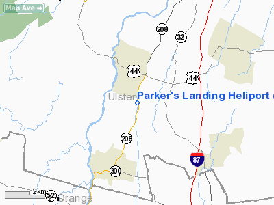
Parker's Landing Heliport |
Location & QuickFacts
| FAA Information Effective: | 2008-09-25 |
| Airport Identifier: | NK38 |
| Airport Status: | Operational |
| Longitude/Latitude: | 074-08-25.5220W/41-39-16.3360N
-74.140423/41.654538 (Estimated) |
| Elevation: | 350 ft / 106.68 m (Estimated) |
| Land: | 40 acres |
| From nearest city: | 3 nautical miles SE of Gardiner, NY |
| Location: | Ulster County, NY |
| Magnetic Variation: | 13W (1990) |
Owner & Manager
| Ownership: | Privately owned |
| Owner: | George Parker Jr. |
| Address: | Po Box 180
Gardiner, NY 12525-0180 |
| Phone number: | 914-225-0670 |
| Manager: | G.j. Parker |
| Address: | Po Box 180
Gardiner, NY 12525-0180 |
| Phone number: | 914-225-0670 |
Airport Operations and Facilities
| Airport Use: | Private |
| Wind indicator: | Yes |
| Segmented Circle: | No |
| Control Tower: | No |
| Sectional chart: | New York |
| Region: | AEA - Eastern |
| Boundary ARTCC: | ZBW - Boston |
| Tie-in FSS: | ISP - New York |
| FSS Toll Free: | 1-800-WX-BRIEF |
Runway Information
Helipad H1
| Dimension: | 800 x 100 ft / 243.8 x 30.5 m |
| Surface: | TURF, |
| |
Runway H1 |
Runway |
| Traffic Pattern: | Left | Left |
|
Radio Navigation Aids
| ID |
Type |
Name |
Ch |
Freq |
Var |
Dist |
| SKU | FAN MARKER | Stanwyck | | | 12W | 8.7 nm |
| GBR | FAN MARKER | Sheffield | | | 13W | 44.9 nm |
| SKU | NDB | Stanwyck | | 261.00 | 12W | 8.7 nm |
| PO | NDB | Meier | | 403.00 | 12W | 9.2 nm |
| SW | NDB | Neely | | 335.00 | 14W | 10.9 nm |
| MS | NDB | Monga | | 359.00 | 12W | 33.0 nm |
| PFH | NDB | Philmont | | 272.00 | 13W | 40.5 nm |
| PNJ | NDB | Paterson | | 347.00 | 12W | 42.6 nm |
| TBY | NDB | Waterbury | | 257.00 | 14W | 45.4 nm |
| GBR | NDB | Great Barrington | | 395.00 | 14W | 45.8 nm |
| IGN | VOR/DME | Kingston | 123X | 117.60 | 12W | 14.3 nm |
| HUO | VOR/DME | Huguenot | 108X | 116.10 | 11W | 25.1 nm |
| PWL | VOR/DME | Pawling | 090X | 114.30 | 12W | 25.2 nm |
| CMK | VOR/DME | Carmel | 113X | 116.60 | 12W | 33.8 nm |
| DNY | VOR/DME | De Lancey | 058X | 112.10 | 11W | 48.2 nm |
| TEB | VOR/DME | Teterboro | 021X | 108.40 | 11W | 48.6 nm |
| SAX | VORTAC | Sparta | 104X | 115.70 | 11W | 39.6 nm |
Remarks
- VFR; DAYLIGHT OPERATIONS ONLY; LIMITED TO MEDIUM HELS; INGRESS/EGRESS TO/FROM THE SOUTH; CORD WITH ARPT
Images and information placed above are from
http://www.airport-data.com/airport/NK38/
We thank them for the data!
| General Info
|
| Country |
United States
|
| State |
NEW YORK
|
| FAA ID |
NK38
|
| Latitude |
41-39-16.336N
|
| Longitude |
074-08-25.522W
|
| Elevation |
350 feet
|
| Near City |
GARDINER
|
We don't guarantee the information is fresh and accurate. The data may
be wrong or outdated.
For more up-to-date information please refer to other sources.
|
|


