 |
|
Location & QuickFacts
| FAA Information Effective: | 2008-09-25 |
| Airport Identifier: | D82 |
| Airport Status: | Operational |
| Longitude/Latitude: | 076-47-46.8340W/42-39-17.2540N
-76.796343/42.654793 (Estimated) |
| Elevation: | 1062 ft / 323.70 m (Surveyed) |
| Land: | 0 acres |
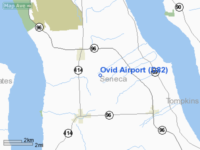
| From nearest city: | 2 nautical miles SE of Ovid, NY |
| Location: | Seneca County, NY |
| Magnetic Variation: | 11W (1985) |
Owner & Manager
| Ownership: | Privately owned |
| Owner: | John H King |
| Address: | 9752 Kingtown Rd
Trumansburg, NY 14886 |
| Phone number: | 607-387-5225 |
| Manager: | John H. King |
| Address: | 9752 Kingtown Rd
Trumansburg, NY 14886 |
| Phone number: | 607-869-5601 |
Airport Operations and Facilities
| Airport Use: | Open to public |
| Wind indicator: | Yes |
| Segmented Circle: | No |
| Control Tower: | No |
| Landing fee charge: | No |
| Sectional chart: | New York |
| Region: | AEA - Eastern |
| Boundary ARTCC: | ZOB - Cleveland |
| Responsible ARTCC: | ZNY - New York |
| Tie-in FSS: | BUF - Buffalo |
| FSS on Airport: | No |
| FSS Toll Free: | 1-800-WX-BRIEF |
| NOTAMs Facility: | BUF (NOTAM-d service avaliable) |
Airport Communications
| CTAF: | 122.800 |
| Unicom: | 122.800 |
Airport Services
| Airframe Repair: | NONE |
| Power Plant Repair: | NONE |
Runway Information
Runway 01L/19R
| Dimension: | 2200 x 60 ft / 670.6 x 18.3 m
RY 01L/19R SOFT & WET MAR-JUN. |
| Surface: | TURF, Good Condition
RY 01R/19L TRTD GRVL. |
| |
Runway 01L |
Runway 19R |
| Traffic Pattern: | Left | Left |
| Obstruction: | 59 ft trees, 78.0 ft from runway, 83 ft left of centerline, 1:1 slope to clear | 34 ft trees, 1426.0 ft from runway, 150 ft left of centerline, 41:1 slope to clear |
|
Runway 01R/19L
| Dimension: | 2800 x 40 ft / 853.4 x 12.2 m
RY 01L/19R SOFT & WET MAR-JUN. |
| Surface: | ASPHRVL, Good Condition
RY 01R/19L TRTD GRVL. |
| |
Runway 01R |
Runway 19L |
| Traffic Pattern: | Left | Left |
| Obstruction: | 35 ft trees, 255.0 ft from runway, 68 ft right of centerline, 1:1 slope to clear
HAS +43 FT TREES, 7 FT TO 66 FT FM RY END. 78 FT TO 81 FT LT. | 34 ft trees, 1426.0 ft from runway, 150 ft left of centerline, 36:1 slope to clear |
|
Radio Navigation Aids
| ID |
Type |
Name |
Ch |
Freq |
Var |
Dist |
| PYA | NDB | Penn Yan | | 260.00 | 12W | 11.5 nm |
| ALP | NDB | Alpine | | 245.00 | 12W | 25.1 nm |
| AVN | NDB | Avon | | 344.00 | 09W | 47.9 nm |
| ITH | VOR/DME | Ithaca | 055X | 111.80 | 10W | 17.7 nm |
| ULW | VOR/DME | Elmira | 033Y | 109.65 | 12W | 35.2 nm |
| GEE | VOR/DME | Geneseo | 019X | 108.20 | 09W | 42.7 nm |
| SYR | VORTAC | Syracuse | 117X | 117.00 | 11W | 40.0 nm |
| CFB | VORTAC | Binghamton | 059X | 112.20 | 10W | 41.8 nm |
| GGT | VORTAC | Georgetown | 125X | 117.80 | 11W | 43.6 nm |
| ROC | VORTAC | Rochester | 037X | 110.00 | 09W | 47.7 nm |
Remarks
- USE RY 19L FOR CALM WIND LANDINGS.
- RY 19L SLOPES UPHILL.
- ARPT CLSD TO TRANSIENT ACFT 1 DEC - 1 MAY (YEARLY).
- TURF RY 19R THLD BEGINS 470 FT BYD PAVED RY 19L THLD.
- EXISTED PRIOR TO 1959.
Images and information placed above are from
http://www.airport-data.com/airport/D82/
We thank them for the data!
| General Info
|
| Country |
United States
|
| State |
NEW YORK
|
| FAA ID |
D82
|
| Latitude |
42-39-17.254N
|
| Longitude |
076-47-46.834W
|
| Elevation |
1062 feet
|
| Near City |
OVID
|
We don't guarantee the information is fresh and accurate. The data may
be wrong or outdated.
For more up-to-date information please refer to other sources.
|
|


