 |
|
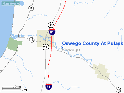
Oswego County At Pulaski Heliport |
Location & QuickFacts
| FAA Information Effective: | 2008-09-25 |
| Airport Identifier: | 05NY |
| Airport Status: | Operational |
| Longitude/Latitude: | 076-05-24.7240W/43-33-07.2500N
-76.090201/43.552014 (Estimated) |
| Elevation: | 445 ft / 135.64 m (Estimated) |
| Land: | 5 acres |
| From nearest city: | 1 nautical miles SE of Pulaski, NY |
| Location: | Oswego County, NY |
| Magnetic Variation: | 12W (1985) |
Owner & Manager
| Ownership: | Privately owned |
| Owner: | Oswego Co Hgwy Dept |
| Address: | 46 Bridge St.
Oswego, NY 13126 |
| Phone number: | 315-349-8331 |
| Manager: | Mr. Donald Morey |
| Address: | 46 Bridge St.
Oswego, NY 13126 |
| Phone number: | 315-349-8331 |
Airport Operations and Facilities
| Airport Use: | Private |
| Wind indicator: | Yes |
| Segmented Circle: | No |
| Control Tower: | No |
| Lighting Schedule: | RDO-CTL
ACTVT ROTG BCN & PERIMETER LGTS - 122.9. |
| Beacon Color: | Clear-Green-Yellow (heliport) |
| Sectional chart: | New York |
| Region: | AEA - Eastern |
| Boundary ARTCC: | ZBW - Boston |
| Tie-in FSS: | BTV - Burlington |
| FSS on Airport: | No |
| FSS Toll Free: | 1-800-WX-BRIEF |
Runway Information
Helipad H1
| Dimension: | 75 x 75 ft / 22.9 x 22.9 m |
| Surface: | ASPH-CONC, Good Condition |
| |
Runway H1 |
Runway |
| Traffic Pattern: | Left | Left |
|
Radio Navigation Aids
| ID |
Type |
Name |
Ch |
Freq |
Var |
Dist |
| BK | NDB | Plein | | 329.00 | 12W | 33.1 nm |
| GTB | NDB | Drum | | 257.00 | 13W | 34.6 nm |
| CJY | NDB | Clay | | 275.00 | 12W | 47.0 nm |
| GSS | TACAN | Griffiss | 057X | | 12W | 35.4 nm |
| SYR | VORTAC | Syracuse | 117X | 117.00 | 11W | 24.1 nm |
| ART | VORTAC | Watertown | 035X | 109.80 | 12W | 24.1 nm |
| GGT | VORTAC | Georgetown | 125X | 117.80 | 11W | 47.3 nm |
Remarks
- PRVDD A LTR OF AGREEMENT IS ENTERED INTO WITH OPERATORS OF RICHLAND ARPT & PULASKI FIELD THROUGH THE SYRACUSE ATCT.
Images and information placed above are from
http://www.airport-data.com/airport/05NY/
We thank them for the data!
| General Info
|
| Country |
United States
|
| State |
NEW YORK
|
| FAA ID |
05NY
|
| Latitude |
43-33-07.250N
|
| Longitude |
076-05-24.724W
|
| Elevation |
445 feet
|
| Near City |
PULASKI
|
We don't guarantee the information is fresh and accurate. The data may
be wrong or outdated.
For more up-to-date information please refer to other sources.
|
|


