 |
|
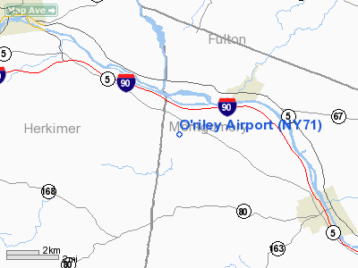
Location & QuickFacts
| FAA Information Effective: | 2008-09-25 |
| Airport Identifier: | NY71 |
| Airport Status: | Operational |
| Longitude/Latitude: | 074-43-47.5260W/42-58-32.2580N
-74.729868/42.975627 (Estimated) |
| Elevation: | 700 ft / 213.36 m (Estimated) |
| Land: | 106 acres |
| From nearest city: | 6 nautical miles NW of Fort Plain, NY |
| Location: | Montgomery County, NY |
| Magnetic Variation: | 14W (1990) |
Owner & Manager
| Ownership: | Privately owned |
| Owner: | John O'riley |
| Address: | Rr1 Box 59
Poughquag, NY 12570 |
| Phone number: | 914-724-5710 |
| Manager: | John O'riley |
| Address: | Rr1 Box 59
Poughquag, NY 12570 |
| Phone number: | 914-724-5710 |
Airport Operations and Facilities
| Airport Use: | Private |
| Segmented Circle: | No |
| Control Tower: | No |
| Sectional chart: | New York |
| Region: | AEA - Eastern |
| Boundary ARTCC: | ZBW - Boston |
| Tie-in FSS: | BUF - Buffalo |
| FSS on Airport: | No |
| FSS Toll Free: | 1-800-WX-BRIEF |
Runway Information
Runway 12/30
| Dimension: | 1500 x 50 ft / 457.2 x 15.2 m |
| Surface: | TURF, |
| |
Runway 12 |
Runway 30 |
| Traffic Pattern: | Left | Left |
|
Radio Navigation Aids
| ID |
Type |
Name |
Ch |
Freq |
Var |
Dist |
| JJH | NDB | Johnstown | | 523.00 | 14W | 17.5 nm |
| CJY | NDB | Clay | | 275.00 | 12W | 23.9 nm |
| HEU | NDB | Hunter | | 356.00 | 14W | 35.8 nm |
| BK | NDB | Plein | | 329.00 | 12W | 36.2 nm |
| GSS | TACAN | Griffiss | 057X | | 12W | 33.6 nm |
| RKA | VOR/DME | Rockdale | 073X | 112.60 | 11W | 38.0 nm |
| DNY | VOR/DME | De Lancey | 058X | 112.10 | 11W | 49.0 nm |
| UCA | VORTAC | Utica | 049X | 111.20 | 12W | 19.4 nm |
| ALB | VORTAC | Albany | 100X | 115.30 | 13W | 43.1 nm |
| GGT | VORTAC | Georgetown | 125X | 117.80 | 11W | 49.6 nm |
| ALB | VOT | Albany County | | 108.20 | | 42.4 nm |
Images and information placed above are from
http://www.airport-data.com/airport/NY71/
We thank them for the data!
| General Info
|
| Country |
United States
|
| State |
NEW YORK
|
| FAA ID |
NY71
|
| Latitude |
42-58-32.258N
|
| Longitude |
074-43-47.526W
|
| Elevation |
700 feet
|
| Near City |
FORT PLAIN
|
We don't guarantee the information is fresh and accurate. The data may
be wrong or outdated.
For more up-to-date information please refer to other sources.
|
|


