|
|
Coordinates: 41°30′36″N 074°15′53″W / 41.51°N 74.26472°W / 41.51; -74.26472
| Orange County Airport |
 |
| IATA: MGJ – ICAO: KMGJ – FAA LID: MGJ |
| Summary |
| Airport type |
Public |
| Owner |
Orange County, New York |
| Location |
Montgomery, New York |
| Elevation AMSL |
365 ft / 111 m |
| Runways |
| Direction |
Length |
Surface |
| ft |
m |
| 3/21 |
5,006 |
1,526 |
Asphalt |
| 8/26 |
3,672 |
1,119 |
Asphalt |
| Statistics (2007) |
| Aircraft operations |
120,000 |
| Based aircraft |
228 |
| Source: Federal Aviation Administration |
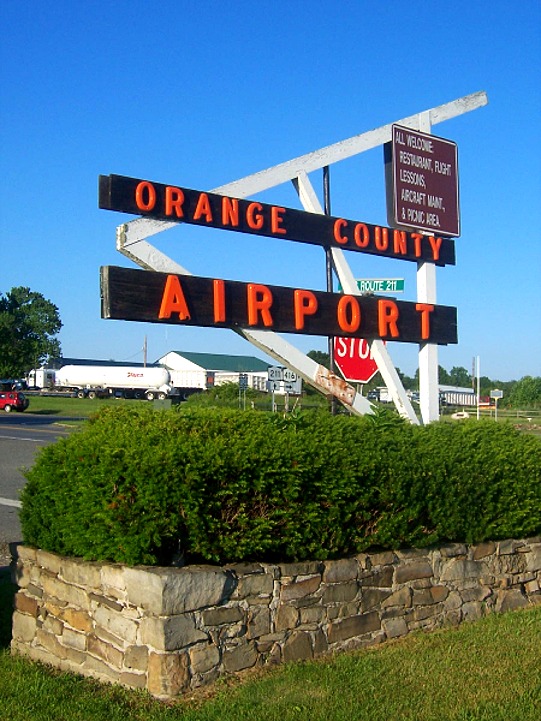
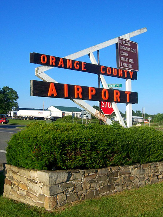
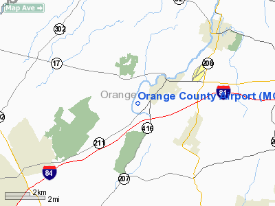
New York’s Orange County Airport (IATA: MGJ, ICAO: KMGJ, FAA LID: MGJ) is an untowered general aviation airport located 1 mile (2 km) southwest of village of Montgomery, in the Town of Montgomery, New York. The 526 acre (2.1 km²) airport is owned by Orange County and can be found at the junction of state highways 211 and NY-416.
It is a popular place for aspiring local pilots to learn to fly or practice their skills. With 125,000 takeoffs and landings annually, it is New York's second-busiest general-aviation airport.
Transmissions between pilots and the airport are rebroadcast on a one-watt station at 88.1 megahertz, so it is possible to tune into them on a standard car radio while driving in the vicinity.
The airport's low traffic and out-of-the-way location have been making it a popular place to store private jets. In 2006 county officials were reported to be working on a deal with a local developer to build 10 private luxury hangars to cater to what they saw as a growing market and raise money for the airport without raising taxes. Facilities and aircraft
Orange County Airport covers an area of 528 acres (214 ha) which contains two asphalt paved runways: 3/21 measuring 5,006 x 100 ft (1,526 x 30 m) and 8/26 measuring 3,672 x 100 ft (1,119 x 30 m).
For the 12-month period ending August 1, 2007, the airport had 120,000 aircraft operations, an average of 328 per day: 97% general aviation, 2% air taxi and 1% military. There are 228 aircraft based at this airport: 90% single-engine, 9% multi-engine, 1% jet and <1% helicopter.
Auto racing
On July 17, 1960, NASCAR came to the airport with the Empire State 200, on a two-mile course. Rex Allen held off Richard Petty for the win, in front of about 5,000 fans; the mediocre attendance killed any chance of making the race an annual event, as was planned. It remains the only NASCAR event ever held in the Hudson Valley.
The above content comes from Wikipedia and is published under free licenses – click here to read more.
Location & QuickFacts
| FAA Information Effective: | 2008-09-25 |
| Airport Identifier: | MGJ |
| Airport Status: | Operational |
| Longitude/Latitude: | 074-15-52.7000W/41-30-35.9000N
-74.264639/41.509972 (Estimated) |
| Elevation: | 364 ft / 110.95 m (Estimated) |
| Land: | 528 acres |
| From nearest city: | 1 nautical miles SW of Montgomery, NY |
| Location: | Orange County, NY |
| Magnetic Variation: | 14W (2000) |
Owner & Manager
| Ownership: | Publicly owned |
| Owner: | Orange County |
| Address: | Orange County Government Ctr
Goshen, NY 10924 |
| Phone number: | 845-291-2700 |
| Manager: | Vinicio Llerena |
| Address: | 500 Dunn Rd.
Montgomery, NY 12549 |
| Phone number: | 845-457-4925 |
Airport Operations and Facilities
| Airport Use: | Open to public |
| Wind indicator: | Yes
WIND IND ON RY 03/21. |
| Segmented Circle: | Yes |
| Control Tower: | No |
| Lighting Schedule: | DUSK-DAWN
ACTVT HIRL RY 03/21, MIRL RY 08/26, REIL RYS 03 & 21, VASI RY 03, VASI RY 03, & TWY LGTS - CTAF. |
| Beacon Color: | Clear-Green (lighted land airport) |
| Landing fee charge: | No |
| Sectional chart: | New York |
| Region: | AEA - Eastern |
| Boundary ARTCC: | ZBW - Boston |
| Responsible ARTCC: | ZNY - New York |
| Tie-in FSS: | ISP - New York |
| FSS on Airport: | No |
| FSS Toll Free: | 1-800-WX-BRIEF |
| NOTAMs Facility: | MGJ (NOTAM-d service avaliable) |
| Federal Agreements: | NGPY |
Airport Communications
| CTAF: | 122.725 |
| Unicom: | 122.725
A UNICOM. |
Airport Services
| Fuel available: | 100LLA
FUEL AVBL AFT HRS BY CREDIT CARD SELF-SVC RAMP. |
| Airframe Repair: | MAJOR |
| Power Plant Repair: | MAJOR |
| Bottled Oxygen: | HIGH/LOW |
| Bulk Oxygen: | HIGH/LOW |
Runway Information
Runway 03/21
| Dimension: | 5007 x 100 ft / 1526.1 x 30.5 m |
| Surface: | ASPH, Good Condition |
| Weight Limit: | Single wheel: 30000 lbs.
Dual wheel: 57000 lbs.
Dual tandem wheel: 85000 lbs. |
| Edge Lights: | High |
| |
Runway 03 |
Runway 21 |
| Longitude: | 074-16-08.6267W | 074-15-51.0735W |
| Latitude: | 41-30-16.6372N | 41-31-04.3097N |
| Elevation: | 349.00 ft | 350.00 ft |
| Alignment: | 15 | 127 |
| ILS Type: | ILS
| |
| Traffic Pattern: | Left | Right |
| Markings: | Precision instrument, Fair Condition
RY 03 NSTD DSPLCD THLD MKGS YELLOW. | Precision instrument, Fair Condition |
| Crossing Height: | 52.00 ft | 0.00 ft |
| Displaced threshold: | 292.00 ft | 0.00 ft |
| VASI: | 4-box on left side | 2-light PAPI on left side |
| Visual Glide Angle: | 3.00° | 3.50° |
| Runway End Identifier: | Yes | Yes |
| Centerline Lights: | No | No |
| Touchdown Lights: | No | No |
| Obstruction: | 50 ft trees, 565.0 ft from runway, 551 ft right of centerline, 7:1 slope to clear
RWY 03 APCH SLOPE 31:1 TO DSPLCD THLD. | 8 ft brush, 201.0 ft from runway, 70 ft right of centerline |
|
Runway 08/26
| Dimension: | 3664 x 99 ft / 1116.8 x 30.2 m |
| Surface: | ASPH, Good Condition |
| Weight Limit: | Single wheel: 30000 lbs.
Dual wheel: 57000 lbs.
Dual tandem wheel: 85000 lbs. |
| Edge Lights: | Medium |
| |
Runway 08 |
Runway 26 |
| Longitude: | 074-16-05.0121W | 074-15-20.9378W |
| Latitude: | 41-30-22.5106N | 41-30-37.0994N |
| Elevation: | 351.00 ft | 364.00 ft |
| Alignment: | 66 | 127 |
| Traffic Pattern: | Left | Right |
| Markings: | Non-precision instrument, Good Condition | Precision instrument, Good Condition
RY 26 NSTD DSPLCD THLD MKGS YELLOW. |
| Displaced threshold: | 0.00 ft | 301.00 ft |
| VASI: | 2-light PAPI on left side | 2-light PAPI on left side |
| Visual Glide Angle: | 3.50° | 3.50° |
| Centerline Lights: | No | No |
| Touchdown Lights: | No | No |
| Obstruction: | 30 ft trees, 812.0 ft from runway, 250 ft left of centerline, 20:1 slope to clear | 65 ft trees, 800.0 ft from runway, 9:1 slope to clear
RWY 26 APCH SLOPE 17:1 TO DSPLCD THLD. |
|
Radio Navigation Aids
| ID |
Type |
Name |
Ch |
Freq |
Var |
Dist |
| SKU | FAN MARKER | Stanwyck | | | 12W | 9.9 nm |
| EWR | FAN MARKER | Maryann | | | 11W | 48.6 nm |
| SW | NDB | Neely | | 335.00 | 14W | 2.2 nm |
| SKU | NDB | Stanwyck | | 261.00 | 12W | 9.9 nm |
| PO | NDB | Meier | | 403.00 | 12W | 14.0 nm |
| MS | NDB | Monga | | 359.00 | 12W | 30.9 nm |
| PNJ | NDB | Paterson | | 347.00 | 12W | 34.3 nm |
| CAT | NDB | Chatham | | 254.00 | 11W | 46.8 nm |
| HUO | VOR/DME | Huguenot | 108X | 116.10 | 11W | 15.9 nm |
| IGN | VOR/DME | Kingston | 123X | 117.60 | 12W | 22.0 nm |
| PWL | VOR/DME | Pawling | 090X | 114.30 | 12W | 33.7 nm |
| CMK | VOR/DME | Carmel | 113X | 116.60 | 12W | 33.8 nm |
| TEB | VOR/DME | Teterboro | 021X | 108.40 | 11W | 40.8 nm |
| STW | VOR/DME | Stillwater | 033X | 109.60 | 11W | 41.2 nm |
| LGA | VOR/DME | La Guardia | 078X | 113.10 | 12W | 46.8 nm |
| BWZ | VOR/DME | Broadway | 089X | 114.20 | 11W | 49.6 nm |
| SAX | VORTAC | Sparta | 104X | 115.70 | 11W | 29.3 nm |
Remarks
- 23 FT STABILIZED SHOULDER EACH SIDE OF RY 3/21 AND 9 FT OF RY 8/26.
- FUEL AVAIL. AFT HRS BY CREDIT CARD SELF-SVC RAMP.
- AFTER LNDG 180 DEG TURNS ARE PROHIBITED.
- NOISE ABATEMENT PROCEDURES IN EFFECT; CTC AMGR 845-457-4925.
- BE AWARE OF LARGE TURBOJET ACFT VICINITY OF STEWART ARPT LCTD 7 NM ESE. 800 FT HILL 1/2 MILE NW OF ARPT ON DOWNWIND/BASE LEG FOR RY 21.
- SAWRS
- ESTABD PRIOR TO 1959.
Images and information placed above are from
http://www.airport-data.com/airport/MGJ/
We thank them for the data!
| General Info
|
| Country |
United States
|
| State |
NEW YORK
|
| FAA ID |
MGJ
|
| Latitude |
41-30-35.938N
|
| Longitude |
074-15-52.742W
|
| Elevation |
365 feet
|
| Near City |
MONTGOMERY
|
We don't guarantee the information is fresh and accurate. The data may
be wrong or outdated.
For more up-to-date information please refer to other sources.
|
|