 |
|
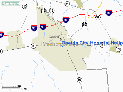
Oneida City Hospital Heliport |
Location & QuickFacts
| FAA Information Effective: | 2008-09-25 |
| Airport Identifier: | 1NK2 |
| Airport Status: | Operational |
| Longitude/Latitude: | 075-39-07.6540W/43-04-27.2450N
-75.652126/43.074235 (Estimated) |
| Elevation: | 523 ft / 159.41 m (Estimated) |
| Land: | 0 acres |
| From nearest city: | 1 nautical miles S of Oneida, NY |
| Location: | Madison County, NY |
| Magnetic Variation: | 13W (1990) |
Owner & Manager
| Ownership: | Publicly owned |
| Owner: | Oneida City Hospital |
| Address: | 321 Genessee St
Oneida, NY 13421 |
| Phone number: | 315-363-6000 |
| Manager: | Jeff Mark |
| Address: | 321 Genessee St
Oneida, NY 13421 |
| Phone number: | 315-363-6000 |
Airport Operations and Facilities
| Airport Use: | Private
MEDICAL USE. |
| Wind indicator: | Yes |
| Segmented Circle: | No |
| Control Tower: | No |
| Lighting Schedule: | PHONE REQ
FOR ARPT BCN & PERIMETER LGTS CALL 315-363-6000. |
| Beacon Color: | Clear-Green-Yellow (heliport) |
| Sectional chart: | New York |
| Region: | AEA - Eastern |
| Boundary ARTCC: | ZBW - Boston |
| Tie-in FSS: | BUF - Buffalo |
| FSS on Airport: | No |
| FSS Toll Free: | 1-800-WX-BRIEF |
Runway Information
Helipad H1
| Dimension: | 80 x 40 ft / 24.4 x 12.2 m |
| Surface: | CONC, |
| |
Runway H1 |
Runway |
| Traffic Pattern: | Left | Left |
|
Radio Navigation Aids
| ID |
Type |
Name |
Ch |
Freq |
Var |
Dist |
| BK | NDB | Plein | | 329.00 | 12W | 11.6 nm |
| CJY | NDB | Clay | | 275.00 | 12W | 17.1 nm |
| GSS | TACAN | Griffiss | 057X | | 12W | 14.2 nm |
| RKA | VOR/DME | Rockdale | 073X | 112.60 | 11W | 40.8 nm |
| ITH | VOR/DME | Ithaca | 055X | 111.80 | 10W | 49.8 nm |
| GGT | VORTAC | Georgetown | 125X | 117.80 | 11W | 18.8 nm |
| UCA | VORTAC | Utica | 049X | 111.20 | 12W | 21.6 nm |
| SYR | VORTAC | Syracuse | 117X | 117.00 | 11W | 24.8 nm |
Remarks
- PROVIDED COORDINATION FOR OPERATIONAL PROCEDURES BE MADE WITH THE AIRPORT MANAGEMENT OF KAMP (DURHAMVILLE) ARPT.
Images and information placed above are from
http://www.airport-data.com/airport/1NK2/
We thank them for the data!
| General Info
|
| Country |
United States
|
| State |
NEW YORK
|
| FAA ID |
1NK2
|
| Latitude |
43-04-27.245N
|
| Longitude |
075-39-07.654W
|
| Elevation |
523 feet
|
| Near City |
ONEIDA
|
We don't guarantee the information is fresh and accurate. The data may
be wrong or outdated.
For more up-to-date information please refer to other sources.
|
|


