 |
|
Location & QuickFacts
| FAA Information Effective: | 2008-09-25 |
| Airport Identifier: | NK26 |
| Airport Status: | Operational |
| Longitude/Latitude: | 074-58-34.3800W/43-43-30.6600N
-74.976217/43.725183 (Estimated) |
| Elevation: | 1753 ft / 534.31 m (Estimated) |
| Land: | 18 acres |
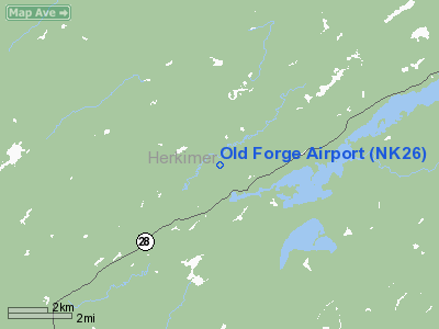
| From nearest city: | 1 nautical miles N of Old Forge, NY |
| Location: | Herkimer County, NY |
| Magnetic Variation: | () |
Owner & Manager
| Ownership: | Publicly owned |
| Owner: | Adirondack Homes Llc |
| Address: | Po Box 158
Old Forge, NY 13420 |
| Phone number: | 315-369-6004 |
| Manager: | Mike Mitchell |
| Address: | Po Box 158
Old Forge, NY 13420 |
| Phone number: | 315-369-6004 |
Airport Operations and Facilities
| Airport Use: | Private |
| Wind indicator: | Yes |
| Control Tower: | No |
| Sectional chart: | New York |
| Region: | AEA - Eastern |
| Boundary ARTCC: | ZBW - Boston |
| Responsible ARTCC: | ZBW - Boston |
| Tie-in FSS: | BUF - Buffalo |
| FSS Toll Free: | 1-800-WX-BRIEF |
Runway Information
Runway 09/27
| Dimension: | 3200 x 100 ft / 975.4 x 30.5 m |
| Surface: | TURF, |
| |
Runway 09 |
Runway 27 |
| Traffic Pattern: | Left | Left |
| Obstruction: | 50 ft trees, 300.0 ft from runway | 50 ft trees, 300.0 ft from runway |
|
Radio Navigation Aids
| ID |
Type |
Name |
Ch |
Freq |
Var |
Dist |
| BK | NDB | Plein | | 329.00 | 12W | 37.4 nm |
| GTB | NDB | Drum | | 257.00 | 13W | 38.8 nm |
| CJY | NDB | Clay | | 275.00 | 12W | 42.3 nm |
| GSS | TACAN | Griffiss | 057X | | 12W | 35.2 nm |
| UCA | VORTAC | Utica | 049X | 111.20 | 12W | 42.8 nm |
| ART | VORTAC | Watertown | 035X | 109.80 | 12W | 49.1 nm |
Remarks
- FOR WINTER CONDITIONS & SNOW REMOVAL CALL 315-369-6004.
- PPR FOR LANDING CALL 315-369-6004.
- DEER ON & INVOF ARPT.
- PRVDD OPER & PVT USE.
Images and information placed above are from
http://www.airport-data.com/airport/NK26/
We thank them for the data!
| General Info
|
| Country |
United States
|
| State |
NEW YORK
|
| FAA ID |
NK26
|
| Latitude |
42-03-02.200N
|
| Longitude |
078-59-14.150W
|
| Elevation |
1386 feet
|
| Near City |
SOUTH VALLEY
|
We don't guarantee the information is fresh and accurate. The data may
be wrong or outdated.
For more up-to-date information please refer to other sources.
|
|


