 |
|
Coordinates: 44°40′55″N 075°27′56″W / 44.68194°N 75.46556°W / 44.68194; -75.46556
| Ogdensburg International Airport |
| IATA: OGS – ICAO: KOGS – FAA LID: OGS |
| Summary |
| Airport type |
Public |
| Owner |
Ogdensburg Bridge & Port Authority |
| Serves |
Ogdensburg, New York |
| Elevation AMSL |
297 ft / 91 m |
| Runways |
| Direction |
Length |
Surface |
| ft |
m |
| 9/27 |
5,200 |
1,585 |
Asphalt |
| Statistics (2007) |
| Aircraft operations |
2,750 |
| Source: Federal Aviation Administration |
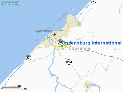
Ogdensburg International Airport (IATA: OGS, ICAO: KOGS, FAA LID: OGS) is a public airport located two miles (3 km) southeast of the central business district of Ogdensburg, a city in St. Lawrence County, New York, United States. It is owned by the Ogdensburg Bridge & Port Authority. and is situated just outside the city limits on NYS Route 812. The airport has served air commuters and flying enthusiasts for over 40 years.
As per Federal Aviation Administration records, the airport had 2,078 passenger boardings (enplanements) in calendar year 2005 and 1,664 enplanements in 2006. According to the FAA's National Plan of Integrated Airport Systems for 2007–2011, Ogdensburg is a general aviation airport because a commercial service classification requires at least 2,500 passenger boardings per year. Airlines and destinations
| Airlines |
Destinations |
| Cape Air |
Albany |
Facilities and aircraft
Ogdensburg International Airport covers an area of 500 acres (202 ha) which contains one asphalt paved runway designated 9/27 and measuring 5,200 x 150 ft. (1,585 x 46 m). For the 12-month period ending March 26, 2007, the airport had 2,750 aircraft operations, an average of 7 per day: 56% scheduled commercial, 36% general aviation and 7% military.
The above content comes from Wikipedia and is published under free licenses – click here to read more.
Location & QuickFacts
| FAA Information Effective: | 2008-09-25 |
| Airport Identifier: | OGS |
| Airport Status: | Operational |
| Longitude/Latitude: | 075-27-55.8000W/44-40-54.7000N
-75.465500/44.681861 (Estimated) |
| Elevation: | 297 ft / 90.53 m (Surveyed) |
| Land: | 500 acres |
| From nearest city: | 2 nautical miles SE of Ogdensburg, NY |
| Location: | St Lawrence County, NY |
| Magnetic Variation: | 13W (1980) |
Owner & Manager
| Ownership: | Publicly owned |
| Owner: | Ogdensburg Bridge & Port |
| Address: | Bridge Plaza
Ogdensburg, NY 13669 |
| Phone number: | 315-393-4080 |
| Manager: | Steven Lawrence |
| Address: | 5840 State Hwy 812
Ogdensburg, NY 13669 |
| Phone number: | 315-393-4080 |
Airport Operations and Facilities
| Airport Use: | Open to public |
| Wind indicator: | Yes |
| Segmented Circle: | No |
| Control Tower: | No |
| Lighting Schedule: | DUSK-DAWN
ACTVT HIRL RY 09/27, MALS RY 27, VASI RYS 09 & 27, & TWY LGTS - CTAF. |
| Beacon Color: | Clear-Green (lighted land airport) |
| Landing fee charge: | Yes |
| Sectional chart: | Montreal |
| Region: | AEA - Eastern |
| Boundary ARTCC: | ZBW - Boston |
| Tie-in FSS: | BTV - Burlington |
| FSS on Airport: | No |
| FSS Toll Free: | 1-800-WX-BRIEF |
| NOTAMs Facility: | OGS (NOTAM-d service avaliable) |
| Certification type/date: | II A S 05/198
PPR 24 HRS FOR ACR OPNS WITH MORE THAN 30 PSGR SEATS; CALL AMGR (315) 393-4721. |
| Federal Agreements: | NGY |
Airport Communications
| CTAF: | 122.800 |
| Unicom: | 122.800 |
Airport Services
| Fuel available: | 100LLA
SELF SERVICE 100LL AVAILABLE 24 HOURS DAILY. |
| Bottled Oxygen: | NONE |
| Bulk Oxygen: | NONE |
Runway Information
Runway 09/27
| Dimension: | 5200 x 150 ft / 1585.0 x 45.7 m |
| Surface: | ASPH, Good Condition |
| Surface Treatment: | Saw-cut or plastic Grooved |
| Weight Limit: | Single wheel: 44000 lbs.
Dual wheel: 50000 lbs.
Dual tandem wheel: 77000 lbs. |
| Edge Lights: | High |
| |
Runway 09 |
Runway 27 |
| Longitude: | 075-28-30.7075W | 075-27-20.8757W |
| Latitude: | 44-40-48.4518N | 44-41-00.8598N |
| Elevation: | 286.00 ft | 297.00 ft |
| Alignment: | 76 | 127 |
| ILS Type: | | LOCALIZER
|
| Traffic Pattern: | Left | Left |
| Markings: | Non-precision instrument, Good Condition | Non-precision instrument, Good Condition |
| Crossing Height: | 39.00 ft | 52.00 ft |
| VASI: | 4-box on left side | 4-box on left side |
| Visual Glide Angle: | 3.00° | 3.00° |
| Approach lights: | | MALS |
| Obstruction: | 51 ft tree, 1090.0 ft from runway, 260 ft right of centerline, 17:1 slope to clear | 76 ft tree, 2050.0 ft from runway, 575 ft right of centerline, 24:1 slope to clear |
|
Radio Navigation Aids
| ID |
Type |
Name |
Ch |
Freq |
Var |
Dist |
| PTD | NDB | Potsdam | | 400.00 | 14W | 25.0 nm |
| YSH | NDB | Smiths Falls | | 334.00 | 13W | 26.7 nm |
| YUP | NDB | Uplands | | 352.00 | 14W | 32.9 nm |
| YRR | NDB | Greely | | 377.00 | 14W | 35.6 nm |
| O | NDB | Oscar | | 344.00 | 14W | 37.8 nm |
| GTB | NDB | Drum | | 257.00 | 13W | 38.7 nm |
| OW | NDB | Ottawa | | 236.00 | 14W | 41.0 nm |
| UUP | TACAN | Uplands | 025X | | 14W | 39.2 nm |
| MSS | VORTAC | Massena | 088X | 114.10 | 14W | 34.6 nm |
| YOW | VORTAC | Ottawa | 093X | 114.60 | 14W | 49.2 nm |
Remarks
- BIRDS & DEER ON OR INVOF ARPT.
- FILED FOR RECORD PURPOSES ONLY.
Images and information placed above are from
http://www.airport-data.com/airport/OGS/
We thank them for the data!
| General Info
|
| Country |
United States
|
| State |
NEW YORK
|
| FAA ID |
OGS
|
| Latitude |
44-40-54.700N
|
| Longitude |
075-27-55.800W
|
| Elevation |
297 feet
|
| Near City |
OGDENSBURG
|
We don't guarantee the information is fresh and accurate. The data may
be wrong or outdated.
For more up-to-date information please refer to other sources.
|
|


