 |
|
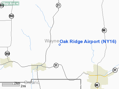
Location & QuickFacts
| FAA Information Effective: | 2008-09-25 |
| Airport Identifier: | NY16 |
| Airport Status: | Operational |
| Longitude/Latitude: | 077-10-54.9250W/43-05-54.2280N
-77.181924/43.098397 (Estimated) |
| Elevation: | 540 ft / 164.59 m (Estimated) |
| Land: | 0 acres |
| From nearest city: | 3 nautical miles SE of East Palmyra, NY |
| Location: | Wayne County, NY |
| Magnetic Variation: | 11W (1985) |
Owner & Manager
| Ownership: | Privately owned |
| Owner: | Max Albertson |
| Address: | Oak Ridge Farms
Palmyra, NY 14522 |
| Phone number: | 315-926-4845 |
| Address: |
|
Airport Operations and Facilities
| Airport Use: | Private |
| Wind indicator: | No |
| Segmented Circle: | No |
| Control Tower: | No |
| Landing fee charge: | No |
| Sectional chart: | New York |
| Region: | AEA - Eastern |
| Boundary ARTCC: | ZOB - Cleveland |
| Tie-in FSS: | BUF - Buffalo |
| FSS on Airport: | No |
| FSS Toll Free: | 1-800-WX-BRIEF |
Runway Information
Runway 17/35
| Dimension: | 2500 x 60 ft / 762.0 x 18.3 m |
| Surface: | TURF, |
| |
Runway 17 |
Runway 35 |
| Traffic Pattern: | Left | Left |
|
Radio Navigation Aids
| ID |
Type |
Name |
Ch |
Freq |
Var |
Dist |
| AVN | NDB | Avon | | 344.00 | 09W | 26.3 nm |
| PYA | NDB | Penn Yan | | 260.00 | 12W | 27.9 nm |
| GEE | VOR/DME | Geneseo | 019X | 108.20 | 09W | 29.0 nm |
| ITH | VOR/DME | Ithaca | 055X | 111.80 | 10W | 48.3 nm |
| ROC | VORTAC | Rochester | 037X | 110.00 | 09W | 21.6 nm |
| SYR | VORTAC | Syracuse | 117X | 117.00 | 11W | 43.0 nm |
Remarks
Images and information placed above are from
http://www.airport-data.com/airport/NY16/
We thank them for the data!
| General Info
|
| Country |
United States
|
| State |
NEW YORK
|
| FAA ID |
NY16
|
| Latitude |
43-05-54.228N
|
| Longitude |
077-10-54.925W
|
| Elevation |
540 feet
|
| Near City |
EAST PALMYRA
|
We don't guarantee the information is fresh and accurate. The data may
be wrong or outdated.
For more up-to-date information please refer to other sources.
|
|


