 |
|
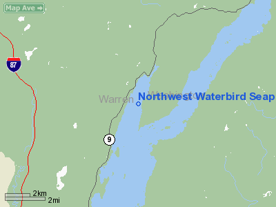
Northwest Waterbird Seaplane Base Airport |
Location & QuickFacts
| FAA Information Effective: | 2008-09-25 |
| Airport Identifier: | 2NK0 |
| Airport Status: | Operational |
| Longitude/Latitude: | 073-37-30.4280W/43-35-36.2400N
-73.625119/43.593400 (Estimated) |
| Elevation: | 320 ft / 97.54 m (Estimated) |
| Land: | 0 acres |
| From nearest city: | 4 nautical miles S of Bolten Landing, NY |
| Location: | Warren County, NY |
| Magnetic Variation: | 15W (1985) |
Owner & Manager
| Ownership: | Privately owned |
| Owner: | Mathew B. Brady |
| Address: | Po Box 603
Bolten Landing, NY 12814 |
| Phone number: | 518-644-3535 |
| Address: |
|
Airport Operations and Facilities
| Airport Use: | Private |
| Segmented Circle: | No |
| Control Tower: | No |
| Sectional chart: | New York |
| Region: | AEA - Eastern |
| Boundary ARTCC: | ZBW - Boston |
| Tie-in FSS: | BTV - Burlington |
| FSS Toll Free: | 1-800-WX-BRIEF |
Runway Information
Runway 01/19
| Dimension: | 15000 x 4000 ft / 4572.0 x 1219.2 m |
| Surface: | WATER, |
| |
Runway 01 |
Runway 19 |
| Traffic Pattern: | Left | Right |
|
Radio Navigation Aids
| ID |
Type |
Name |
Ch |
Freq |
Var |
Dist |
| R | FAN MARKER | Chitt | | | 14W | 28.4 nm |
| DYO | NDB | Smuto | | 221.00 | 15W | 29.8 nm |
| HEU | NDB | Hunter | | 356.00 | 14W | 46.5 nm |
| JJH | NDB | Johnstown | | 523.00 | 14W | 47.2 nm |
| SXD | NDB | Springfield | | 265.00 | 15W | 49.3 nm |
| RUT | VOR/DME | Rutland | 47X | 111.00 | 15W | 29.7 nm |
| CAM | VOR/DME | Cambridge | 097X | 115.00 | 14W | 38.1 nm |
| GFL | VORTAC | Glens Falls | 039X | 110.20 | 14W | 15.1 nm |
Remarks
- PROVIDED COORDINATION AND APPROVAL IS OBTAINED FROM REGULATING AGENCIES.
Images and information placed above are from
http://www.airport-data.com/airport/2NK0/
We thank them for the data!
| General Info
|
| Country |
United States
|
| State |
NEW YORK
|
| FAA ID |
2NK0
|
| Latitude |
43-35-36.240N
|
| Longitude |
073-37-30.428W
|
| Elevation |
320 feet
|
| Near City |
BOLTEN LANDING
|
We don't guarantee the information is fresh and accurate. The data may
be wrong or outdated.
For more up-to-date information please refer to other sources.
|
|


