 |
|
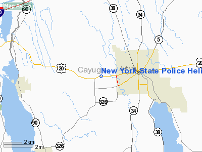
New York State Police Heliport |
Location & QuickFacts
| FAA Information Effective: | 2008-09-25 |
| Airport Identifier: | 0NY6 |
| Airport Status: | Operational |
| Longitude/Latitude: | 076-36-55.8000W/42-55-42.2400N
-76.615500/42.928400 (Estimated) |
| Elevation: | 600 ft / 182.88 m (Estimated) |
| Land: | 3 acres |
| From nearest city: | 2 nautical miles W of Auburn, NY |
| Location: | Cayuga County, NY |
| Magnetic Variation: | 12W (1995) |
Owner & Manager
| Ownership: | Publicly owned |
| Owner: | Ny State Police |
| Address: | 1251 W Genesee St
Auburn, NY 13021 |
| Phone number: | 315-255-2766 |
| Manager: | Sgt L Kent Middleton |
| Address: | Rd1 Box 865a
Cayuga, NY 13034 |
| Phone number: | 315-255-2766 |
Airport Operations and Facilities
| Airport Use: | Private
MEDICAL & EMERGENCY USE. |
| Wind indicator: | Yes |
| Segmented Circle: | No |
| Control Tower: | No |
| Lighting Schedule: | PHONE REQ
FOR FLOODLGTS CALL 315-255-2766. |
| Sectional chart: | New York |
| Region: | AEA - Eastern |
| Boundary ARTCC: | ZBW - Boston |
| Tie-in FSS: | BUF - Buffalo |
| FSS Toll Free: | 1-800-WX-BRIEF |
Runway Information
Helipad H1
| Dimension: | 25 x 25 ft / 7.6 x 7.6 m |
| Surface: | CONC, |
| Edge Lights: | High
FLOODLGT EACH CORNER OF PAD. |
| |
Runway H1 |
Runway |
| Traffic Pattern: | Left | Left |
|
Radio Navigation Aids
| ID |
Type |
Name |
Ch |
Freq |
Var |
Dist |
| PYA | NDB | Penn Yan | | 260.00 | 12W | 25.9 nm |
| ALP | NDB | Alpine | | 245.00 | 12W | 42.0 nm |
| ITH | VOR/DME | Ithaca | 055X | 111.80 | 10W | 26.9 nm |
| GEE | VOR/DME | Geneseo | 019X | 108.20 | 09W | 49.5 nm |
| SYR | VORTAC | Syracuse | 117X | 117.00 | 11W | 22.8 nm |
| GGT | VORTAC | Georgetown | 125X | 117.80 | 11W | 35.7 nm |
| ROC | VORTAC | Rochester | 037X | 110.00 | 09W | 47.9 nm |
Remarks
- HELIPAD LCTD N SIDE STATE POLICE STATION 100 FT FM BLDG.
Images and information placed above are from
http://www.airport-data.com/airport/0NY6/
We thank them for the data!
| General Info
|
| Country |
United States
|
| State |
NEW YORK
|
| FAA ID |
0NY6
|
| Latitude |
42-55-42.240N
|
| Longitude |
076-36-55.800W
|
| Elevation |
600 feet
|
| Near City |
AUBURN
|
We don't guarantee the information is fresh and accurate. The data may
be wrong or outdated.
For more up-to-date information please refer to other sources.
|
|


