 |
|
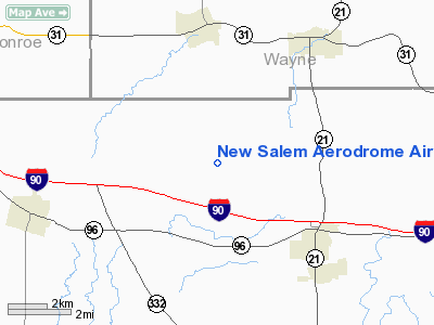
New Salem Aerodrome Airport |
Location & QuickFacts
| FAA Information Effective: | 2008-09-25 |
| Airport Identifier: | 74NY |
| Airport Status: | Operational |
| Longitude/Latitude: | 077-17-28.9600W/43-00-20.2200N
-77.291378/43.005617 (Estimated) |
| Elevation: | 660 ft / 201.17 m (Estimated) |
| Land: | 35 acres |
| From nearest city: | 3 nautical miles NE of Farmington, NY |
| Location: | Ontario County, NY |
| Magnetic Variation: | 11W (1990) |
Owner & Manager
| Ownership: | Privately owned |
| Owner: | Brian I Blazey |
| Address: | 5075 Rushmore Rd
Palmyra, NY 14522 |
| Phone number: | 315-986-7743 |
| Manager: | Brian I Blazey |
| Address: | 5075 Rushmore Rd
Palmyra, NY 14522 |
| Phone number: | 315-986-7743 |
Airport Operations and Facilities
| Airport Use: | Private |
| Wind indicator: | Yes |
| Segmented Circle: | No |
| Control Tower: | No |
| Lighting Schedule: | PHONE REQ
FOR MIRL RY 02/20 CALL 315-986-7743. |
| Landing fee charge: | No |
| Sectional chart: | Detroit |
| Region: | AEA - Eastern |
| Boundary ARTCC: | ZOB - Cleveland |
| Tie-in FSS: | BUF - Buffalo |
| FSS on Airport: | No |
| FSS Toll Free: | 1-800-WX-BRIEF |
Runway Information
Runway 02/20
| Dimension: | 1575 x 50 ft / 480.1 x 15.2 m |
| Surface: | TURF, |
| Edge Lights: | Medium |
| |
Runway 02 |
Runway 20 |
| Traffic Pattern: | Right | Left |
| Obstruction: | 40 ft trees, 800.0 ft from runway | |
|
Radio Navigation Aids
| ID |
Type |
Name |
Ch |
Freq |
Var |
Dist |
| AVN | NDB | Avon | | 344.00 | 09W | 21.0 nm |
| PYA | NDB | Penn Yan | | 260.00 | 12W | 24.1 nm |
| GEE | VOR/DME | Geneseo | 019X | 108.20 | 09W | 22.0 nm |
| ITH | VOR/DME | Ithaca | 055X | 111.80 | 10W | 47.8 nm |
| ROC | VORTAC | Rochester | 037X | 110.00 | 09W | 18.2 nm |
| SYR | VORTAC | Syracuse | 117X | 117.00 | 11W | 48.6 nm |
Remarks
- PROVIDED TRAFFIC PATTERN USAGE COORDINATED WITH MANAGEMENT OF LAKESTONE AND PALMYRA ARPT & ALL OPERATIONS BE RESTRICTED TO SINGLE ENGINE LAND AIRCRAFT.
Images and information placed above are from
http://www.airport-data.com/airport/74NY/
We thank them for the data!
| General Info
|
| Country |
United States
|
| State |
NEW YORK
|
| FAA ID |
74NY
|
| Latitude |
43-00-20.220N
|
| Longitude |
077-17-28.960W
|
| Elevation |
660 feet
|
| Near City |
PALMYRA
|
We don't guarantee the information is fresh and accurate. The data may
be wrong or outdated.
For more up-to-date information please refer to other sources.
|
|


