 |
|
Location & QuickFacts
| FAA Information Effective: | 2008-09-25 |
| Airport Identifier: | NY18 |
| Airport Status: | Operational |
| Longitude/Latitude: | 076-37-00.8050W/42-26-55.2610N
-76.616890/42.448684 (Estimated) |
| Elevation: | 1283 ft / 391.06 m (Surveyed) |
| Land: | 10 acres |
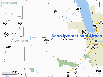
| From nearest city: | 5 nautical miles W of Ithaca, NY |
| Location: | Tompkins County, NY |
| Magnetic Variation: | 11W (1985) |
Owner & Manager
| Ownership: | Privately owned |
| Owner: | John A Neno Sr |
| Address: | 1959 Mecklenberg Rd
Ithaca, NY 14850 |
| Phone number: | 607-272-6261 |
| Manager: | John A Neno Sr |
| Address: | 1959 Mecklenberg Rd
Ithaca, NY 14850 |
| Phone number: | 607-272-8436 |
Airport Operations and Facilities
| Airport Use: | Private |
| Wind indicator: | Yes |
| Segmented Circle: | Yes |
| Control Tower: | No |
| Landing fee charge: | No |
| Sectional chart: | New York |
| Region: | AEA - Eastern |
| Boundary ARTCC: | ZNY - New York |
| Tie-in FSS: | BUF - Buffalo |
| FSS on Airport: | No |
| FSS Toll Free: | 1-800-WX-BRIEF |
Runway Information
Runway 09/27
| Dimension: | 2400 x 50 ft / 731.5 x 15.2 m |
| Surface: | TURF, Fair Condition |
| |
Runway 09 |
Runway 27 |
| Traffic Pattern: | Left | Left |
| Obstruction: | 30 ft trees, 50.0 ft from runway, 50 ft right of centerline, 1:1 slope to clear | 70 ft trees, 140.0 ft from runway, 90 ft right of centerline, 2:1 slope to clear |
|
Runway 18/36
| Dimension: | 2100 x 75 ft / 640.1 x 22.9 m |
| Surface: | TURF, Fair Condition |
| |
Runway 18 |
Runway 36 |
| Traffic Pattern: | Right | Left |
| Obstruction: | 25 ft pline, 90.0 ft from runway, 3:1 slope to clear | 10 ft trees, 30.0 ft from runway, 40 ft left of centerline, 3:1 slope to clear |
|
Radio Navigation Aids
| ID |
Type |
Name |
Ch |
Freq |
Var |
Dist |
| ALP | NDB | Alpine | | 245.00 | 12W | 14.2 nm |
| PYA | NDB | Penn Yan | | 260.00 | 12W | 22.7 nm |
| ITH | VOR/DME | Ithaca | 055X | 111.80 | 10W | 7.5 nm |
| ULW | VOR/DME | Elmira | 033Y | 109.65 | 12W | 28.0 nm |
| CFB | VORTAC | Binghamton | 059X | 112.20 | 10W | 27.6 nm |
| GGT | VORTAC | Georgetown | 125X | 117.80 | 11W | 40.5 nm |
| SYR | VORTAC | Syracuse | 117X | 117.00 | 11W | 46.5 nm |
Remarks
- RY 09/27 CLSD DURING WINTER MONTHS.
- PRVDD THAT ALL TFC PAT BE FLOWN TO THE WEST.
Images and information placed above are from
http://www.airport-data.com/airport/NY18/
We thank them for the data!
| General Info
|
| Country |
United States
|
| State |
NEW YORK
|
| FAA ID |
NY18
|
| Latitude |
42-26-55.261N
|
| Longitude |
076-37-00.805W
|
| Elevation |
1283 feet
|
| Near City |
ITHACA
|
We don't guarantee the information is fresh and accurate. The data may
be wrong or outdated.
For more up-to-date information please refer to other sources.
|
|


