 |
|
Location & QuickFacts
| FAA Information Effective: | 2008-09-25 |
| Airport Identifier: | 2NK5 |
| Airport Status: | Operational |
| Longitude/Latitude: | 075-57-17.8190W/44-18-06.1750N
-75.954950/44.301715 (Estimated) |
| Elevation: | 275 ft / 83.82 m (Estimated) |
| Land: | 0 acres |
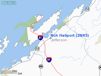
| From nearest city: | 4 nautical miles SW of Alexandria Bay, NY |
| Location: | Jefferson County, NY |
| Magnetic Variation: | 13W (1985) |
Owner & Manager
| Ownership: | Privately owned |
| Owner: | North Country Helicopters Inc |
| Address: | 127 W. Flower Ave
Watertown, NY 13601 |
| Phone number: | 315-782-6642 |
| Manager: | Kenneth Rucki |
| Address: | 127 W. Flower Ave
Watertown, NY 13601 |
| Phone number: | 315-782-6642
OR 315-482-5722. |
Airport Operations and Facilities
| Airport Use: | Private
PERSONAL USE. |
| Wind indicator: | Yes |
| Segmented Circle: | No |
| Control Tower: | No |
| Sectional chart: | Montreal |
| Region: | AEA - Eastern |
| Boundary ARTCC: | ZBW - Boston |
| Tie-in FSS: | BTV - Burlington |
| FSS on Airport: | No |
| FSS Toll Free: | 1-800-WX-BRIEF |
Airport Communications
Runway Information
Helipad H1
| Dimension: | 30 x 30 ft / 9.1 x 9.1 m |
| Surface: | TURF, |
| |
Runway H1 |
Runway |
| Traffic Pattern: | Left | Left |
|
Radio Navigation Aids
| ID |
Type |
Name |
Ch |
Freq |
Var |
Dist |
| GTB | NDB | Drum | | 257.00 | 13W | 16.9 nm |
| YSH | NDB | Smiths Falls | | 334.00 | 13W | 36.1 nm |
| ART | VORTAC | Watertown | 035X | 109.80 | 12W | 21.5 nm |
Images and information placed above are from
http://www.airport-data.com/airport/2NK5/
We thank them for the data!
| General Info
|
| Country |
United States
|
| State |
NEW YORK
|
| FAA ID |
2NK5
|
| Latitude |
44-18-06.175N
|
| Longitude |
075-57-17.819W
|
| Elevation |
275 feet
|
| Near City |
ALEXANDRIA BAY
|
We don't guarantee the information is fresh and accurate. The data may
be wrong or outdated.
For more up-to-date information please refer to other sources.
|
|


