 |
|
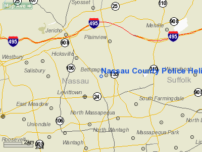
Nassau County Police Heliport |
Location & QuickFacts
| FAA Information Effective: | 2008-09-25 |
| Airport Identifier: | 8NY9 |
| Airport Status: | Operational |
| Longitude/Latitude: | 073-29-28.4480W/40-44-45.3580N
-73.491236/40.745933 (Estimated) |
| Elevation: | 132 ft / 40.23 m (Estimated) |
| Land: | 0 acres |
| From nearest city: | 16 nautical miles NW of Bethpage, NY |
| Location: | Nassau County, NY |
| Magnetic Variation: | 13W (1985) |
Owner & Manager
| Ownership: | Publicly owned |
| Owner: | Nassau County Police Dept |
| Address: | 1490 Franklin Ave
Mineola, NY 11501 |
| Phone number: | 516-573-7000 |
| Manager: | Steven Salz |
| Address: | 101 Grumman Rd West
Bethpage,li, NY 11714 |
| Phone number: | 516-573-4000 |
Airport Operations and Facilities
| Airport Use: | Private |
| Wind indicator: | Yes |
| Segmented Circle: | No |
| Control Tower: | No |
| Lighting Schedule: | 24 HRS
ACTVT PERIMETER LGTS RY H1 DUSK-2320 - 123.0. |
| Beacon Color: | Clear-Green-Yellow (heliport) |
| Landing fee charge: | No |
| Sectional chart: | New York |
| Region: | AEA - Eastern |
| Boundary ARTCC: | ZNY - New York |
| Tie-in FSS: | ISP - New York |
| FSS on Airport: | No |
| FSS Toll Free: | 1-800-WX-BRIEF |
Airport Communications
Airport Services
| Airframe Repair: | NONE |
| Power Plant Repair: | NONE |
Runway Information
Helipad H1
| Dimension: | 50 x 50 ft / 15.2 x 15.2 m |
| Surface: | CONC, |
| |
Runway H1 |
Runway |
| Traffic Pattern: | Left | Left |
| Markings: | Basic, Good Condition | , |
|
Radio Navigation Aids
| ID |
Type |
Name |
Ch |
Freq |
Var |
Dist |
| EWR | FAN MARKER | Maryann | | | 11W | 31.8 nm |
| BBN | NDB | Babylon | | 275.00 | 14W | 6.6 nm |
| OGY | NDB | Bridge | | 414.00 | 12W | 20.8 nm |
| OP | NDB | Old Field Point Light | | 316.00 | 13W | 21.9 nm |
| PNJ | NDB | Paterson | | 347.00 | 12W | 32.3 nm |
| CAT | NDB | Chatham | | 254.00 | 11W | 42.7 nm |
| TBY | NDB | Waterbury | | 257.00 | 14W | 49.6 nm |
| FOK | TACAN | Suffolk Co | 047X | | 13W | 39.5 nm |
| DPK | VOR/DME | Deer Park | 124X | 117.70 | 12W | 9.0 nm |
| JFK | VOR/DME | Kennedy | 106X | 115.90 | 12W | 14.5 nm |
| LGA | VOR/DME | La Guardia | 078X | 113.10 | 12W | 17.7 nm |
| CRI | VOR/DME | Canarsie | 070X | 112.30 | 11W | 20.1 nm |
| TEB | VOR/DME | Teterboro | 021X | 108.40 | 11W | 26.7 nm |
| BDR | VOR/DME | Bridgeport | 25X | 108.80 | 12W | 30.0 nm |
| CMK | VOR/DME | Carmel | 113X | 116.60 | 12W | 32.4 nm |
| CCC | VOR/DME | Calverton | 119X | 117.20 | 13W | 33.4 nm |
| COL | VOR/DME | Colts Neck | 101X | 115.40 | 11W | 40.2 nm |
| HVN | VOR/DME | New Haven | 035X | 109.80 | 13W | 41.5 nm |
| MAD | VOR/DME | Madison | 041X | 110.40 | 13W | 49.8 nm |
| JFK | VOT | Kennedy | | 115.10 | | 14.7 nm |
| ISP | VOT | Long Island Mac Arthur | | 109.40 | | 18.2 nm |
| BDR | VOT | Bridgeport | | 109.25 | | 30.0 nm |
Remarks
- PRVDD VFR OPNS ONLY, CLEAR 8:1 INGRESS/EGRESS, VEHICULAR TFC AROUND SITE BE CONTROLLED, APPROPRIATE INGRESS/EGRESS MKGS PLACED ON PAD.
Images and information placed above are from
http://www.airport-data.com/airport/8NY9/
We thank them for the data!
| General Info
|
| Country |
United States
|
| State |
NEW YORK
|
| FAA ID |
8NY9
|
| Latitude |
40-44-45.358N
|
| Longitude |
073-29-28.448W
|
| Elevation |
132 feet
|
| Near City |
BETHPAGE
|
We don't guarantee the information is fresh and accurate. The data may
be wrong or outdated.
For more up-to-date information please refer to other sources.
|
|


