 |
|
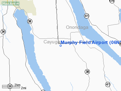
Location & QuickFacts
| FAA Information Effective: | 2008-09-25 |
| Airport Identifier: | 06NY |
| Airport Status: | Operational |
| Longitude/Latitude: | 076-26-43.0000W/42-50-34.0000N
-76.445278/42.842778 (Estimated) |
| Elevation: | 1100 ft / 335.28 m () |
| Land: | 26 acres |
| From nearest city: | 8 nautical miles SE of Auburn, NY |
| Location: | Cayuga County, NY |
| Magnetic Variation: | 12W (2000) |
Owner & Manager
| Ownership: | Privately owned |
| Owner: | James Murphy |
| Address: | 4540 Rowe Rd
Skaneateles, NY 13152 |
| Phone number: | 315-784-5858 |
| Manager: | James Murphy |
| Address: | 4540 Rowe Rd
Skaneateles, NY 13152 |
| Phone number: | 315-784-5858 |
Airport Operations and Facilities
| Airport Use: | Private |
| Wind indicator: | Yes |
| Segmented Circle: | No |
| Control Tower: | No |
| Sectional chart: | New York |
| Region: | AEA - Eastern |
| Boundary ARTCC: | ZNY - New York |
| Tie-in FSS: | BUF - Buffalo |
| FSS Toll Free: | 1-800-WX-BRIEF |
Airport Communications
Runway Information
Runway 15/33
| Dimension: | 2000 x 75 ft / 609.6 x 22.9 m |
| Surface: | TURF, |
| |
Runway 15 |
Runway 33 |
| Traffic Pattern: | Left | Left |
| Obstruction: | | 20 ft pline, 250.0 ft from runway |
|
Radio Navigation Aids
| ID |
Type |
Name |
Ch |
Freq |
Var |
Dist |
| PYA | NDB | Penn Yan | | 260.00 | 12W | 29.5 nm |
| ALP | NDB | Alpine | | 245.00 | 12W | 39.0 nm |
| BK | NDB | Plein | | 329.00 | 12W | 48.1 nm |
| ITH | VOR/DME | Ithaca | 055X | 111.80 | 10W | 20.9 nm |
| SYR | VORTAC | Syracuse | 117X | 117.00 | 11W | 21.8 nm |
| GGT | VORTAC | Georgetown | 125X | 117.80 | 11W | 27.5 nm |
| CFB | VORTAC | Binghamton | 059X | 112.20 | 10W | 43.4 nm |
Remarks
- PRVDD VFR, PLINE BE MKD, CLEAR 20:1 APCH/DEP PATH, TREES NEAR RY 15 SHOULD BE REMOVED.
Images and information placed above are from
http://www.airport-data.com/airport/06NY/
We thank them for the data!
| General Info
|
| Country |
United States
|
| State |
NEW YORK
|
| FAA ID |
06NY
|
| Latitude |
42-50-34.000N
|
| Longitude |
076-26-43.000W
|
| Elevation |
1100 feet
|
| Near City |
AUBURN
|
We don't guarantee the information is fresh and accurate. The data may
be wrong or outdated.
For more up-to-date information please refer to other sources.
|
|


