 |
|
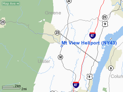
Location & QuickFacts
| FAA Information Effective: | 2008-09-25 |
| Airport Identifier: | NY43 |
| Airport Status: | Operational |
| Longitude/Latitude: | 073-59-56.4000W/42-09-23.8300N
-73.999000/42.156619 (Estimated) |
| Elevation: | 250 ft / 76.20 m (Estimated) |
| Land: | 2 acres |
| From nearest city: | 6 nautical miles NW of Saugerties, NY |
| Location: | Ulster County, NY |
| Magnetic Variation: | 14W (2000) |
Owner & Manager
| Ownership: | Privately owned |
| Owner: | Anthony J. Corrado |
| Address: | 11 Rt 32a
Saugerties, NY 12477 |
| Phone number: | 518-678-5881 |
| Manager: | Anthony J. Corrado |
| Address: | 11 Rt 32a
Saugerties, NY 12477 |
| Phone number: | 518-678-5881 |
Airport Operations and Facilities
| Airport Use: | Private |
| Wind indicator: | Yes |
| Segmented Circle: | No |
| Control Tower: | No |
| Sectional chart: | New York |
| Region: | AEA - Eastern |
| Boundary ARTCC: | ZBW - Boston |
| Tie-in FSS: | ISP - New York |
| FSS Toll Free: | 1-800-WX-BRIEF |
Runway Information
Helipad H1
| Dimension: | 40 x 40 ft / 12.2 x 12.2 m |
| Surface: | TURF, |
| |
Runway H1 |
Runway |
| Traffic Pattern: | Left | Left |
|
Radio Navigation Aids
| ID |
Type |
Name |
Ch |
Freq |
Var |
Dist |
| GBR | FAN MARKER | Sheffield | | | 13W | 28.4 nm |
| SKU | FAN MARKER | Stanwyck | | | 12W | 37.8 nm |
| PSF | FAN MARKER | Abyss | | | 13W | 39.3 nm |
| PFH | NDB | Philmont | | 272.00 | 13W | 13.6 nm |
| GBR | NDB | Great Barrington | | 395.00 | 14W | 26.6 nm |
| PO | NDB | Meier | | 403.00 | 12W | 35.0 nm |
| SKU | NDB | Stanwyck | | 261.00 | 12W | 37.8 nm |
| DXT | NDB | Dalton | | 370.00 | 15W | 41.4 nm |
| SW | NDB | Neely | | 335.00 | 14W | 41.6 nm |
| HEU | NDB | Hunter | | 356.00 | 14W | 42.0 nm |
| MS | NDB | Monga | | 359.00 | 12W | 45.1 nm |
| PWL | VOR/DME | Pawling | 090X | 114.30 | 12W | 29.3 nm |
| IGN | VOR/DME | Kingston | 123X | 117.60 | 12W | 30.6 nm |
| DNY | VOR/DME | De Lancey | 058X | 112.10 | 11W | 42.7 nm |
| CTR | VOR/DME | Chester | 098X | 115.10 | 13W | 47.4 nm |
| ALB | VORTAC | Albany | 100X | 115.30 | 13W | 36.5 nm |
| ALB | VOT | Albany County | | 108.20 | | 36.1 nm |
Remarks
- PRVDD CLEAR 8:1 INGRESS/EGRESS, APPROPRIATE MKGS ON PAD, LGTD WIND INDICATOR, VEHICULAR TFC CONTROLLED, & OPER IN A MANNER TO MINIMIZE NOISE.
Images and information placed above are from
http://www.airport-data.com/airport/NY43/
We thank them for the data!
| General Info
|
| Country |
United States
|
| State |
NEW YORK
|
| FAA ID |
NY43
|
| Latitude |
42-09-23.830N
|
| Longitude |
073-59-56.400W
|
| Elevation |
250 feet
|
| Near City |
SAUGERTIES
|
We don't guarantee the information is fresh and accurate. The data may
be wrong or outdated.
For more up-to-date information please refer to other sources.
|
|


