 |
|
| Mohawk Valley Airport |
| IATA: none – ICAO: none – FAA LID: 31NK |
| Summary |
| Airport type |
Public |
| Owner |
Ray Marshall |
| Serves |
Scotia, New York |
| Elevation AMSL |
240 ft / 73 m |
| Coordinates |
42°52′05″N 074°01′43″W / 42.86806°N 74.02861°W / 42.86806; -74.02861 |
| Runways |
| Direction |
Length |
Surface |
| ft |
m |
| 15/33 |
1,840 |
561 |
Turf |
| Statistics (2007) |
| Aircraft operations |
750 |
| Source: FAA and NYSDOT |
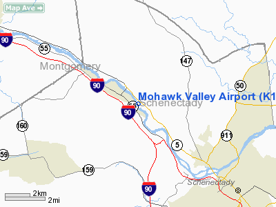
Mohawk Valley Airport (FAA LID: 31NK) is a privately-owned, public-use airport located three nautical miles (6 km) northwest of Scotia, a village in the Town of Glenville in Schenectady County, New York, United States.
Facilities and aircraft
Mohawk Valley Airport covers an area of 44 acres (18 ha) at an elevation of 240 feet (73 m) above mean sea level. It has one runway designated 15/33 with a turf surface measuring 1,840 by 120 feet (561 x 37 m). For the 12-month period ending September 28, 2007, the airport had 750 aircraft operations, an average of 62 per month: 93% general aviation and 7% military.
The above content comes from Wikipedia and is published under free licenses – click here to read more.
Location & QuickFacts
| FAA Information Effective: | 2008-09-25 |
| Airport Identifier: | K13 |
| Airport Status: | Operational |
| Longitude/Latitude: | 074-01-43.4550W/42-52-05.2720N
-74.028738/42.868131 (Estimated) |
| Elevation: | 240 ft / 73.15 m (Estimated) |
| Land: | 44 acres |
| From nearest city: | 3 nautical miles NW of Scotia, NY |
| Location: | Schenectady County, NY |
| Magnetic Variation: | 14W (1985) |
Owner & Manager
| Ownership: | Privately owned |
| Owner: | Ray Marshall |
| Address: | 960 Delaware Ave.
Delmar, NY 12054 |
| Phone number: | 518-858-1899 |
| Manager: | Ray Marshall |
| Address: | 960 Delaware Ave
Delmar, NY 12054 |
| Phone number: | 518-858-1899 |
Airport Operations and Facilities
| Airport Use: | Open to public |
| Wind indicator: | Yes |
| Segmented Circle: | No |
| Control Tower: | No |
| Landing fee charge: | No |
| Sectional chart: | New York |
| Region: | AEA - Eastern |
| Traffic Pattern Alt: | 1100 ft |
| Boundary ARTCC: | ZBW - Boston |
| Tie-in FSS: | BTV - Burlington |
| FSS on Airport: | No |
| FSS Toll Free: | 1-800-WX-BRIEF |
| NOTAMs Facility: | BTV (NOTAM-d service avaliable) |
Airport Communications
Airport Services
| Bottled Oxygen: | NONE |
| Bulk Oxygen: | NONE |
Runway Information
Runway 15/33
| Dimension: | 1840 x 120 ft / 560.8 x 36.6 m |
| Surface: | TURF, Good Condition |
| |
Runway 15 |
Runway 33 |
| Traffic Pattern: | Left | Left |
| Obstruction: | 68 ft trees, 786.0 ft from runway, 11:1 slope to clear | 29 ft trees, 102.0 ft from runway, 3:1 slope to clear |
|
Radio Navigation Aids
| ID |
Type |
Name |
Ch |
Freq |
Var |
Dist |
| PSF | FAN MARKER | Abyss | | | 13W | 43.7 nm |
| HEU | NDB | Hunter | | 356.00 | 14W | 4.3 nm |
| JJH | NDB | Johnstown | | 523.00 | 14W | 15.5 nm |
| PFH | NDB | Philmont | | 272.00 | 13W | 39.4 nm |
| DXT | NDB | Dalton | | 370.00 | 15W | 44.8 nm |
| GBR | NDB | Great Barrington | | 395.00 | 14W | 49.6 nm |
| CAM | VOR/DME | Cambridge | 097X | 115.00 | 14W | 31.1 nm |
| ALB | VORTAC | Albany | 100X | 115.30 | 13W | 12.3 nm |
| GFL | VORTAC | Glens Falls | 039X | 110.20 | 14W | 33.8 nm |
| ALB | VOT | Albany County | | 108.20 | | 11.8 nm |
Remarks
- IN EXISTANCE PRIOR TO 1959
Images and information placed above are from
http://www.airport-data.com/airport/K13/
We thank them for the data!
| General Info
|
| Country |
United States
|
| State |
NEW YORK
|
| FAA ID |
K13
|
| Latitude |
42-52-05.272N
|
| Longitude |
074-01-43.455W
|
| Elevation |
240 feet
|
| Near City |
SCOTIA
|
We don't guarantee the information is fresh and accurate. The data may
be wrong or outdated.
For more up-to-date information please refer to other sources.
|
|


