 |
|
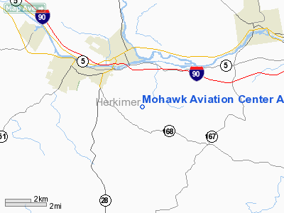
Mohawk Aviation Center Airport |
Location & QuickFacts
| FAA Information Effective: | 2008-09-25 |
| Airport Identifier: | NY23 |
| Airport Status: | Operational |
| Longitude/Latitude: | 074-57-59.5570W/42-59-15.2550N
-74.966544/42.987571 (Estimated) |
| Elevation: | 1210 ft / 368.81 m (Estimated) |
| Land: | 14 acres |
| From nearest city: | 2 nautical miles SE of Mohawk, NY |
| Location: | Herkimer County, NY |
| Magnetic Variation: | 13W (1995) |
Owner & Manager
| Ownership: | Privately owned |
| Owner: | David F. Rankins |
| Address: | 749 Shoemaker Road
Mohawk, NY 13407 |
| Phone number: | 315-866-1064 |
| Manager: | David F. Rankins |
| Address: | 749 Shoemaker Road
Mohawk, NY 13407 |
| Phone number: | 315-866-1064 |
Airport Operations and Facilities
| Airport Use: | Private |
| Wind indicator: | Yes |
| Segmented Circle: | No |
| Control Tower: | No |
| Sectional chart: | New York |
| Region: | AEA - Eastern |
| Boundary ARTCC: | ZBW - Boston |
| Tie-in FSS: | BUF - Buffalo |
| FSS on Airport: | No |
| FSS Toll Free: | 1-800-WX-BRIEF |
Runway Information
Runway 13/31
| Dimension: | 2300 x 150 ft / 701.0 x 45.7 m |
| Surface: | TURF, |
| |
Runway 13 |
Runway 31 |
| Traffic Pattern: | Left | Left |
| Obstruction: | 5 ft fence | 5 ft fence, 0.0 ft from runway |
|
Radio Navigation Aids
| ID |
Type |
Name |
Ch |
Freq |
Var |
Dist |
| CJY | NDB | Clay | | 275.00 | 12W | 13.7 nm |
| BK | NDB | Plein | | 329.00 | 12W | 26.7 nm |
| JJH | NDB | Johnstown | | 523.00 | 14W | 27.9 nm |
| HEU | NDB | Hunter | | 356.00 | 14W | 46.2 nm |
| GSS | TACAN | Griffiss | 057X | | 12W | 24.4 nm |
| RKA | VOR/DME | Rockdale | 073X | 112.60 | 11W | 33.6 nm |
| DNY | VOR/DME | De Lancey | 058X | 112.10 | 11W | 48.6 nm |
| UCA | VORTAC | Utica | 049X | 111.20 | 12W | 9.0 nm |
| GGT | VORTAC | Georgetown | 125X | 117.80 | 11W | 39.7 nm |
Remarks
- PRVDD DALGT OPNS LARGEST CLASS OF ACFT RECOMMENDED FOR OPNS IS SNGL ENG LGT ACFT (5000 MAW); IFR OPNS ARE NOT CONDUCTED; THERE IS A 20:1 APCH SLOPE.
Images and information placed above are from
http://www.airport-data.com/airport/NY23/
We thank them for the data!
| General Info
|
| Country |
United States
|
| State |
NEW YORK
|
| FAA ID |
NY23
|
| Latitude |
42-59-15.255N
|
| Longitude |
074-57-59.557W
|
| Elevation |
1210 feet
|
| Near City |
MOHAWK
|
We don't guarantee the information is fresh and accurate. The data may
be wrong or outdated.
For more up-to-date information please refer to other sources.
|
|


