 |
|
Location & QuickFacts
| FAA Information Effective: | 2008-09-25 |
| Airport Identifier: | 27NK |
| Airport Status: | Operational |
| Longitude/Latitude: | 075-02-40.0800W/43-06-47.9400N
-75.044467/43.113317 (Estimated) |
| Elevation: | 1079 ft / 328.88 m (Estimated) |
| Land: | 0 acres |
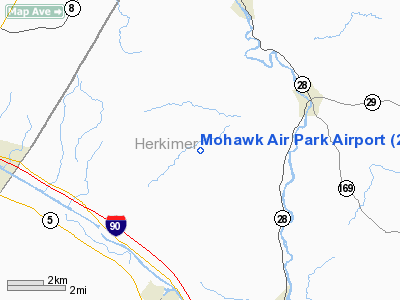
| From nearest city: | 17 nautical miles E of Schyler, NY |
| Location: | Herkimer County, NY |
| Magnetic Variation: | () |
Owner & Manager
| Ownership: | Privately owned |
| Owner: | Ron & Janet Liska |
| Address: | 211 Mountain Road
Ringoes, NJ 08551 |
| Phone number: | 718-981-7900 |
| Manager: | Ron & Janet Liska |
| Address: | 211 Mountain Road
Ringoes, NJ 08551 |
| Phone number: | 718-981-7900 |
Airport Operations and Facilities
| Airport Use: | Private |
| Wind indicator: | Yes |
| Control Tower: | No |
| Sectional chart: | New York |
| Region: | AEA - Eastern |
| Boundary ARTCC: | ZBW - Boston |
| Tie-in FSS: | BUF - Buffalo |
| FSS Toll Free: | 1-800-WX-BRIEF |
Runway Information
Runway 10/28
| Dimension: | 2500 x 30 ft / 762.0 x 9.1 m |
| Surface: | ASPH, |
| |
Runway 10 |
Runway 28 |
| Traffic Pattern: | Left | Left |
| Obstruction: | | 30 ft trees, 150.0 ft from runway |
|
Radio Navigation Aids
| ID |
Type |
Name |
Ch |
Freq |
Var |
Dist |
| CJY | NDB | Clay | | 275.00 | 12W | 10.3 nm |
| BK | NDB | Plein | | 329.00 | 12W | 20.3 nm |
| JJH | NDB | Johnstown | | 523.00 | 14W | 32.0 nm |
| GSS | TACAN | Griffiss | 057X | | 12W | 17.6 nm |
| RKA | VOR/DME | Rockdale | 073X | 112.60 | 11W | 39.8 nm |
| UCA | VORTAC | Utica | 049X | 111.20 | 12W | 7.4 nm |
| GGT | VORTAC | Georgetown | 125X | 117.80 | 11W | 39.6 nm |
Remarks
- PRVDD CLEAR 20:1 APCHS AND CLEAR OBSTACLE FREE ZONE.
Images and information placed above are from
http://www.airport-data.com/airport/27NK/
We thank them for the data!
|
|


