 |
|
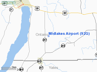
Location & QuickFacts
| FAA Information Effective: | 2008-09-25 |
| Airport Identifier: | 92G |
| Airport Status: | Operational |
| Longitude/Latitude: | 077-12-13.9190W/42-48-45.2370N
-77.203866/42.812566 (Estimated) |
| Elevation: | 1080 ft / 329.18 m (Estimated) |
| Land: | 70 acres |
| From nearest city: | 3 nautical miles W of Gorham, NY |
| Location: | Ontario County, NY |
| Magnetic Variation: | 11W (1985) |
Owner & Manager
| Ownership: | Privately owned |
| Owner: | Robert A. Noaker |
| Address: | 3730 Lake To Lake Rd
Stanley, NY 14561 |
| Phone number: | 585-554-4168 |
| Manager: | Robert Noaker |
| Address: | 3730 Lake To Lake Rd
Stanley, NY 14561 |
| Phone number: | 585-554-4168 |
Airport Operations and Facilities
| Airport Use: | Open to public |
| Wind indicator: | Yes |
| Segmented Circle: | No |
| Control Tower: | No |
| Landing fee charge: | No |
| Sectional chart: | Detroit |
| Region: | AEA - Eastern |
| Boundary ARTCC: | ZOB - Cleveland |
| Tie-in FSS: | BUF - Buffalo |
| FSS on Airport: | No |
| FSS Toll Free: | 1-800-WX-BRIEF |
| NOTAMs Facility: | BUF (NOTAM-d service avaliable) |
Airport Communications
| CTAF: | 122.800 |
| Unicom: | 122.800 |
Airport Services
| Airframe Repair: | MINOR |
| Power Plant Repair: | MINOR |
Runway Information
Runway 14/32
| Dimension: | 1820 x 55 ft / 554.7 x 16.8 m |
| Surface: | TURF, Good Condition |
| |
Runway 14 |
Runway 32 |
| Traffic Pattern: | Left | Left |
| Obstruction: | 10 ft bush, 60.0 ft from runway, 15 ft right of centerline, 6:1 slope to clear | 15 ft road, 21.0 ft from runway, 1:1 slope to clear |
|
Radio Navigation Aids
| ID |
Type |
Name |
Ch |
Freq |
Var |
Dist |
| PYA | NDB | Penn Yan | | 260.00 | 12W | 12.1 nm |
| AVN | NDB | Avon | | 344.00 | 09W | 27.6 nm |
| ALP | NDB | Alpine | | 245.00 | 12W | 39.6 nm |
| GEE | VOR/DME | Geneseo | 019X | 108.20 | 09W | 23.4 nm |
| ITH | VOR/DME | Ithaca | 055X | 111.80 | 10W | 38.0 nm |
| ULW | VOR/DME | Elmira | 033Y | 109.65 | 12W | 43.9 nm |
| ROC | VORTAC | Rochester | 037X | 110.00 | 09W | 27.7 nm |
| SYR | VORTAC | Syracuse | 117X | 117.00 | 11W | 48.7 nm |
Remarks
- RY 14/32 SOFT & WET DURG MAR-JUN.
- RY 32 HAS +80 FT TREES 735 FT FM THLD +80 FT L/R OF CNTRLN.
- VFR USE ONLY.
Images and information placed above are from
http://www.airport-data.com/airport/92G/
We thank them for the data!
| General Info
|
| Country |
United States
|
| State |
NEW YORK
|
| FAA ID |
92G
|
| Latitude |
42-48-45.237N
|
| Longitude |
077-12-13.919W
|
| Elevation |
1080 feet
|
| Near City |
GORHAM
|
We don't guarantee the information is fresh and accurate. The data may
be wrong or outdated.
For more up-to-date information please refer to other sources.
|
|


