 |
|
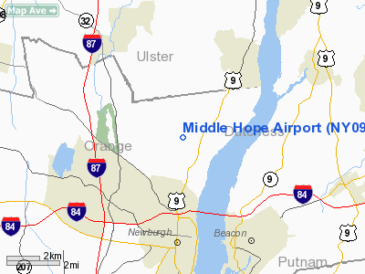
Location & QuickFacts
| FAA Information Effective: | 2008-09-25 |
| Airport Identifier: | NY09 |
| Airport Status: | Operational |
| Longitude/Latitude: | 074-00-58.5050W/41-33-40.3370N
-74.016251/41.561205 (Estimated) |
| Elevation: | 450 ft / 137.16 m (Estimated) |
| Land: | 8 acres |
| From nearest city: | 3 nautical miles N of Newburgh, NY |
| Location: | Orange County, NY |
| Magnetic Variation: | 13W (1985) |
Owner & Manager
| Ownership: | Privately owned |
| Owner: | T. F. & D. B. Taylor |
| Address: | 78holmes Rd
Newburgh, NY 12550 |
| Phone number: | 845-564-1931 |
| Manager: | T. F. Taylor |
| Address: | 78 Holmes Rd
Newburgh, NY 12550 |
| Phone number: | 845-562-0489 |
Airport Operations and Facilities
| Airport Use: | Private |
| Wind indicator: | Yes |
| Segmented Circle: | No |
| Control Tower: | No |
| Landing fee charge: | No |
| Sectional chart: | New York |
| Region: | AEA - Eastern |
| Boundary ARTCC: | ZBW - Boston |
| Tie-in FSS: | ISP - New York |
| FSS on Airport: | No |
| FSS Toll Free: | 1-800-WX-BRIEF |
Airport Services
| Airframe Repair: | NONE |
| Power Plant Repair: | NONE |
Runway Information
Runway 09/27
| Dimension: | 1600 x 90 ft / 487.7 x 27.4 m |
| Surface: | TURF, |
| |
Runway 09 |
Runway 27 |
| Traffic Pattern: | Left | Left |
|
Radio Navigation Aids
| ID |
Type |
Name |
Ch |
Freq |
Var |
Dist |
| SKU | FAN MARKER | Stanwyck | | | 12W | 2.4 nm |
| GBR | FAN MARKER | Sheffield | | | 13W | 44.9 nm |
| SKU | NDB | Stanwyck | | 261.00 | 12W | 2.4 nm |
| PO | NDB | Meier | | 403.00 | 12W | 2.5 nm |
| SW | NDB | Neely | | 335.00 | 14W | 10.6 nm |
| PNJ | NDB | Paterson | | 347.00 | 12W | 37.4 nm |
| TBY | NDB | Waterbury | | 257.00 | 14W | 39.3 nm |
| MS | NDB | Monga | | 359.00 | 12W | 39.9 nm |
| PFH | NDB | Philmont | | 272.00 | 13W | 43.6 nm |
| GBR | NDB | Great Barrington | | 395.00 | 14W | 46.3 nm |
| IGN | VOR/DME | Kingston | 123X | 117.60 | 12W | 10.7 nm |
| PWL | VOR/DME | Pawling | 090X | 114.30 | 12W | 22.5 nm |
| CMK | VOR/DME | Carmel | 113X | 116.60 | 12W | 25.9 nm |
| HUO | VOR/DME | Huguenot | 108X | 116.10 | 11W | 27.5 nm |
| TEB | VOR/DME | Teterboro | 021X | 108.40 | 11W | 42.9 nm |
| BDR | VOR/DME | Bridgeport | 25X | 108.80 | 12W | 46.9 nm |
| LGA | VOR/DME | La Guardia | 078X | 113.10 | 12W | 46.9 nm |
| SAX | VORTAC | Sparta | 104X | 115.70 | 11W | 37.9 nm |
| BDR | VOT | Bridgeport | | 109.25 | | 46.8 nm |
Remarks
- IN EXISTENCE PRIOR TO 1959.
Images and information placed above are from
http://www.airport-data.com/airport/NY09/
We thank them for the data!
| General Info
|
| Country |
United States
|
| State |
NEW YORK
|
| FAA ID |
NY09
|
| Latitude |
41-33-40.337N
|
| Longitude |
074-00-58.505W
|
| Elevation |
450 feet
|
| Near City |
NEWBURGH
|
We don't guarantee the information is fresh and accurate. The data may
be wrong or outdated.
For more up-to-date information please refer to other sources.
|
|


