 |
|
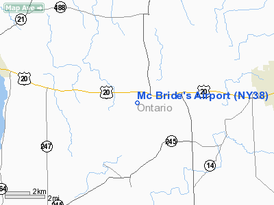
Location & QuickFacts
| FAA Information Effective: | 2008-09-25 |
| Airport Identifier: | NY38 |
| Airport Status: | Operational |
| Longitude/Latitude: | 077-07-28.9050W/42-51-11.2360N
-77.124696/42.853121 (Estimated) |
| Elevation: | 915 ft / 278.89 m (Estimated) |
| Land: | 4 acres |
| From nearest city: | 4 nautical miles N of Gorham, NY |
| Location: | Ontario County, NY |
| Magnetic Variation: | 11W (1985) |
Owner & Manager
| Ownership: | Privately owned |
| Owner: | John M. Mc Bride |
| Address: | 3629 Goose St
Stanley, NY 14561 |
| Phone number: | 716-526-6366 |
| Manager: | John M. Mc Bride |
| Address: | 3629 Goose St
Stanley, NY 14561 |
| Phone number: | 716-526-6366 |
Airport Operations and Facilities
| Airport Use: | Private |
| Wind indicator: | Yes |
| Segmented Circle: | No |
| Control Tower: | No |
| Sectional chart: | Detroit |
| Region: | AEA - Eastern |
| Boundary ARTCC: | ZOB - Cleveland |
| Tie-in FSS: | BUF - Buffalo |
| FSS Toll Free: | 1-800-WX-BRIEF |
Runway Information
Runway 01/19
| Dimension: | 1800 x 80 ft / 548.6 x 24.4 m |
| Surface: | TURF, |
| |
Runway 01 |
Runway 19 |
| Traffic Pattern: | Left | Left |
| Obstruction: | 20 ft trees, 600.0 ft from runway | 25 ft pline, 2600.0 ft from runway |
|
Radio Navigation Aids
| ID |
Type |
Name |
Ch |
Freq |
Var |
Dist |
| PYA | NDB | Penn Yan | | 260.00 | 12W | 12.9 nm |
| AVN | NDB | Avon | | 344.00 | 09W | 29.9 nm |
| ALP | NDB | Alpine | | 245.00 | 12W | 40.2 nm |
| GEE | VOR/DME | Geneseo | 019X | 108.20 | 09W | 26.8 nm |
| ITH | VOR/DME | Ithaca | 055X | 111.80 | 10W | 36.4 nm |
| ULW | VOR/DME | Elmira | 033Y | 109.65 | 12W | 45.8 nm |
| ROC | VORTAC | Rochester | 037X | 110.00 | 09W | 29.0 nm |
| SYR | VORTAC | Syracuse | 117X | 117.00 | 11W | 44.5 nm |
Remarks
- VFR USE ONLY;TREES EAST OF RWY BE CLEARED IN ACCORDANCE WITH FAR PART 77.25
Images and information placed above are from
http://www.airport-data.com/airport/NY38/
We thank them for the data!
| General Info
|
| Country |
United States
|
| State |
NEW YORK
|
| FAA ID |
NY38
|
| Latitude |
42-51-11.236N
|
| Longitude |
077-07-28.905W
|
| Elevation |
910 feet
|
| Near City |
GORHAM
|
We don't guarantee the information is fresh and accurate. The data may
be wrong or outdated.
For more up-to-date information please refer to other sources.
|
|


