 |
|
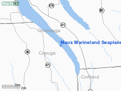
Maus Marineland Seaplane Base Airport |
Location & QuickFacts
| FAA Information Effective: | 2008-09-25 |
| Airport Identifier: | NK0 |
| Airport Status: | Operational |
| Longitude/Latitude: | 076-18-38.7520W/42-48-37.2440N
-76.310764/42.810346 (Estimated) |
| Elevation: | 863 ft / 263.04 m (Estimated) |
| Land: | 0 acres |
| From nearest city: | 2 nautical miles NE of New Hope, NY |
| Location: | Cayuga County, NY |
| Magnetic Variation: | 12W (1985) |
Owner & Manager
| Ownership: | Privately owned |
| Owner: | Herman J. Mau, Jr. |
| Address: | 5 Fire Lane 13aa
Moravia, NY 13118 |
| Phone number: | 315-496-8766 |
| Manager: | Herman J. Mau, Jr. |
| Address: | 5 Fire Lane 13aa
Moravia, NY 13118 |
| Phone number: | 315-496-2092 |
Airport Operations and Facilities
| Airport Use: | Open to public |
| Wind indicator: | No |
| Segmented Circle: | No |
| Control Tower: | No |
| Landing fee charge: | No |
| Sectional chart: | New York |
| Region: | AEA - Eastern |
| Boundary ARTCC: | ZNY - New York |
| Tie-in FSS: | BUF - Buffalo |
| FSS on Airport: | No |
| FSS Toll Free: | 1-800-WX-BRIEF |
| NOTAMs Facility: | BUF (NOTAM-d service avaliable) |
Airport Communications
Airport Services
Runway Information
Runway 14/32
| Dimension: | 15000 x 4000 ft / 4572.0 x 1219.2 m |
| Surface: | WATER, |
| |
Runway 14 |
Runway 32 |
| Traffic Pattern: | Left | Right |
|
Radio Navigation Aids
| ID |
Type |
Name |
Ch |
Freq |
Var |
Dist |
| PYA | NDB | Penn Yan | | 260.00 | 12W | 34.4 nm |
| ALP | NDB | Alpine | | 245.00 | 12W | 39.8 nm |
| BK | NDB | Plein | | 329.00 | 12W | 44.0 nm |
| CJY | NDB | Clay | | 275.00 | 12W | 48.3 nm |
| GSS | TACAN | Griffiss | 057X | | 12W | 46.9 nm |
| ITH | VOR/DME | Ithaca | 055X | 111.80 | 10W | 20.1 nm |
| GGT | VORTAC | Georgetown | 125X | 117.80 | 11W | 21.4 nm |
| SYR | VORTAC | Syracuse | 117X | 117.00 | 11W | 21.6 nm |
| CFB | VORTAC | Binghamton | 059X | 112.20 | 10W | 40.0 nm |
Images and information placed above are from
http://www.airport-data.com/airport/NK0/
We thank them for the data!
| General Info
|
| Country |
United States
|
| State |
NEW YORK
|
| FAA ID |
NK0
|
| Latitude |
42-48-37.244N
|
| Longitude |
076-18-38.752W
|
| Elevation |
863 feet
|
| Near City |
NEW HOPE
|
We don't guarantee the information is fresh and accurate. The data may
be wrong or outdated.
For more up-to-date information please refer to other sources.
|
|


