 |
|
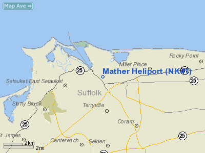
Location & QuickFacts
| FAA Information Effective: | 2008-09-25 |
| Airport Identifier: | NK41 |
| Airport Status: | Operational |
| Longitude/Latitude: | 073-03-15.7820W/40-56-20.6550N
-73.054384/40.939071 (Estimated) |
| Elevation: | 203 ft / 61.87 m (Estimated) |
| Land: | 0 acres |
| From nearest city: | 0 nautical miles N of Port Jefferson, NY |
| Location: | Suffolk County, NY |
| Magnetic Variation: | 14W (1985) |
Owner & Manager
| Ownership: | Privately owned |
| Owner: | J T Mather Mem Hosp |
| Address: | North Country Rd
Port Jefferson, NY 11777 |
| Phone number: | 516-473-1320
EXT 457. |
| Manager: | Ass't Director-administration |
| Address: |
|
| Phone number: | 516-473-1320 |
Airport Operations and Facilities
| Airport Use: | Private
MEDICAL USE. |
| Wind indicator: | Yes |
| Segmented Circle: | No |
| Control Tower: | No |
| Lighting Schedule: | PHONE REQ
FOR PERIMETER LGTS CALL 516-473-1320 EXT 457. |
| Sectional chart: | New York |
| Region: | AEA - Eastern |
| Boundary ARTCC: | ZBW - Boston |
| Responsible ARTCC: | ZNY - New York |
| Tie-in FSS: | ISP - New York |
| FSS on Airport: | No |
| FSS Toll Free: | 1-800-WX-BRIEF |
Runway Information
Helipad H1
| Dimension: | 110 x 110 ft / 33.5 x 33.5 m |
| Surface: | ASPH-CONC, |
| |
Runway H1 |
Runway |
| Traffic Pattern: | Left | Left |
| Markings: | Basic, | , |
|
Radio Navigation Aids
| ID |
Type |
Name |
Ch |
Freq |
Var |
Dist |
| OP | NDB | Old Field Point Light | | 316.00 | 13W | 3.7 nm |
| BBN | NDB | Babylon | | 275.00 | 14W | 22.0 nm |
| TBY | NDB | Waterbury | | 257.00 | 14W | 35.7 nm |
| MMK | NDB | Meriden | | 238.00 | 14W | 35.8 nm |
| OGY | NDB | Bridge | | 414.00 | 12W | 43.8 nm |
| HF | NDB | Lomis | | 244.00 | 15W | 46.1 nm |
| PNJ | NDB | Paterson | | 347.00 | 12W | 49.8 nm |
| FOK | TACAN | Suffolk Co | 047X | | 13W | 20.1 nm |
| CCC | VOR/DME | Calverton | 119X | 117.20 | 13W | 11.6 nm |
| BDR | VOR/DME | Bridgeport | 25X | 108.80 | 12W | 13.7 nm |
| DPK | VOR/DME | Deer Park | 124X | 117.70 | 12W | 14.4 nm |
| HVN | VOR/DME | New Haven | 035X | 109.80 | 13W | 20.9 nm |
| MAD | VOR/DME | Madison | 041X | 110.40 | 13W | 27.9 nm |
| CMK | VOR/DME | Carmel | 113X | 116.60 | 12W | 31.5 nm |
| JFK | VOR/DME | Kennedy | 106X | 115.90 | 12W | 37.5 nm |
| LGA | VOR/DME | La Guardia | 078X | 113.10 | 12W | 38.5 nm |
| CRI | VOR/DME | Canarsie | 070X | 112.30 | 11W | 43.0 nm |
| TEB | VOR/DME | Teterboro | 021X | 108.40 | 11W | 46.1 nm |
| HFD | VOR/DME | Hartford | 096X | 114.90 | 13W | 48.0 nm |
| HTO | VORTAC | Hampton | 083X | 113.60 | 13W | 33.5 nm |
| ISP | VOT | Long Island Mac Arthur | | 109.40 | | 9.2 nm |
| BDR | VOT | Bridgeport | | 109.25 | | 13.7 nm |
| JFK | VOT | Kennedy | | 115.10 | | 37.7 nm |
Remarks
Images and information placed above are from
http://www.airport-data.com/airport/NK41/
We thank them for the data!
| General Info
|
| Country |
United States
|
| State |
NEW YORK
|
| FAA ID |
NK41
|
| Latitude |
40-56-20.655N
|
| Longitude |
073-03-15.782W
|
| Elevation |
203 feet
|
| Near City |
PORT JEFFERSON
|
We don't guarantee the information is fresh and accurate. The data may
be wrong or outdated.
For more up-to-date information please refer to other sources.
|
|


