 |
|
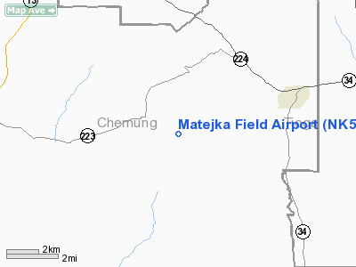
Location & QuickFacts
| FAA Information Effective: | 2008-09-25 |
| Airport Identifier: | NK54 |
| Airport Status: | Operational |
| Longitude/Latitude: | 076-38-27.8120W/42-10-36.2680N
-76.641059/42.176741 (Estimated) |
| Elevation: | 1690 ft / 515.11 m (Estimated) |
| Land: | 0 acres |
| From nearest city: | 1 nautical miles SE of Erin, NY |
| Location: | Chemung County, NY |
| Magnetic Variation: | 14W (1985) |
Owner & Manager
| Ownership: | Privately owned |
| Owner: | James Matejka |
| Address: | Rr2 Box 234
Voorheesville, NY 12186 |
| Phone number: | 518-765-5563 |
| Manager: | James Matejka |
| Address: | Rr2 Box 234
Voorheesville, NY 12186 |
| Phone number: | 518-765-5563 |
Airport Operations and Facilities
| Airport Use: | Private |
| Wind indicator: | Yes |
| Segmented Circle: | No |
| Control Tower: | No |
| Sectional chart: | New York |
| Region: | AEA - Eastern |
| Boundary ARTCC: | ZNY - New York |
| Tie-in FSS: | BUF - Buffalo |
| FSS Toll Free: | 1-800-WX-BRIEF |
Runway Information
Runway 11/29
| Dimension: | 1600 x 60 ft / 487.7 x 18.3 m |
| Surface: | TURF, |
| |
Runway 11 |
Runway 29 |
| Traffic Pattern: | Left | Left |
|
Radio Navigation Aids
| ID |
Type |
Name |
Ch |
Freq |
Var |
Dist |
| ALP | NDB | Alpine | | 245.00 | 12W | 6.6 nm |
| PYA | NDB | Penn Yan | | 260.00 | 12W | 33.6 nm |
| ULW | VOR/DME | Elmira | 033Y | 109.65 | 12W | 17.8 nm |
| ITH | VOR/DME | Ithaca | 055X | 111.80 | 10W | 20.8 nm |
| SFK | VOR/DME | Stonyfork | 023X | 108.60 | 08W | 45.3 nm |
| CFB | VORTAC | Binghamton | 059X | 112.20 | 10W | 22.5 nm |
Images and information placed above are from
http://www.airport-data.com/airport/NK54/
We thank them for the data!
| General Info
|
| Country |
United States
|
| State |
NEW YORK
|
| FAA ID |
NK54
|
| Latitude |
42-10-36.268N
|
| Longitude |
076-38-27.812W
|
| Elevation |
1690 feet
|
| Near City |
ERIN
|
We don't guarantee the information is fresh and accurate. The data may
be wrong or outdated.
For more up-to-date information please refer to other sources.
|
|


