 |
|
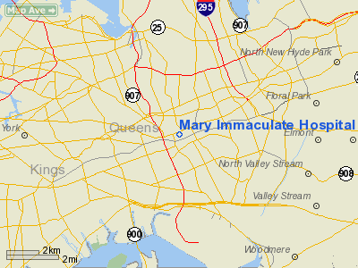
Mary Immaculate Hospital Heliport |
Location & QuickFacts
| FAA Information Effective: | 2008-09-25 |
| Airport Identifier: | 6NY5 |
| Airport Status: | Operational |
| Longitude/Latitude: | 073-48-16.4810W/40-42-19.3700N
-73.804578/40.705381 (Estimated) |
| Elevation: | 15 ft / 4.57 m (Estimated) |
| Land: | 0 acres |
| From nearest city: | 4 nautical miles S of Jamaica Queens, NY |
| Location: | Queens County, NY |
| Magnetic Variation: | 13W (1985) |
Owner & Manager
| Ownership: | Publicly owned |
| Address: |
|
| Manager: | Ann Allen-ryan, Exec. Dir |
| Address: | 152-11 89th Ave.
Jamaica, NY 11432 |
| Phone number: | 718-291-3300 |
Airport Operations and Facilities
| Airport Use: | Private
MEDICAL USE. |
| Wind indicator: | No |
| Segmented Circle: | No |
| Control Tower: | No |
| Landing fee charge: | No |
| Sectional chart: | New York |
| Region: | AEA - Eastern |
| Boundary ARTCC: | ZNY - New York |
| Tie-in FSS: | ISP - New York |
| FSS on Airport: | No |
| FSS Toll Free: | 1-800-WX-BRIEF |
Runway Information
Helipad H1
| Dimension: | 50 x 50 ft / 15.2 x 15.2 m
LNDG AREA NORTH END OF PARK, 89TH AVE BTN 150TH-153RD STS. |
| Surface: | TURF, |
| |
Runway H1 |
Runway |
| Traffic Pattern: | Left | Left |
|
Radio Navigation Aids
| ID |
Type |
Name |
Ch |
Freq |
Var |
Dist |
| EWR | FAN MARKER | Maryann | | | 11W | 17.4 nm |
| OGY | NDB | Bridge | | 414.00 | 12W | 9.0 nm |
| BBN | NDB | Babylon | | 275.00 | 14W | 19.3 nm |
| PNJ | NDB | Paterson | | 347.00 | 12W | 21.4 nm |
| CAT | NDB | Chatham | | 254.00 | 11W | 28.6 nm |
| OP | NDB | Old Field Point Light | | 316.00 | 13W | 35.2 nm |
| NEL | NDB | Lakehurst | | 396.00 | 13W | 46.6 nm |
| NEL | TACAN | Lakehurst | 055X | | 11W | 47.4 nm |
| NEL | UHF/NDB | Lakehurst | | 274.80 | 13W | 46.6 nm |
| JFK | VOR/DME | Kennedy | 106X | 115.90 | 12W | 4.6 nm |
| LGA | VOR/DME | La Guardia | 078X | 113.10 | 12W | 6.0 nm |
| CRI | VOR/DME | Canarsie | 070X | 112.30 | 11W | 6.9 nm |
| TEB | VOR/DME | Teterboro | 021X | 108.40 | 11W | 14.6 nm |
| DPK | VOR/DME | Deer Park | 124X | 117.70 | 12W | 23.4 nm |
| COL | VOR/DME | Colts Neck | 101X | 115.40 | 11W | 28.7 nm |
| CMK | VOR/DME | Carmel | 113X | 116.60 | 12W | 36.0 nm |
| BDR | VOR/DME | Bridgeport | 25X | 108.80 | 12W | 41.3 nm |
| SBJ | VOR/DME | Solberg | 076X | 112.90 | 10W | 43.4 nm |
| BWZ | VOR/DME | Broadway | 089X | 114.20 | 11W | 46.7 nm |
| CCC | VOR/DME | Calverton | 119X | 117.20 | 13W | 47.7 nm |
| SAX | VORTAC | Sparta | 104X | 115.70 | 11W | 39.8 nm |
| RBV | VORTAC | Robbinsville | 085X | 113.80 | 10W | 43.7 nm |
| JFK | VOT | Kennedy | | 115.10 | | 4.4 nm |
| ISP | VOT | Long Island Mac Arthur | | 109.40 | | 32.7 nm |
| BDR | VOT | Bridgeport | | 109.25 | | 41.2 nm |
Remarks
- HELIPAD FOR USE ONLY IN REGIONAL DISASTER OR MEDICAL EMERG FOR SVC AT MARY IMMACULATE HOSPT.
Images and information placed above are from
http://www.airport-data.com/airport/6NY5/
We thank them for the data!
| General Info
|
| Country |
United States
|
| State |
NEW YORK
|
| FAA ID |
6NY5
|
| Latitude |
40-42-19.370N
|
| Longitude |
073-48-16.481W
|
| Elevation |
15 feet
|
| Near City |
JAMAICA QUEENS
|
We don't guarantee the information is fresh and accurate. The data may
be wrong or outdated.
For more up-to-date information please refer to other sources.
|
|


