 |
|
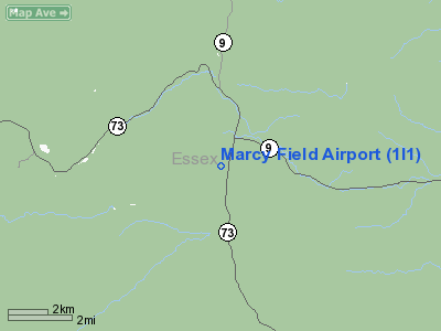
Location & QuickFacts
| FAA Information Effective: | 2008-09-25 |
| Airport Identifier: | 1I1 |
| Airport Status: | Operational |
| Longitude/Latitude: | 073-47-28.5030W/44-13-15.1730N
-73.791251/44.220881 (Estimated) |
| Elevation: | 985 ft / 300.23 m (Surveyed) |
| Land: | 36 acres |
| From nearest city: | 2 nautical miles S of Keene, NY |
| Location: | Essex County, NY |
| Magnetic Variation: | 15W (1985) |
Owner & Manager
| Ownership: | Publicly owned |
| Owner: | Town Of Keene |
| Address: | Route 73
Keene, NY 12942 |
| Phone number: | 518-576-4444 |
| Manager: | Charlie Segard |
| Address: | Box 89
Keene, NY 12942 |
| Phone number: | 518-576-4755 |
Airport Operations and Facilities
| Airport Use: | Open to public |
| Wind indicator: | No |
| Segmented Circle: | No |
| Control Tower: | No |
| Landing fee charge: | No |
| Sectional chart: | Montreal |
| Region: | AEA - Eastern |
| Boundary ARTCC: | ZBW - Boston |
| Tie-in FSS: | BTV - Burlington |
| FSS on Airport: | No |
| FSS Toll Free: | 1-800-WX-BRIEF |
| NOTAMs Facility: | BTV (NOTAM-d service avaliable) |
Airport Communications
Airport Services
| Airframe Repair: | NONE |
| Power Plant Repair: | NONE |
Runway Information
Runway N/S
| Dimension: | 2390 x 95 ft / 728.5 x 29.0 m |
| Surface: | TURF, Good Condition |
| |
Runway N |
Runway S |
| Traffic Pattern: | Left | Left |
| Obstruction: | 15 ft road | 71 ft trees, 20.0 ft from runway, 112 ft right of centerline |
|
Radio Navigation Aids
| ID |
Type |
Name |
Ch |
Freq |
Var |
Dist |
| MPV | FAN MARKER | Brook | | | | 49.2 nm |
| R | FAN MARKER | Chitt | | | 14W | 49.8 nm |
| DYO | NDB | Smuto | | 221.00 | 15W | 47.5 nm |
| VKN | NDB | Mount Mansfield | | 268.00 | 16W | 48.3 nm |
| SLK | VOR/DME | Saranac Lake | 029X | 109.20 | 14W | 20.3 nm |
| BTV | VORTAC | Burlington | 122X | 117.50 | 15W | 28.2 nm |
| PLB | VORTAC | Plattsburgh | 116X | 116.90 | 15W | 30.2 nm |
| BTV | VOT | Burlington Intl | | 109.00 | | 31.3 nm |
Remarks
- CLOSES LATE OCTOBER - REOPENS MID MAY.
- EXISTED PRIOR TO 1959.
Images and information placed above are from
http://www.airport-data.com/airport/1I1/
We thank them for the data!
| General Info
|
| Country |
United States
|
| State |
NEW YORK
|
| FAA ID |
1I1
|
| Latitude |
44-13-15.173N
|
| Longitude |
073-47-28.503W
|
| Elevation |
985 feet
|
| Near City |
KEENE
|
We don't guarantee the information is fresh and accurate. The data may
be wrong or outdated.
For more up-to-date information please refer to other sources.
|
|


