 |
|
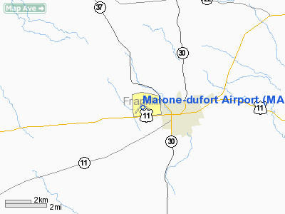
Location & QuickFacts
| FAA Information Effective: | 2008-09-25 |
| Airport Identifier: | MAL |
| Airport Status: | Operational |
| Longitude/Latitude: | 074-19-44.2190W/44-51-13.1660N
-74.328950/44.853657 (Estimated) |
| Elevation: | 790 ft / 240.79 m (Surveyed) |
| Land: | 135 acres |
| From nearest city: | 2 nautical miles W of Malone, NY |
| Location: | Franklin County, NY |
| Magnetic Variation: | 15W (2000) |
Owner & Manager
| Ownership: | Publicly owned |
| Owner: | Town Of Malone |
| Address: | 12 Elm St
Malone, NY 12953 |
| Phone number: | 518-483-2431 |
| Manager: | Mark Besio |
| Address: | 12 Elm St
Malone, NY 12953 |
| Phone number: | 518-483-2431 |
Airport Operations and Facilities
| Airport Use: | Open to public |
| Wind indicator: | Yes |
| Segmented Circle: | Yes |
| Control Tower: | No |
| Lighting Schedule: | DUSK-DAWN
ACTVT MIRL RY 05/23, 14/32 & TWY LGTS - CTAF. |
| Beacon Color: | Clear-Green (lighted land airport) |
| Landing fee charge: | No |
| Sectional chart: | Montreal |
| Region: | AEA - Eastern |
| Traffic Pattern Alt: | 800 ft |
| Boundary ARTCC: | ZBW - Boston |
| Tie-in FSS: | BTV - Burlington |
| FSS on Airport: | No |
| FSS Toll Free: | 1-800-WX-BRIEF |
| NOTAMs Facility: | BTV (NOTAM-d service avaliable) |
| Federal Agreements: | NGY13 |
Airport Communications
| CTAF: | 122.800 |
| Unicom: | 122.800 |
Airport Services
| Airframe Repair: | NONE |
| Power Plant Repair: | NONE |
| Bottled Oxygen: | NONE |
| Bulk Oxygen: | NONE |
Runway Information
Runway 05/23
| Dimension: | 4000 x 100 ft / 1219.2 x 30.5 m |
| Surface: | ASPH, |
| Edge Lights: | Medium |
| |
Runway 05 |
Runway 23 |
| Longitude: | 074-20-10.6800W | 074-19-37.3800W |
| Latitude: | 44-50-58.1200N | 44-51-29.6700N |
| Elevation: | 770.00 ft | 754.00 ft |
| Alignment: | 36 | 127 |
| Traffic Pattern: | Left | Left |
| Markings: | Non-precision instrument, Good Condition | Non-precision instrument, Good Condition |
| Runway End Identifier: | Yes | Yes |
| Centerline Lights: | No | No |
| Touchdown Lights: | No | No |
| Obstruction: | 40 ft pole, 792.0 ft from runway, 209 ft left of centerline, 14:1 slope to clear | 37 ft trees, 557.0 ft from runway, 293 ft right of centerline, 9:1 slope to clear |
|
Runway 14/32
| Dimension: | 3245 x 75 ft / 989.1 x 22.9 m |
| Surface: | ASPH, |
| Edge Lights: | Medium |
| |
Runway 14 |
Runway 32 |
| Longitude: | 074-19-50.1900W | 074-19-14.1200W |
| Latitude: | 44-51-21.9000N | 44-51-02.6400N |
| Elevation: | 759.00 ft | 790.00 ft |
| Alignment: | 126 | 127 |
| Traffic Pattern: | Left | Left |
| Markings: | Basic, Good Condition | Basic, Good Condition |
| Obstruction: | , 50:1 slope to clear | 29 ft tree, 481.0 ft from runway, 140 ft right of centerline, 9:1 slope to clear |
|
Radio Navigation Aids
| ID |
Type |
Name |
Ch |
Freq |
Var |
Dist |
| PTD | NDB | Potsdam | | 400.00 | 14W | 24.9 nm |
| UL | NDB | Montreal | | 248.00 | 16W | 41.8 nm |
| U | NDB | Uniform | | 201.00 | 15W | 43.1 nm |
| JL | NDB | Cote St Luc | | 370.00 | 16W | 46.7 nm |
| NDB | Mike | | 348.00 | 15W | 49.4 nm |
| SLK | VOR/DME | Saranac Lake | 029X | 109.20 | 14W | 28.7 nm |
| YUL | VOR/DME | Montreal | 110X | 116.30 | 16W | 48.2 nm |
| MSS | VORTAC | Massena | 088X | 114.10 | 14W | 17.2 nm |
| PLB | VORTAC | Plattsburgh | 116X | 116.90 | 15W | 35.9 nm |
| YJN | VORTAC | St Jean | 105X | 115.80 | 16W | 49.1 nm |
Remarks
- HAYING ACTIVITY & EQUIPMENT PRESENT JUN - SEP.
- RY 14/32 HAS SNOW REMOVAL BUT VISUAL INSPECTION & NOTAM CHECK MUST BE DONE AS TOWN ROADS ARE PLOWED BEFORE ARPT.
- FILED FOR RECORD PURPOSES ONLY.
Images and information placed above are from
http://www.airport-data.com/airport/MAL/
We thank them for the data!
| General Info
|
| Country |
United States
|
| State |
NEW YORK
|
| FAA ID |
MAL
|
| Latitude |
44-51-13.166N
|
| Longitude |
074-19-44.219W
|
| Elevation |
790 feet
|
| Near City |
MALONE
|
We don't guarantee the information is fresh and accurate. The data may
be wrong or outdated.
For more up-to-date information please refer to other sources.
|
|


