 |
|
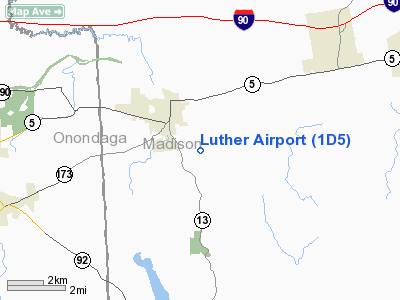
Location & QuickFacts
| FAA Information Effective: | 2008-09-25 |
| Airport Identifier: | 1D5 |
| Airport Status: | Operational |
| Longitude/Latitude: | 075-50-43.6840W/43-01-45.2410N
-75.845468/43.029234 (Estimated) |
| Elevation: | 740 ft / 225.55 m (Estimated) |
| Land: | 0 acres |
| From nearest city: | 1 nautical miles E of Chittenango, NY |
| Location: | Madison County, NY |
| Magnetic Variation: | 12W (1985) |
Owner & Manager
| Ownership: | Privately owned |
| Owner: | Mr. P. Deierlein |
| Address: | 6257 Perryville Road
Chittenango, NY 13037 |
| Phone number: | 315-687-5456 |
| Manager: | Mr. P. Deierlein |
| Address: | 6257 Perryville Road
Chittenango, NY 13037 |
| Phone number: | 315-687-3281 |
Airport Operations and Facilities
| Airport Use: | Open to public |
| Wind indicator: | Yes |
| Segmented Circle: | No |
| Control Tower: | No |
| Landing fee charge: | No |
| Sectional chart: | New York |
| Region: | AEA - Eastern |
| Boundary ARTCC: | ZBW - Boston |
| Tie-in FSS: | BUF - Buffalo |
| FSS on Airport: | No |
| FSS Toll Free: | 1-800-WX-BRIEF |
| NOTAMs Facility: | BUF (NOTAM-d service avaliable) |
Airport Communications
Airport Services
| Airframe Repair: | NONE |
| Power Plant Repair: | NONE |
Runway Information
Runway 09/27
| Dimension: | 1700 x 80 ft / 518.2 x 24.4 m |
| Surface: | TURF, Good Condition |
| |
Runway 09 |
Runway 27 |
| Traffic Pattern: | Left | Left |
| Markings: | Numbers only, Poor Condition
NUMBERS BARELY VISIBLE IN GRASS | Numbers only, Poor Condition
NUMBERS BARELY VISIBLE IN GRASS |
| Obstruction: | 30 ft pline, 95.0 ft from runway, 63 ft left of centerline, 3:1 slope to clear | 10 ft brush, 13.0 ft from runway, 1:1 slope to clear |
|
Runway 17/35
| Dimension: | 1060 x 90 ft / 323.1 x 27.4 m |
| Surface: | TURF, Fair Condition |
| |
Runway 17 |
Runway 35 |
| Traffic Pattern: | Left | Left |
| Obstruction: | 50 ft tree, 50.0 ft from runway, 1:1 slope to clear | 50 ft tree, 20.0 ft from runway |
|
Radio Navigation Aids
| ID |
Type |
Name |
Ch |
Freq |
Var |
Dist |
| BK | NDB | Plein | | 329.00 | 12W | 19.7 nm |
| CJY | NDB | Clay | | 275.00 | 12W | 25.6 nm |
| GSS | TACAN | Griffiss | 057X | | 12W | 22.6 nm |
| ITH | VOR/DME | Ithaca | 055X | 111.80 | 10W | 42.0 nm |
| RKA | VOR/DME | Rockdale | 073X | 112.60 | 11W | 43.1 nm |
| GGT | VORTAC | Georgetown | 125X | 117.80 | 11W | 14.5 nm |
| SYR | VORTAC | Syracuse | 117X | 117.00 | 11W | 17.6 nm |
| UCA | VORTAC | Utica | 049X | 111.20 | 12W | 29.9 nm |
Remarks
- FIRST 50' OF RY 35 DROPS OFF APRXLY 8'.
- RY NOT ALWAYS PLOWED FOR WINTER OPNS; CALL 315-687-9072 FOR CONDITIONS.
- RWY 17/35- CROSSWIND RWY NOT MOWED
- RWY 9/27: MOWED CLEAR AREA 100' X 100' BEFORE EACH RWY BEG.
- RWY 9: 2.5% UPSLOPE FIRST 400' OF RWY
- RWY 9: +50'-80' TREES PENETRATE LAT. TRANS. SURF., 128'-305' NORTH OF CNTRLN, 225'-710' PAST THLD; +20-60' TREES PENETRATE LAT. TRANS. SURF., 40'-80' SOUTH OF CNTRLN, 0'-1300' PAST THLD
- RWY 9: +40-85' TREES IN PRIM. SURF., 45'-75' NORTH OF CNTRLN, 700-800 PAST THLD
- RWY 27: +24' UTILITY POLES/WIRES CROSS RWY AT A SKEW. CLOSEST IS 104' RT., 170' FRM THLD.; +21' TREE, 100' RT., 40' FRM THLD.
- EXISTED PRIOR TO 5/15/59.
Images and information placed above are from
http://www.airport-data.com/airport/1D5/
We thank them for the data!
| General Info
|
| Country |
United States
|
| State |
NEW YORK
|
| FAA ID |
1D5
|
| Latitude |
43-01-45.241N
|
| Longitude |
075-50-43.684W
|
| Elevation |
740 feet
|
| Near City |
CHITTENANGO
|
We don't guarantee the information is fresh and accurate. The data may
be wrong or outdated.
For more up-to-date information please refer to other sources.
|
|


