 |
|
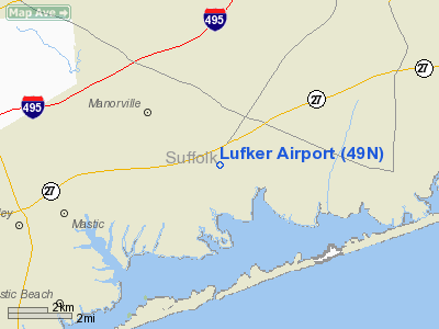
Location & QuickFacts
| FAA Information Effective: | 2008-09-25 |
| Airport Identifier: | 49N |
| Airport Status: | Operational |
| Longitude/Latitude: | 072-45-03.3590W/40-49-29.3550N
-72.750933/40.824821 (Estimated) |
| Elevation: | 57 ft / 17.37 m (Estimated) |
| Land: | 30 acres |
| From nearest city: | 1 nautical miles NE of East Moriches, NY |
| Location: | Suffolk County, NY |
| Magnetic Variation: | 14W (1985) |
Owner & Manager
| Ownership: | Privately owned |
| Owner: | Louis Lufker |
| Address: | 115 Montauk Hwy
East Moriches, NY 11940 |
| Phone number: | 631-909-1772
PHONE AT ARPT; (516) 878-6302/516-769-1379. |
| Manager: | Chris Burks |
| Address: | 115 Montauk Hwy
East Moriches, NY 11940 |
| Phone number: | 516-384-7445 |
Airport Operations and Facilities
| Airport Use: | Open to public |
| Wind indicator: | Yes |
| Segmented Circle: | No |
| Control Tower: | No |
| Landing fee charge: | Yes
$2 AFTER FIRST LANDING |
| Sectional chart: | New York |
| Region: | AEA - Eastern |
| Boundary ARTCC: | ZBW - Boston |
| Responsible ARTCC: | ZNY - New York |
| Tie-in FSS: | ISP - New York |
| FSS Toll Free: | 1-800-WX-BRIEF
FOR LOCAL CALL TO FSS DIAL 737-1000. |
| NOTAMs Facility: | ISP (NOTAM-d service avaliable) |
Airport Communications
Airport Services
Runway Information
Runway N/S
| Dimension: | 2300 x 100 ft / 701.0 x 30.5 m
SOUTH END OF RY MARKED WITH BOARDS |
| Surface: | TURF, |
| |
Runway N |
Runway S |
| Traffic Pattern: | Left | Right |
| Obstruction: | 10 ft tree, 75 ft left of centerline | 15 ft road, 60.0 ft from runway, 4:1 slope to clear |
|
Radio Navigation Aids
| ID |
Type |
Name |
Ch |
Freq |
Var |
Dist |
| OP | NDB | Old Field Point Light | | 316.00 | 13W | 19.0 nm |
| BBN | NDB | Babylon | | 275.00 | 14W | 30.3 nm |
| MMK | NDB | Meriden | | 238.00 | 14W | 41.4 nm |
| TBY | NDB | Waterbury | | 257.00 | 14W | 45.9 nm |
| HF | NDB | Lomis | | 244.00 | 15W | 49.1 nm |
| FOK | TACAN | Suffolk Co | 047X | | 13W | 5.5 nm |
| CCC | VOR/DME | Calverton | 119X | 117.20 | 13W | 6.7 nm |
| DPK | VOR/DME | Deer Park | 124X | 117.70 | 12W | 25.2 nm |
| BDR | VOR/DME | Bridgeport | 25X | 108.80 | 12W | 26.4 nm |
| HVN | VOR/DME | New Haven | 035X | 109.80 | 13W | 27.0 nm |
| MAD | VOR/DME | Madison | 041X | 110.40 | 13W | 29.5 nm |
| GON | VOR/DME | Groton | 45Y | 110.85 | 14W | 43.9 nm |
| CMK | VOR/DME | Carmel | 113X | 116.60 | 12W | 46.5 nm |
| JFK | VOR/DME | Kennedy | 106X | 115.90 | 12W | 47.9 nm |
| HFD | VOR/DME | Hartford | 096X | 114.90 | 13W | 49.9 nm |
| HTO | VORTAC | Hampton | 083X | 113.60 | 13W | 20.5 nm |
| ISP | VOT | Long Island Mac Arthur | | 109.40 | | 15.8 nm |
| BDR | VOT | Bridgeport | | 109.25 | | 26.4 nm |
| GON | VOT | Groton | | 110.25 | | 43.7 nm |
| JFK | VOT | Kennedy | | 115.10 | | 48.2 nm |
Remarks
- BANNER TOWING OPERATION MAY-OCT.
- GLIDER & ULTRALIGHT OPNS DALGT HRS MAY-OCT.
- PAJA ADJ TO SAPDARO ARPT.
- SPADARO ARPT TFC PATTERN 590 FT EAST.
- RWY "S", +14' BRUSH, 50' FROM RWY BEG.
- POVIDED TRAFFIC PATTERN CONFLICT RESOLUTION AS STATED IN APPLICATION IS ADHERED TO.
Images and information placed above are from
http://www.airport-data.com/airport/49N/
We thank them for the data!
|
|


