 |
|
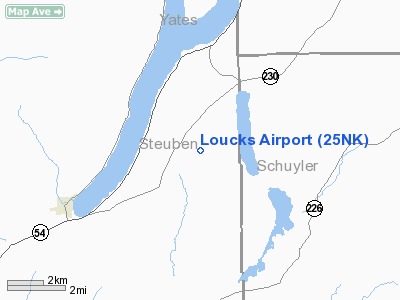
Location & QuickFacts
| FAA Information Effective: | 2008-09-25 |
| Airport Identifier: | 25NK |
| Airport Status: | Operational |
| Longitude/Latitude: | 077-07-55.8900W/42-26-10.2500N
-77.132192/42.436181 (Estimated) |
| Elevation: | 1425 ft / 434.34 m (Estimated) |
| Land: | 0 acres |
| From nearest city: | 4 nautical miles S of Hammondsport, NY |
| Location: | Steuben County, NY |
| Magnetic Variation: | () |
Owner & Manager
| Ownership: | Privately owned |
| Owner: | Gary D. Loucks |
| Address: | 8961 Ridge Rd.
Hammond Sport, NY 14840 |
| Phone number: | 607-292-6286 |
| Manager: | Gary D. Loucks |
| Address: | 8961 Ridge Rd.
Hammond Sport, NY 14840 |
| Phone number: | 607-292-6286 |
Airport Operations and Facilities
| Airport Use: | Private |
| Wind indicator: | Yes |
| Control Tower: | No |
| Sectional chart: | Detroit |
| Region: | AEA - Eastern |
| Boundary ARTCC: | ZOB - Cleveland |
| Tie-in FSS: | BUF - Buffalo |
| FSS Toll Free: | 1-800-WX-BRIEF |
Runway Information
Runway 11/29
| Dimension: | 2700 x 100 ft / 823.0 x 30.5 m |
| Surface: | TURF, |
| |
Runway 11 |
Runway 29 |
| Traffic Pattern: | Left | Left |
|
Radio Navigation Aids
| ID |
Type |
Name |
Ch |
Freq |
Var |
Dist |
| PYA | NDB | Penn Yan | | 260.00 | 12W | 12.9 nm |
| ALP | NDB | Alpine | | 245.00 | 12W | 20.2 nm |
| EL | NDB | Halos | | 269.00 | 09W | 40.0 nm |
| AVN | NDB | Avon | | 344.00 | 09W | 44.5 nm |
| ULW | VOR/DME | Elmira | 033Y | 109.65 | 12W | 21.1 nm |
| ITH | VOR/DME | Ithaca | 055X | 111.80 | 10W | 30.0 nm |
| GEE | VOR/DME | Geneseo | 019X | 108.20 | 09W | 35.8 nm |
| SFK | VOR/DME | Stonyfork | 023X | 108.60 | 08W | 46.3 nm |
| ELZ | VORTAC | Wellsville | 051X | 111.40 | 09W | 43.8 nm |
| CFB | VORTAC | Binghamton | 059X | 112.20 | 10W | 47.3 nm |
| ROC | VORTAC | Rochester | 037X | 110.00 | 09W | 47.6 nm |
Remarks
- PRVDD DAYLGT OPNS AND A CLEAR 20:1 APCH/DEP.
Images and information placed above are from
http://www.airport-data.com/airport/25NK/
We thank them for the data!
|
|


