 |
|
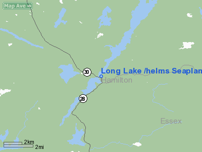
Long Lake /helms Seaplane Base Airport |
Location & QuickFacts
| FAA Information Effective: | 2008-09-25 |
| Airport Identifier: | NY9 |
| Airport Status: | Operational |
| Longitude/Latitude: | 074-25-13.5840W/43-58-30.2220N
-74.420440/43.975062 (Estimated) |
| Elevation: | 1629 ft / 496.52 m (Estimated) |
| Land: | 0 acres |
| From nearest city: | 0 nautical miles N of Long Lake, NY |
| Location: | Hamilton County, NY |
| Magnetic Variation: | 14W (1985) |
Owner & Manager
| Ownership: | Privately owned |
| Owner: | Helms Aero Svc Inc |
| Address: | Po Box 337
Long Lake, NY 12847 |
| Phone number: | 518-624-3931 |
| Manager: | Thomas J. Helms |
| Address: | Po Box 337
Long Lake, NY 12847 |
| Phone number: | 518-624-3931 |
Airport Operations and Facilities
| Airport Use: | Open to public |
| Wind indicator: | No |
| Segmented Circle: | No |
| Control Tower: | No |
| Landing fee charge: | No |
| Sectional chart: | New York |
| Region: | AEA - Eastern |
| Boundary ARTCC: | ZBW - Boston |
| Tie-in FSS: | BUF - Buffalo |
| FSS on Airport: | No |
| FSS Toll Free: | 1-800-WX-BRIEF |
| NOTAMs Facility: | BUF (NOTAM-d service avaliable) |
Airport Communications
| CTAF: | 122.800 |
| Unicom: | 122.800 |
Airport Services
| Fuel available: | 100LL |
| Airframe Repair: | MINOR |
| Power Plant Repair: | MINOR |
Runway Information
Runway NE/SW
| Dimension: | 15000 x 1500 ft / 4572.0 x 457.2 m |
| Surface: | WATER, |
| |
Runway NE |
Runway SW |
| Traffic Pattern: | Left | Left |
|
Radio Navigation Aids
| ID |
Type |
Name |
Ch |
Freq |
Var |
Dist |
| PTD | NDB | Potsdam | | 400.00 | 14W | 49.2 nm |
| SLK | VOR/DME | Saranac Lake | 029X | 109.20 | 14W | 26.3 nm |
Remarks
- DO NOT TAXI UNDER BRIDGE AT HIGH WATER LEVELS; POSSIBLE AT LOW WATER LEVEL; STAY TO WEST (HIGH) SIDE OF BRIDGE. WATER LEVELS MAY VARY +/- 10 FT.
- BRIDGE ACROSS LAKE (ROUTE 30) 500 FT NW OF BASE.
- ONE RY NORTH OF BRIDGE & THE OTHER RY SOUTH OF BRIDGE.
- PLINE AT BASE & BLDG ACROSS FM BASE; +50 FT PLINES ALONG ROAD & BRIDGE (ROUTE 30).
- EXISTED PRIOR TO 1959.
Images and information placed above are from
http://www.airport-data.com/airport/NY9/
We thank them for the data!
| General Info
|
| Country |
United States
|
| State |
NEW YORK
|
| FAA ID |
NY9
|
| Latitude |
43-58-30.222N
|
| Longitude |
074-25-13.584W
|
| Elevation |
1629 feet
|
| Near City |
LONG LAKE
|
We don't guarantee the information is fresh and accurate. The data may
be wrong or outdated.
For more up-to-date information please refer to other sources.
|
|


