|
 |
|
||||
|
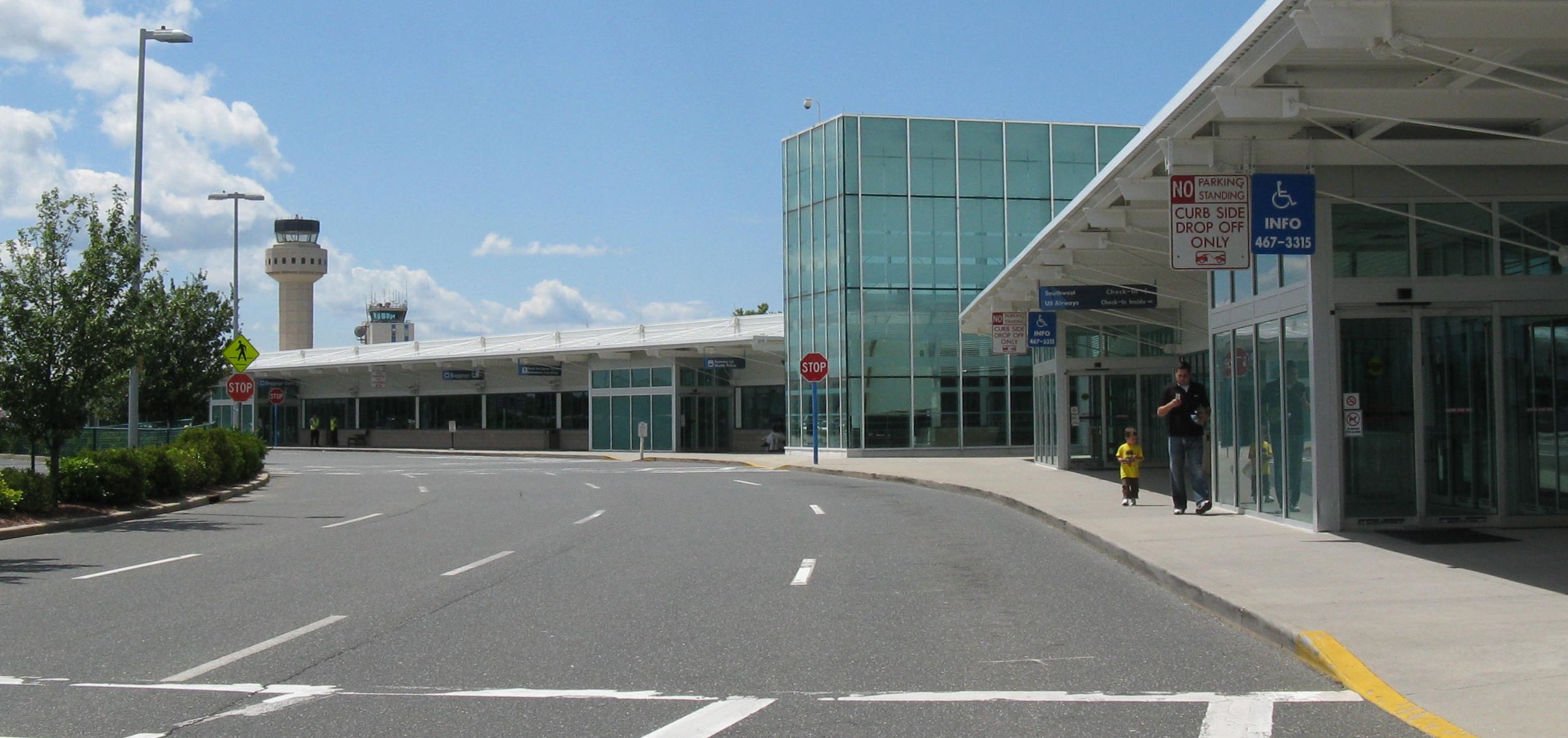
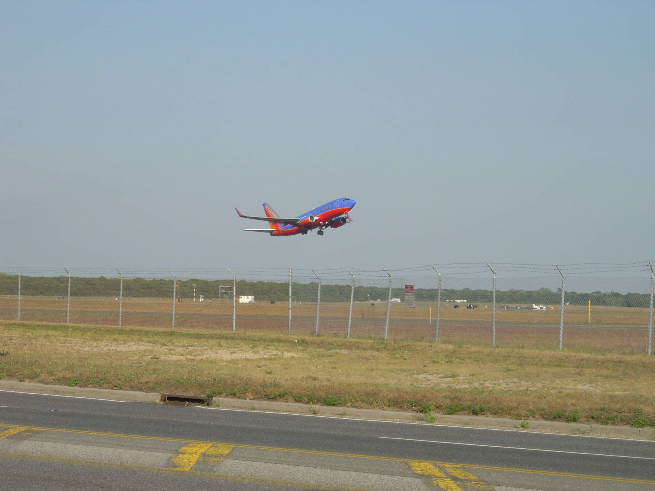
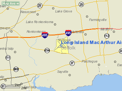
Long Island MacArthur Airport, formerly known as Islip Airport (IATA: ISP, ICAO: KISP, FAA LID: ISP) is a public airport located on Long Island, in Ronkonkoma, Town of Islip, Suffolk County, New York, United States. It is seven miles (11 km) northeast of the central business district of Islip hamlet. Long Island MacArthur Airport covers an area of 1,311 acres (531 ha) containing four runways and two helipads. The Town owns and operates the airport, which serves approximately two million commercial passengers a year, as well as a thriving general aviation sector. Located midway between Montauk Point 60 miles to the east and Manhattan 60 miles to the west, MacArthur Airport serves primarily the three million residents of Nassau and Suffolk counties. In addition, the airport serves travelers from the Greater New York Metropolitan Area and around the nation who want a more convenient alternative to the congestion at JFK and LaGuardia airports – both located in Queens. MacArthur Airport, which does not share the congested air space of the city-centric airports, has an exceptional record of on-time performance. During 2009, for instance, 83.6% of flights arrived on time and 85.6% of flights departed on time. During 2007, the airport served more than 2.3 million commercial passengers. For the 12-month period ending December 31, 2007, the airport had 182,142 aircraft operations, an average of 499 per day; 80 percent general aviation; 15 percent scheduled commercial; five percent air taxi and approximately one percent military. There are 243 aircraft based at the airport: 63% single-engine; 10% multi-engine; 19% jet aircraft; seven percent helicopters; and less than one percent military. The Town-owned Foreign Trade Zone is located adjacent to airport property. HistoryIn April 1942, four months after the bombing of Pearl Harbor, which precipitated the entrance of the United States into World War II, the Town of Islip entered into contract with the federal government to build an airfield on Town-owned land for potential military purposes during the war. Within months, the Civil Aeronautics Administration – predecessor to today’s Federal Aviation Administration – constructed three paved runways, and at the suggestion of Charles H. Duryea, a local elected official, named the airport MacArthur Airport, after General Douglas MacArthur, General of the Army. In 1944, Lockheed Aircraft Corporation built the first hangar at the airport. Five years later, after the federal government returned the airport to the control of the Town of Islip, the Town built the airport’s first terminal building preparing the way for commercial service. Throughout the 1950s, the Sperry Corporation conducted aerospace research at the airport. In 1960, Allegheny Airlines was the first commercial airline to offer scheduled flights to Boston, Philadelphia and Washington. The General Douglas MacArthur Terminal was completed in 1966, and a few years later, American Airlines began operating non-stop flights to Chicago. In the 50 years since Long Island MacArthur Airport introduced scheduled air service, the airport has become a major transportation hub and economic engine of the region. Although several airlines have discontinued service over the years, during the decade between 1999 and 2009 passenger traffic grew with the airport now serving approximately two million passengers a year through its two commercial carriers: Southwest Airlines, and legacy carrier US Airways Express. Continental Express and Continental Connection offered non-stop flights to Albany and to Cleveland, but discontinued service in 2005. Spirit Airlines had scheduled service to several Florida cities and Detroit, before they moved their New York business to LaGuardia Airport in 2001. However, in May 2008, the airline resumed service to Fort Lauderdale from MacArthur Airport, only to discontinue it again shortly thereafter. Delta Express, which offered non-stop flights to Orlando and Fort Lauderdale, discontinued service at MacArthur Airport in 2003, after experiencing a decline in passenger traffic. Delta Connection to and from Atlanta ended on May 1, 2008 following a mid-April announcement that Delta and Northwest Airlines were planning to merge – a move that led to significant operational changes for the merged airline. As of 2010, the only legacy carrier service serving the airport is US Airways Express operating short distance shuttle flights to its hub at Philadelphia Airport, where passengers can make connections to 800 destinations worldwide. Southwest Airlines offers non-stop service to several Florida cities: Fort Lauderdale, Orlando, Tampa, and West Palm Beach, as well as hubs in Baltimore, Chicago, and Las Vegas, which offer connections throughout the Southwest system. In November 2010, Southwest will no longer offer direct flights to Las Vegas, but travelers will be able to get to Vegas from LIMA through BWI and MDW. Growth and Expansion in the 21st Century
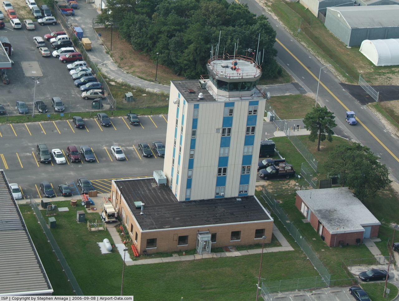
Established approximately midway through the 20th century, by the end of the century MacArthur Airport had been completely transformed and continues to grow and expand today. In 2004, MacArthur Airport embarked on an expansion that included a dedicated Southwest Airlines terminal constructed by the airline at a cost of $65 million. Phase one of the expansion included four gates to be used by Southwest Airlines, as well as space for shops and restaurants. Phase two, completed in November 2006, added four more gates for a total of eight new gates. Prior to the expansion project, passengers had to pass back through the ticketing area of the airport to reach the baggage claim area. With completion of Phase two, the new concourse provided a more convenient exit point to baggage claim, ground transportation and the airport’s roadway exit. A major proponent of the airport’s 2004 – 2006 expansion projects was Peter J. McGowan, then, Islip Town Supervisor. When completed, the new concourse was named after McGowan. However, when in March 2006 he resigned from office, the terminal was re-named Veterans Memorial Concourse in homage to Long Island’s distinction as home to more military veterans than almost any other community in the Unites States. While no further expansion is currently planned for the interior of the terminal building, numerous exterior infrastructure projects are underway, or planned to commence during 2010. The Federal Aviation Administration is in the final phase of construction for a new FAA Control Tower to replace the outdated tower built in the early sixties. The control tower will be completed in 2011. In 2010, a new state-of-the-art Fuel Farm will substantially increase the airport’s on-site jet fuel supplies. In addition, the airport has plans to reconfigure the roadway to improve access and facilitate traffic flow in front of the terminal; an additional taxiway is also planned along with various other airfield projects utilizing FAA airport improvement program funding. Furthermore, development of the airport’s West Side, home to a thriving general aviation sector, will also get underway in late 2010. While the airport continues to expand and enhance its infrastructure, it has also added numerous amenities, including free courtesy cell phone parking (located in the rear of Lot 6B). Since 2009, the airport has also provided numerous tools to facilitate communication for and with passengers. In November 2009, MacArthur Airport became the only airport in the Tri-state region to offer free wireless throughout the entire terminal and in the courtesy cell phone parking lot. In addition, the airport launched several tools designed to provide up-to-date information to travelers, including: the airport’s first official Website – www.flyLIMA.com; a radio frequency (1630 AM); as well as social media outlets Facebook and Twitter. All passenger food catering within the airport terminal is provided by HMSHost, which operates five restaurants. For passengers traveling with small dogs, the airport created a pet relief area conveniently located just outside the baggage claim area. As part of the airport’s endeavor to attract new airlines, in 2009 the airport launched the first brand-focused advertising campaign using the central theme line “We make flying a breeze.” Airlines and destinationsThe following airlines offer non-stop scheduled flights to and from MacArthur Airport:
About the Airport AdministrationLong Island MacArthur Airport is owned and operated by the Town of Islip. The Department of Aviation is led by the Commissioner of Aviation and Transportation, who works closely with the Town Board to manage and steward the airport. Mission critical departments include Airport Operations, Custodial, Fire Rescue, Law Enforcement, Maintenance, and Public Affairs. The Long Island MacArthur Airport Fire Rescue Department provides 24 hour fire protection, EMS, and rescue services on airport grounds., The department is equipped with crash trucks, a 3500 gallon Class A tanker, a Hazardous Material Response truck, a Heavy Rescue Response Unit, a Crash Recovery and Salvage Unit, and an EMS First Responder Unit. MacArthur Airport Fire Department is part of Suffolk County’s Fire Rescue Mutual Aid Response Plan.
The Long Island MacArthur Airport Law Enforcement Division is the primary law enforcement agency located at the airport. This division patrols the terminal building, the grounds, roadways and parking areas of the airport – both on foot and vehicles. The division enforces federal, state and local laws and assists the public. LIMA Law Enforcement works closely with the Transportation Security Administration (TSA), which is the aviation division of the Department of Homeland Security, as well as the Suffolk County Police Department. These entities work closely with LIMA Law Enforcement on a range of security-related issues to provide the highest level of safety for the traveling public. In addition, the Fire Rescue and Law Enforcement Divisions at Long Island MacArthur Airport train together in order to be better able to assist each other’s divisions and respond more efficiently. Along with the Fire Rescue and Law Enforcement Divisions, the Airport Operations Division plays a primary role in maintaining a safe environment at Long Island MacArthur Airport. This division is responsible for safety monitoring of the airfield and land side of the airport property under FAA “Part 139” regulations and performs safety inspections of the grounds several times a day. In addition, this division oversees all construction projects – both those of the airport administration and of third parties, and manages the process for obtaining federal grant funding for airport for infrastructure, as well as strategic planning purposes. Tenants of Long Island MacArthur AirportLong Island MacArthur Airport’s West Side houses numerous general aviation tenants, including three fixed based operators: Sheltair Aviation, Excelaire, and Mid Island Air, which offer a full range of general aviation services. The Suffolk County Police (SCPD) Aviation Section has a Law Enforcement and MEDEVAC helicopter based at MacArthur Airport. The base is staffed 24 hours a day by Police Pilots, as well as Flight Paramedics employed by the Stony Brook University Medical Center. Until the early 1990s, the 2nd Battalion (Attack), 142nd Aviation Regiment of the N.Y. Army National Guard's 42nd Infantry Division Aviation Brigade, was based at Long Island MacArthur Airport, equipped with Bell AH-1F Cobra helicopters. In 2006, the 3rd Battalion (Assault), 126th Aviation Regiment moved its headquarters from Latham, N.Y. to Long Island MacArthur Airport, bringing it's Sikorsky UH-60L Black Hawk helicopters. In May 2007, following yet another reorganization in which the battalion was re-configured, the unit received its mobilization alert order to participate in Operation Iraqi Freedom. Over the course of their deployment, the unit – which came to be known as Task Force Jester – flew more than 15,000 flight hours. The last of the battalion’s troops returned home to Long Island MacArthur Airport in May 2009. Accidents and IncidentsUp to date, there has been only one deadly accident at MacArthur Airport: On April 4, 1955, a Douglas DC-6 of United Airlines operating on a pilot test flight bound for LaGuardia Airport lost control soon after take-off and subsequently crashed, killing all three crew members onboard. Another incident occurred on July 25, 2008, when a bomb threat was received for Southwest Airlines Flight 2622, bound for Chicago. Subsequently, Concourse A was evacuated for several hours and a thorough search of the airplane and building commenced, which led to no dangerous item to be found. Ground transportationMacArthur Airport is connected with the nearby Long Island Rail Road station at Ronkonkoma by dedicated shuttles. The LIRR currently offers a discount package for airport passengers, which includes the cost of shuttle service between the train station and airport terminal. http://www.mta.info/lirr/getaways/LongIsland/MacArthur.htm. Taxi, rental car, and limousine service is available, too. Five national rental car companies serve the airport. Many hotels in the surrounding area also provide shuttle service to and from the airport, including the Holiday Inn – Long Island Islip Airport located on airport property less than five minutes from the terminal building. Suffolk Transit's S57 route serves the airport, connecting it with Sayville and the Smith Haven Mall, located in Lake Grove, NY. Popular cultureThe airport scene in the 1970 Academy Award-winning film The Out-of-Towners where George Kellerman (Jack Lemmon) and his wife Gwen (Sandy Dennis) depart Ohio for New York was filmed at Long Island MacArthur Airport. In 2008, several scenes for the independent film Everyday, starring Helen Hunt, Liev Schrieber and Brian Dennehy were filmed at Long Island MacArthur Airport. In 2009, Comedy Central filmed promotional commercials for comedian Mike Birbiglia’s nationwide tour and television special “I’m in the Future Also.” In addition, scenes for the new comedy “Louie” that debuted on FX in June 2010 were also filmed at Long Island MacArthur Airport. In August, scenes for a Dune Road Films’ documentary about behavioral pharmacologist Victor DeNoble, “Addiction, INC.” were filmed at the airport. The above content comes from Wikipedia and is published under free licenses – click here to read more.
Location & QuickFacts
Owner & Manager
Airport Operations and Facilities
Airport Communications
Airport Services
Runway InformationRunway 06/24
Runway 10/28
Runway 15L/33R
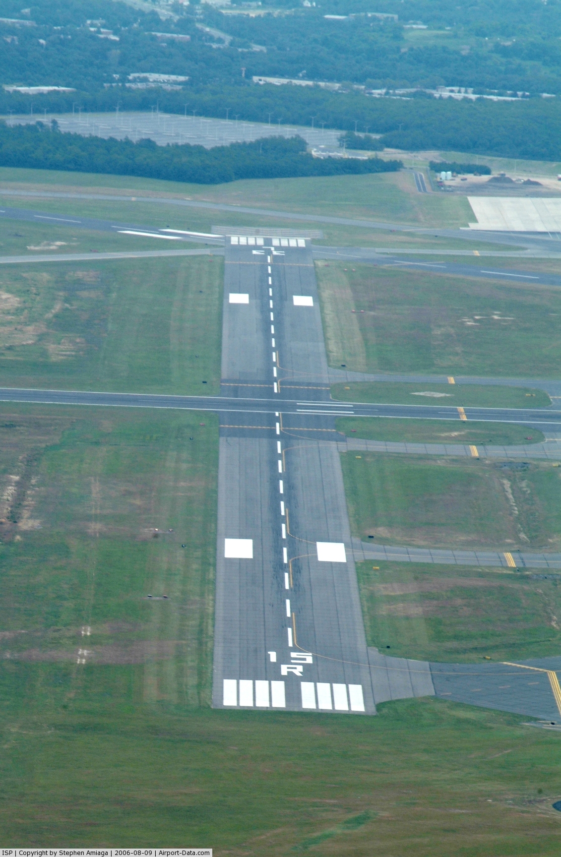
Runway 15R/33L
Helipad H1
Helipad H2
Radio Navigation Aids
Remarks
Images and information placed above are from We thank them for the data!
We don't guarantee the information is fresh and accurate. The data may
be wrong or outdated.
|
||||||||||||||||||||||||||||||||||||||||||||||||||||||||||||||||||||||||||||||||||||||||||||||||||||||||||||||||||||||||||||||||||||||||||||||||||||||||||||||||||||||||||||||||||||||||||||||||||||||||||||||||||||||||||||||||||||||||||||||||||||||||||||||||||||||||||||||||||||||||||||||||||||||||||||||||||||||||||||||||||||||||||||||||||||||||||||||||||||||||||||||||||||||||||||||||||||||||||||||||||||||||||||||||||||||||||||||||||||||||||||||||||||||||||||||||||||||||||||||||||||||||||||||||||||||||||||||||||||||||||||||||||||||||||||||||||||||||||||||||||||||||||||||||||||||||||||||||||||||||||||||||||||||||||||||||||||||||

 |
|
Copyright 2004-2026 © by Airports-Worldwide.com, Vyshenskoho st. 36, Lviv 79010, Ukraine Legal Disclaimer |