 |
|
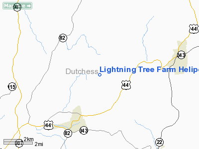
Lightning Tree Farm Heliport |
Location & QuickFacts
| FAA Information Effective: | 2008-09-25 |
| Airport Identifier: | 4NK7 |
| Airport Status: | Operational |
| Longitude/Latitude: | 073-39-34.4500W/41-49-54.3300N
-73.659569/41.831758 (Estimated) |
| Elevation: | 945 ft / 288.04 m () |
| Land: | 0 acres |
| From nearest city: | 4 nautical miles NE of Millbrook, NY |
| Location: | Dutchess County, NY |
| Magnetic Variation: | 14W (1995) |
Owner & Manager
| Ownership: | Privately owned |
| Owner: | Elizabeth Ross-johnson |
| Address: | 153 N Mabbettsville Rd/co Rd 98
Millbrook, NY 12545 |
| Phone number: | 914-677-9351 |
| Manager: | Elizabth Ross-johnson |
| Address: | 153 N Mabbettsvill Rd/co Rd 98
Millbrook, NY 12545 |
| Phone number: | 914-677-9351 |
Airport Operations and Facilities
| Airport Use: | Private |
| Wind indicator: | Yes |
| Segmented Circle: | No |
| Control Tower: | No |
| Lighting Schedule: | PHONE REQ
FOR PERIMETER LGTS CALL 914-677-9351. |
| Sectional chart: | New York |
| Region: | AEA - Eastern |
| Boundary ARTCC: | ZBW - Boston |
| Tie-in FSS: | ISP - New York |
| FSS Toll Free: | 1-800-WX-BRIEF |
Runway Information
Helipad H1
| Dimension: | 40 x 40 ft / 12.2 x 12.2 m |
| Surface: | TURF, |
| |
Runway H1 |
Runway |
| Traffic Pattern: | Left | Left |
|
Radio Navigation Aids
| ID |
Type |
Name |
Ch |
Freq |
Var |
Dist |
| GBR | FAN MARKER | Sheffield | | | 13W | 22.2 nm |
| SKU | FAN MARKER | Stanwyck | | | 12W | 25.2 nm |
| PSF | FAN MARKER | Abyss | | | 13W | 42.4 nm |
| PO | NDB | Meier | | 403.00 | 12W | 20.6 nm |
| GBR | NDB | Great Barrington | | 395.00 | 14W | 24.0 nm |
| SKU | NDB | Stanwyck | | 261.00 | 12W | 25.2 nm |
| PFH | NDB | Philmont | | 272.00 | 13W | 25.5 nm |
| TBY | NDB | Waterbury | | 257.00 | 14W | 29.4 nm |
| SW | NDB | Neely | | 335.00 | 14W | 32.9 nm |
| MMK | NDB | Meriden | | 238.00 | 14W | 42.0 nm |
| DXT | NDB | Dalton | | 370.00 | 15W | 44.2 nm |
| HF | NDB | Lomis | | 244.00 | 15W | 47.9 nm |
| PWL | VOR/DME | Pawling | 090X | 114.30 | 12W | 4.6 nm |
| IGN | VOR/DME | Kingston | 123X | 117.60 | 12W | 12.4 nm |
| CMK | VOR/DME | Carmel | 113X | 116.60 | 12W | 33.3 nm |
| CTR | VOR/DME | Chester | 098X | 115.10 | 13W | 42.0 nm |
| BDR | VOR/DME | Bridgeport | 25X | 108.80 | 12W | 47.0 nm |
| HVN | VOR/DME | New Haven | 035X | 109.80 | 13W | 48.8 nm |
| HUO | VOR/DME | Huguenot | 108X | 116.10 | 11W | 49.0 nm |
| BDL | VORTAC | Bradley | 027X | 109.00 | 14W | 43.9 nm |
| BAF | VORTAC | Barnes | 077X | 113.00 | 14W | 46.6 nm |
| BDL | VOT | Bradley Intl | | 111.40 | | 44.2 nm |
| HFD | VOT | Hartford | | 108.20 | | 45.6 nm |
| BDR | VOT | Bridgeport | | 109.25 | | 46.9 nm |
Remarks
- PRVDD VRF ONLY, 8:1 INGRESS/EGRESS, PLINES MKD, INGRESS/EGRESS MKGS ON PAD.
Images and information placed above are from
http://www.airport-data.com/airport/4NK7/
We thank them for the data!
| General Info
|
| Country |
United States
|
| State |
NEW YORK
|
| FAA ID |
4NK7
|
| Latitude |
41-49-54.330N
|
| Longitude |
073-39-34.450W
|
| Elevation |
945 feet
|
| Near City |
MILLBROOK
|
We don't guarantee the information is fresh and accurate. The data may
be wrong or outdated.
For more up-to-date information please refer to other sources.
|
|


