 |
|
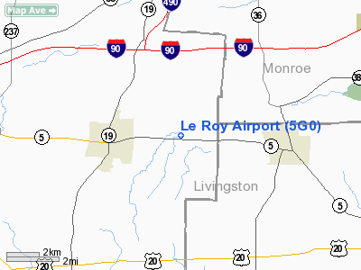
| Le Roy Airport |
| IATA: none – ICAO: none – FAA LID: 5G0 |
| Summary |
| Airport type |
Public |
| Owner |
LeRoy Aviation Services Inc |
| Serves |
Le Roy, New York |
| Elevation AMSL |
780 ft / 238 m |
| Coordinates |
42°58′52.92″N 077°56′15.05″W / 42.9813667°N 77.9375139°W / 42.9813667; -77.9375139 |
| Runways |
| Direction |
Length |
Surface |
| ft |
m |
| 10/28 |
2,640 |
805 |
Asphalt |
| Statistics (2006) |
| Aircraft operations |
14,268 |
| Based aircraft |
19 |
| Source: Federal Aviation Administration |
Le Roy Airport is a public use airport in Genesee County, New York, United States. It is owned by LeRoy Aviation Services Inc and is located two nautical miles (3.74 km) east of the central business district of the Town of Le Roy. According to the FAA's National Plan of Integrated Airport Systems for 2007-2011, it is categorized as a reliever airport.
Although most U.S. airports use the same three-letter location identifier for the FAA and IATA, this airport is assigned 5G0 by the FAA but has no designation from the IATA.
Facilities and aircraft
Le Roy Airport covers an area of 56 acres (22.7 ha) at an elevation of 780 feet (238 m) above mean sea level. It has one runway designated 10/28 with an asphalt surface measuring 2,640 by 60 feet (805 x 18 m).
For the 12-month period ending June 22, 2006, the airport had 14,268 aircraft operations, an average of 39 per day: 98% general aviation, 1% air taxi and 1% military. At that time there were 19 aircraft based at this airport: 100% single-engine.
The above content comes from Wikipedia and is published under free licenses – click here to read more.
Location & QuickFacts
| FAA Information Effective: | 2008-09-25 |
| Airport Identifier: | 5G0 |
| Airport Status: | Operational |
| Longitude/Latitude: | 077-56-15.0500W/42-58-52.9200N
-77.937514/42.981367 (Estimated) |
| Elevation: | 780 ft / 237.74 m (Surveyed) |
| Land: | 56 acres |
| From nearest city: | 2 nautical miles E of Le Roy, NY |
| Location: | Genesee County, NY |
| Magnetic Variation: | 11W (1985) |
Owner & Manager
| Ownership: | Privately owned |
| Owner: | Leroy Aviation Services Inc |
| Address: | 8267 East Main Road
Le Roy, NY 14482 |
| Phone number: | 585-768-4560 |
| Manager: | Ray Detor |
| Address: | 283 Westminster Road
Rochester, NY 14607-3229 |
| Phone number: | 585-244-6017 |
Airport Operations and Facilities
| Airport Use: | Open to public |
| Wind indicator: | Yes
WINDSOCK LGTS OTS INDEFLY. |
| Segmented Circle: | Yes |
| Control Tower: | No |
| Lighting Schedule: | DUSK-DAWN
ACTVT MIRL, PAPI, REIL RY 10/28 - CTAF. |
| Beacon Color: | Clear-Green (lighted land airport) |
| Landing fee charge: | No |
| Sectional chart: | Detroit |
| Region: | AEA - Eastern |
| Boundary ARTCC: | ZOB - Cleveland |
| Tie-in FSS: | BUF - Buffalo |
| FSS on Airport: | No |
| FSS Toll Free: | 1-800-WX-BRIEF |
| NOTAMs Facility: | BUF (NOTAM-d service avaliable) |
| Federal Agreements: | N |
Airport Communications
| CTAF: | 122.800 |
| Unicom: | 122.800 |
Airport Services
| Fuel available: | 100LL |
| Airframe Repair: | MINOR |
| Power Plant Repair: | MINOR |
| Bottled Oxygen: | NONE |
| Bulk Oxygen: | NONE |
Runway Information
Runway 10/28
| Dimension: | 2640 x 60 ft / 804.7 x 18.3 m |
| Surface: | ASPH, Good Condition |
| Weight Limit: | Single wheel: 12500 lbs. |
| Edge Lights: | Medium |
| |
Runway 10 |
Runway 28 |
| Longitude: | 077-56-32.7900W | 077-55-57.3200W |
| Latitude: | 42-58-53.5600N | 42-58-52.2700N |
| Elevation: | 780.00 ft | 770.00 ft |
| Alignment: | 93 | 127 |
| Traffic Pattern: | Left | Left |
| Markings: | Non-precision instrument, Good Condition | Non-precision instrument, Good Condition |
| VASI: | 2-light PAPI on left side
RWY 10 PAPI OTS INDEFLY. | 2-light PAPI on left side |
| Visual Glide Angle: | 3.00° | 3.00° |
| Runway End Identifier: | Yes
REIL RY 10 OTS INDEFLY. | Yes
REIL RY 28 OTS INDEFLY. |
| Centerline Lights: | No | No |
| Touchdown Lights: | No | No |
| Obstruction: | 7 ft fence, 201.0 ft from runway, 96 ft left of centerline
RWY 10 +5' FENCE, 0-200' FRM RWY,96' LEFT | 5 ft fence, 201.0 ft from runway, 102 ft right of centerline
RWY 28 +5' FENCE, 0'-200' FROM RWY , 102' RIGHT |
|
Radio Navigation Aids
| ID |
Type |
Name |
Ch |
Freq |
Var |
Dist |
| AVN | NDB | Avon | | 344.00 | 09W | 7.6 nm |
| PYA | NDB | Penn Yan | | 260.00 | 12W | 43.8 nm |
| LYS | NDB | Olean | | 360.00 | 09W | 45.5 nm |
| IAG | TACAN | Niagara Falls | 047X | | 10W | 45.6 nm |
| GEE | VOR/DME | Geneseo | 019X | 108.20 | 09W | 12.6 nm |
| BUF | VOR/DME | Buffalo | 111X | 116.40 | 08W | 31.3 nm |
| ROC | VORTAC | Rochester | 037X | 110.00 | 09W | 14.3 nm |
| BUF | VOT | Buffalo | | 109.00 | | 35.1 nm |
Remarks
- TGL NOT AUTHORIZED.
- IN ACCORD WITH VFR.
Images and information placed above are from
http://www.airport-data.com/airport/5G0/
We thank them for the data!
| General Info
|
| Country |
United States
|
| State |
NEW YORK
|
| FAA ID |
5G0
|
| Latitude |
42-58-52.920N
|
| Longitude |
077-56-15.050W
|
| Elevation |
780 feet
|
| Near City |
LE ROY
|
We don't guarantee the information is fresh and accurate. The data may
be wrong or outdated.
For more up-to-date information please refer to other sources.
|
|


