 |
|
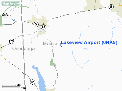
Location & QuickFacts
| FAA Information Effective: | 2008-09-25 |
| Airport Identifier: | 0NK9 |
| Airport Status: | Operational |
| Longitude/Latitude: | 075-49-36.6810W/43-00-37.2400N
-75.826856/43.010344 (Estimated) |
| Elevation: | 1050 ft / 320.04 m (Estimated) |
| Land: | 0 acres |
| From nearest city: | 3 nautical miles SE of Chittenango, NY |
| Location: | Madison County, NY |
| Magnetic Variation: | 12W (1980) |
Owner & Manager
| Ownership: | Privately owned |
| Owner: | James G. Carpenter |
| Address: | Rd 1 Dwyer Road
Chittenango, NY 13037 |
| Phone number: | 315-655-3796 |
| Manager: | James G. Carpenter |
| Address: | Rd 1 Dwyer Road
Chittenago, NY 13037 |
| Phone number: | 315-655-3796 |
Airport Operations and Facilities
| Airport Use: | Private
PERSONAL USE. |
| Wind indicator: | Yes |
| Segmented Circle: | No |
| Control Tower: | No |
| Sectional chart: | New York |
| Region: | AEA - Eastern |
| Boundary ARTCC: | ZBW - Boston |
| Tie-in FSS: | BUF - Buffalo |
| FSS Toll Free: | 1-800-WX-BRIEF |
Runway Information
Runway 09/27
| Dimension: | 1700 x 60 ft / 518.2 x 18.3 m |
| Surface: | TURF, |
| |
Runway 09 |
Runway 27 |
| Traffic Pattern: | Left | Left |
| Displaced threshold: | 340.00 ft | 644.00 ft |
| Obstruction: | 30 ft road | 40 ft pline |
|
Radio Navigation Aids
| ID |
Type |
Name |
Ch |
Freq |
Var |
Dist |
| BK | NDB | Plein | | 329.00 | 12W | 19.8 nm |
| CJY | NDB | Clay | | 275.00 | 12W | 24.8 nm |
| GSS | TACAN | Griffiss | 057X | | 12W | 22.6 nm |
| ITH | VOR/DME | Ithaca | 055X | 111.80 | 10W | 41.7 nm |
| RKA | VOR/DME | Rockdale | 073X | 112.60 | 11W | 41.7 nm |
| GGT | VORTAC | Georgetown | 125X | 117.80 | 11W | 13.3 nm |
| SYR | VORTAC | Syracuse | 117X | 117.00 | 11W | 18.9 nm |
| UCA | VORTAC | Utica | 049X | 111.20 | 12W | 29.1 nm |
Remarks
- PRVDD LTR OF AGREEMENT IS ENTERED IN WITH LUTHER ARPT REGARDING TRAFFIC PATTERNS.
Images and information placed above are from
http://www.airport-data.com/airport/0NK9/
We thank them for the data!
| General Info
|
| Country |
United States
|
| State |
NEW YORK
|
| FAA ID |
0NK9
|
| Latitude |
43-00-37.240N
|
| Longitude |
075-49-36.681W
|
| Elevation |
1050 feet
|
| Near City |
CHITTENANGO
|
We don't guarantee the information is fresh and accurate. The data may
be wrong or outdated.
For more up-to-date information please refer to other sources.
|
|


