 |
|
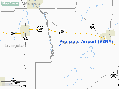
Location & QuickFacts
| FAA Information Effective: | 2008-09-25 |
| Airport Identifier: | 98NY |
| Airport Status: | Operational |
| Longitude/Latitude: | 077-31-58.9810W/42-53-00.2300N
-77.533050/42.883397 (Estimated) |
| Elevation: | 1035 ft / 315.47 m (Estimated) |
| Land: | 0 acres |
| From nearest city: | 2 nautical miles S of West Bloomfield, NY |
| Location: | Ontario County, NY |
| Magnetic Variation: | 11W (1985) |
Owner & Manager
| Ownership: | Privately owned |
| Owner: | John B. Randall |
| Address: | 3661 Abbey Rd
Holcomb, NY 14469 |
| Phone number: | 716-657-4647 |
| Manager: | John B. Randall |
| Address: | 3661 Abbey Rd
Holcomb, NY 14469 |
| Phone number: | 716-657-4647 |
Airport Operations and Facilities
| Airport Use: | Private |
| Wind indicator: | No |
| Segmented Circle: | No |
| Control Tower: | No |
| Landing fee charge: | No |
| Sectional chart: | Detroit |
| Region: | AEA - Eastern |
| Boundary ARTCC: | ZOB - Cleveland |
| Tie-in FSS: | BUF - Buffalo |
| FSS on Airport: | No |
| FSS Toll Free: | 1-800-WX-BRIEF |
Airport Services
| Airframe Repair: | NONE |
| Power Plant Repair: | NONE |
Runway Information
Runway E/W
| Dimension: | 1400 x 75 ft / 426.7 x 22.9 m |
| Surface: | TURF, |
| |
Runway E |
Runway W |
| Traffic Pattern: | Left | Left |
|
Runway N/S
| Dimension: | 1750 x 75 ft / 533.4 x 22.9 m |
| Surface: | TURF, |
| |
Runway N |
Runway S |
| Traffic Pattern: | Left | Left |
|
Radio Navigation Aids
| ID |
Type |
Name |
Ch |
Freq |
Var |
Dist |
| AVN | NDB | Avon | | 344.00 | 09W | 12.9 nm |
| PYA | NDB | Penn Yan | | 260.00 | 12W | 25.5 nm |
| EL | NDB | Halos | | 269.00 | 09W | 49.5 nm |
| GEE | VOR/DME | Geneseo | 019X | 108.20 | 09W | 9.3 nm |
| BUF | VOR/DME | Buffalo | 111X | 116.40 | 08W | 49.1 nm |
| ROC | VORTAC | Rochester | 037X | 110.00 | 09W | 15.5 nm |
Remarks
- AIRSPACE DETERMINATION PENDING.
Images and information placed above are from
http://www.airport-data.com/airport/98NY/
We thank them for the data!
| General Info
|
| Country |
United States
|
| State |
NEW YORK
|
| FAA ID |
98NY
|
| Latitude |
42-53-00.230N
|
| Longitude |
077-31-58.981W
|
| Elevation |
1035 feet
|
| Near City |
WEST BLOOMFIELD
|
We don't guarantee the information is fresh and accurate. The data may
be wrong or outdated.
For more up-to-date information please refer to other sources.
|
|


