 |
|
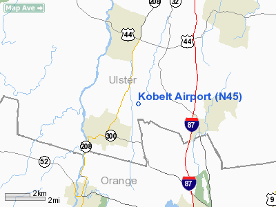
| Kobelt Airport |
| IATA: none – ICAO: none – FAA LID: N45 |
| Summary |
| Airport type |
Public |
| Owner |
Wallkill Airpark, Inc |
| Serves |
Wallkill, Ulster County, New York |
| Elevation AMSL |
420 ft / 128 m |
| Coordinates |
41°37′26.4″N 074°08′30.48″W / 41.624°N 74.1418°W / 41.624; -74.1418 |
| Runways |
| Direction |
Length |
Surface |
| ft |
m |
| 03/21 |
2,864 |
873 |
Asphalt |
| Statistics (2007) |
| Aircraft operations |
15,000 |
| Based aircraft |
36 |
| Source: Federal Aviation Administration |
Kobelt Airport is a public use airport in Ulster County, New York, United States. It is owned by Wallkill Airpark, Inc and is located three nautical miles (5.56 km) northeast of the central business district of the Hamlet of Wallkill. According to the FAA's National Plan of Integrated Airport Systems for 2007-2011, it is categorized as a reliever airport.
Although most U.S. airports use the same three-letter location identifier for the FAA and IATA, this airport is assigned N45 by the FAA but has no designation from the IATA.
Facilities and aircraft
Kobelt Airport covers an area of 125 acres (50.6 ha) at an elevation of 420 feet (128 m) above mean sea level. It has one runway designated 03/21 with an asphalt surface measuring 2,864 by 50 feet (873 x 15 m).
For the 12-month period ending November 4, 2007, the airport had 15,000 aircraft operations, an average of 41 per day: 100% general aviation. At that time there were 36 aircraft based at this airport: 97% single-engine and 3% helicopters.
The above content comes from Wikipedia and is published under free licenses – click here to read more.
Location & QuickFacts
| FAA Information Effective: | 2008-09-25 |
| Airport Identifier: | N45 |
| Airport Status: | Operational |
| Longitude/Latitude: | 074-08-01.5210W/41-37-40.3360N
-74.133756/41.627871 (Estimated) |
| Elevation: | 420 ft / 128.02 m (Estimated) |
| Land: | 125 acres |
| From nearest city: | 3 nautical miles NE of Wallkill, NY |
| Location: | Ulster County, NY |
| Magnetic Variation: | 13W (1985) |
Owner & Manager
| Ownership: | Privately owned |
| Owner: | Wallkill Airpark, Inc |
| Address: | 863 Plains Road
Wallkill, NY 12589 |
| Phone number: | 845-255-1087 |
| Manager: | William Richards & Kay Hoiby-griep |
| Address: | Po Box 269
Gardiner, NY 12525 |
| Phone number: | 845-255-1087 |
Airport Operations and Facilities
| Airport Use: | Open to public |
| Wind indicator: | Yes |
| Segmented Circle: | No |
| Control Tower: | No |
| Lighting Schedule: | SS-SR |
| Beacon Color: | Clear-Green (lighted land airport) |
| Landing fee charge: | No |
| Sectional chart: | New York |
| Region: | AEA - Eastern |
| Boundary ARTCC: | ZBW - Boston |
| Responsible ARTCC: | ZNY - New York |
| Tie-in FSS: | ISP - New York |
| FSS on Airport: | No |
| FSS Toll Free: | 1-800-WX-BRIEF |
| NOTAMs Facility: | ISP (NOTAM-d service avaliable) |
| Federal Agreements: | N |
Airport Communications
| CTAF: | 122.800 |
| Unicom: | 122.800 |
Airport Services
| Bottled Oxygen: | NONE |
| Bulk Oxygen: | NONE |
Runway Information
Runway 03/21
| Dimension: | 2864 x 50 ft / 872.9 x 15.2 m |
| Surface: | ASPH, |
| Weight Limit: | Single wheel: 13000 lbs. |
| |
Runway 03 |
Runway 21 |
| Traffic Pattern: | Left | Left |
| Obstruction: | 60 ft trees, 200.0 ft from runway, 100 ft left of centerline
+15 FOOT TREE AT 100 FOOT DISTANCE AND 100 FEET LEFT OF CENTERLINE | 60 ft trees, 200.0 ft from runway, 100 ft left of centerline
+6 FOOT BRUSH AT 60 FEET RIGHT OF CENTERLINE |
|
Radio Navigation Aids
| ID |
Type |
Name |
Ch |
Freq |
Var |
Dist |
| SKU | FAN MARKER | Stanwyck | | | 12W | 7.2 nm |
| GBR | FAN MARKER | Sheffield | | | 13W | 45.7 nm |
| SKU | NDB | Stanwyck | | 261.00 | 12W | 7.2 nm |
| PO | NDB | Meier | | 403.00 | 12W | 8.2 nm |
| SW | NDB | Neely | | 335.00 | 14W | 9.5 nm |
| MS | NDB | Monga | | 359.00 | 12W | 33.7 nm |
| PNJ | NDB | Paterson | | 347.00 | 12W | 41.0 nm |
| PFH | NDB | Philmont | | 272.00 | 13W | 41.8 nm |
| TBY | NDB | Waterbury | | 257.00 | 14W | 44.9 nm |
| GBR | NDB | Great Barrington | | 395.00 | 14W | 46.7 nm |
| IGN | VOR/DME | Kingston | 123X | 117.60 | 12W | 14.2 nm |
| HUO | VOR/DME | Huguenot | 108X | 116.10 | 11W | 24.4 nm |
| PWL | VOR/DME | Pawling | 090X | 114.30 | 12W | 25.4 nm |
| CMK | VOR/DME | Carmel | 113X | 116.60 | 12W | 32.5 nm |
| TEB | VOR/DME | Teterboro | 021X | 108.40 | 11W | 46.9 nm |
| DNY | VOR/DME | De Lancey | 058X | 112.10 | 11W | 49.5 nm |
| SAX | VORTAC | Sparta | 104X | 115.70 | 11W | 38.3 nm |
Remarks
- ARPT CLSD TO ACFT 13500 LBS & OVER.
- RY 03 HAS ACCESS ROAD 10 FT FM THLD BOTH SIDES.
- DEER ON & INVOF ARPT.
- 18 FT WIDE PARALLEL TWY, STUB CONNECTORS TO RUNWAY BETWEEN ENDS IN FAIR CONDITION.
- RY CTR WIDTH OF 30 FT IN GOOD CONDITION, 10 FT OUTSIDE WIDTH ON BOTH SIDES OF CNTRLN IN POOR CONDITION WITH EXTENSIVE CRACKS AND VEGETATION.
Images and information placed above are from
http://www.airport-data.com/airport/N45/
We thank them for the data!
| General Info
|
| Country |
United States
|
| State |
NEW YORK
|
| FAA ID |
N45
|
| Latitude |
41-37-40.336N
|
| Longitude |
074-08-01.521W
|
| Elevation |
420 feet
|
| Near City |
WALLKILL
|
We don't guarantee the information is fresh and accurate. The data may
be wrong or outdated.
For more up-to-date information please refer to other sources.
|
|


