 |
|
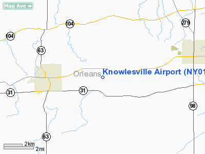
Location & QuickFacts
| FAA Information Effective: | 2008-09-25 |
| Airport Identifier: | NY01 |
| Airport Status: | Operational |
| Longitude/Latitude: | 078-18-54.0820W/43-13-15.2100N
-78.315023/43.220892 (Estimated) |
| Elevation: | 555 ft / 169.16 m (Estimated) |
| Land: | 14 acres |
| From nearest city: | 2 nautical miles S of Knowlesville, NY |
| Location: | Orleans County, NY |
| Magnetic Variation: | 10W (1985) |
Owner & Manager
| Ownership: | Privately owned |
| Owner: | Felstead Air Ltd. |
| Address: | 2886 S. Lyndonville Road
Medina, NY 14103 |
| Phone number: | 716-798-1031 |
| Manager: | Ronald Felstead |
| Address: | 2886 Lyndonville Road
Medina, NY 14103 |
| Phone number: | 716-798-1031 |
Airport Operations and Facilities
| Airport Use: | Private |
| Wind indicator: | Yes |
| Segmented Circle: | No |
| Control Tower: | No |
| Landing fee charge: | No |
| Sectional chart: | Detroit |
| Region: | AEA - Eastern |
| Boundary ARTCC: | ZOB - Cleveland |
| Tie-in FSS: | BUF - Buffalo |
| FSS on Airport: | No |
| FSS Toll Free: | 1-800-WX-BRIEF |
Airport Services
| Airframe Repair: | NONE |
| Power Plant Repair: | NONE |
Runway Information
Runway E/W
| Dimension: | 1925 x 60 ft / 586.7 x 18.3 m |
| Surface: | TURF, Good Condition |
| |
Runway E |
Runway W |
| Traffic Pattern: | Left | Left |
| Obstruction: | 17 ft road, 36.0 ft from runway, 2:1 slope to clear | 42 ft trees, 0.0 ft from runway, 100 ft right of centerline, 1:1 slope to clear |
|
Radio Navigation Aids
| ID |
Type |
Name |
Ch |
Freq |
Var |
Dist |
| AVN | NDB | Avon | | 344.00 | 09W | 27.1 nm |
| SN | NDB | St Catherines | | 408.00 | 01E | 41.4 nm |
| OO | NDB | Oshawa | | 391.00 | 10W | 49.2 nm |
| IAG | TACAN | Niagara Falls | 047X | | 10W | 29.0 nm |
| BUF | VOR/DME | Buffalo | 111X | 116.40 | 08W | 22.8 nm |
| GEE | VOR/DME | Geneseo | 019X | 108.20 | 09W | 34.6 nm |
| ROC | VORTAC | Rochester | 037X | 110.00 | 09W | 28.8 nm |
| BUF | VOT | Buffalo | | 109.00 | | 25.0 nm |
Remarks
- CTN WHEN LNDG TO W/HWY TFC/SOME BRUSH GROWTH 300 FT WEST OF WEST END OF RUNWAY
- NO RECORD OF CLRNC.
Images and information placed above are from
http://www.airport-data.com/airport/NY01/
We thank them for the data!
| General Info
|
| Country |
United States
|
| State |
NEW YORK
|
| FAA ID |
NY01
|
| Latitude |
43-13-15.210N
|
| Longitude |
078-18-54.082W
|
| Elevation |
555 feet
|
| Near City |
KNOWLESVILLE
|
We don't guarantee the information is fresh and accurate. The data may
be wrong or outdated.
For more up-to-date information please refer to other sources.
|
|


