 |
|
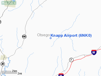
Location & QuickFacts
| FAA Information Effective: | 2008-09-25 |
| Airport Identifier: | 6NK0 |
| Airport Status: | Operational |
| Longitude/Latitude: | 074-49-14.9900W/42-37-44.9800N
-74.820831/42.629161 (Estimated) |
| Elevation: | 1300 ft / 396.24 m (Estimated) |
| Land: | 4 acres |
| From nearest city: | 4 nautical miles N of Schenevus, NY |
| Location: | Otsego County, NY |
| Magnetic Variation: | 13W (1995) |
Owner & Manager
| Ownership: | Privately owned |
| Owner: | Frederick D Knapp |
| Address: | Box 74 Rr#1
Schenevus, NY 12155-9705 |
| Phone number: | 607-638-5478 |
| Manager: | Frederick D Knapp |
| Address: | Box 74 Rr#1
Schenevus, NY 12155-9705 |
| Phone number: | 607-638-5478 |
Airport Operations and Facilities
| Airport Use: | Private |
| Wind indicator: | Yes |
| Segmented Circle: | No |
| Control Tower: | No |
| Sectional chart: | New York |
| Region: | AEA - Eastern |
| Boundary ARTCC: | ZBW - Boston |
| Tie-in FSS: | BUF - Buffalo |
| FSS Toll Free: | 1-800-WX-BRIEF |
Runway Information
Runway 02/20
| Dimension: | 1600 x 54 ft / 487.7 x 16.5 m |
| Surface: | TURF, |
| |
Runway 02 |
Runway 20 |
| Traffic Pattern: | Left | Left |
| Obstruction: | | 4 ft brush, 40.0 ft from runway |
|
Radio Navigation Aids
| ID |
Type |
Name |
Ch |
Freq |
Var |
Dist |
| JJH | NDB | Johnstown | | 523.00 | 14W | 31.0 nm |
| CJY | NDB | Clay | | 275.00 | 12W | 32.1 nm |
| HEU | NDB | Hunter | | 356.00 | 14W | 41.4 nm |
| BK | NDB | Plein | | 329.00 | 12W | 46.0 nm |
| GSS | TACAN | Griffiss | 057X | | 12W | 44.6 nm |
| RKA | VOR/DME | Rockdale | 073X | 112.60 | 11W | 21.0 nm |
| DNY | VOR/DME | De Lancey | 058X | 112.10 | 11W | 27.8 nm |
| HNK | VOR/DME | Hancock | 115X | 116.80 | 11W | 40.5 nm |
| UCA | VORTAC | Utica | 049X | 111.20 | 12W | 28.3 nm |
| GGT | VORTAC | Georgetown | 125X | 117.80 | 11W | 45.5 nm |
| ALB | VORTAC | Albany | 100X | 115.30 | 13W | 45.5 nm |
| ALB | VOT | Albany County | | 108.20 | | 44.7 nm |
Remarks
- PRVDD DAY/VFR OPNS ONLY, RY GRADED & LEVELED.
Images and information placed above are from
http://www.airport-data.com/airport/6NK0/
We thank them for the data!
| General Info
|
| Country |
United States
|
| State |
NEW YORK
|
| FAA ID |
6NK0
|
| Latitude |
42-37-44.980N
|
| Longitude |
074-49-14.990W
|
| Elevation |
1300 feet
|
| Near City |
SCHENEVUS
|
We don't guarantee the information is fresh and accurate. The data may
be wrong or outdated.
For more up-to-date information please refer to other sources.
|
|


