 |
|
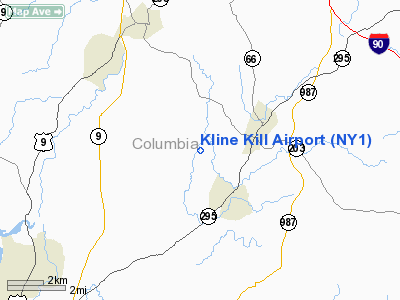
Location & QuickFacts
| FAA Information Effective: | 2008-09-25 |
| Airport Identifier: | NY1 |
| Airport Status: | Operational |
| Longitude/Latitude: | 073-38-13.4270W/42-21-00.3060N
-73.637063/42.350085 (Estimated) |
| Elevation: | 380 ft / 115.82 m (Estimated) |
| Land: | 25 acres |
| From nearest city: | 2 nautical miles N of Ghent, NY |
| Location: | Columbia County, NY |
| Magnetic Variation: | 14W (1985) |
Owner & Manager
| Ownership: | Privately owned |
| Owner: | Kline Kill Flying Club Inc |
| Address: | Po Box 271
Chatham, NY 12037 |
| Phone number: | 518-392-2079
ALTN CTC FOR ARPT CONDS CALL FELIX GARDINIA AT (518) 392-2438. |
| Manager: | Jeff Dupier |
| Address: | Po Box 271
Chatham, NY 12037 |
| Phone number: | 518-392-0509 |
Airport Operations and Facilities
| Airport Use: | Open to public |
| Wind indicator: | Yes |
| Segmented Circle: | No |
| Control Tower: | No |
| Landing fee charge: | No |
| Sectional chart: | New York |
| Region: | AEA - Eastern |
| Boundary ARTCC: | ZBW - Boston |
| Tie-in FSS: | BTV - Burlington |
| FSS on Airport: | No |
| FSS Toll Free: | 1-800-WX-BRIEF |
| NOTAMs Facility: | BTV (NOTAM-d service avaliable) |
Airport Communications
Airport Services
| Airframe Repair: | MAJOR |
| Power Plant Repair: | MAJOR |
| Bottled Oxygen: | NONE |
| Bulk Oxygen: | NONE |
Runway Information
Runway 01/19
| Dimension: | 4000 x 75 ft / 1219.2 x 22.9 m |
| Surface: | TURF, Good Condition |
| |
Runway 01 |
Runway 19 |
| Traffic Pattern: | Left | Left |
| Obstruction: | 40 ft trees, 20.0 ft from runway | 16 ft road, 20.0 ft from runway, 1:1 slope to clear |
|
Radio Navigation Aids
| ID |
Type |
Name |
Ch |
Freq |
Var |
Dist |
| GBR | FAN MARKER | Sheffield | | | 13W | 18.1 nm |
| PSF | FAN MARKER | Abyss | | | 13W | 19.8 nm |
| PFH | NDB | Philmont | | 272.00 | 13W | 7.0 nm |
| GBR | NDB | Great Barrington | | 395.00 | 14W | 14.4 nm |
| DXT | NDB | Dalton | | 370.00 | 15W | 22.0 nm |
| HEU | NDB | Hunter | | 356.00 | 14W | 33.0 nm |
| VWD | NDB | Mount Snow | | 224.00 | 15W | 48.7 nm |
| PO | NDB | Meier | | 403.00 | 12W | 48.8 nm |
| JJH | NDB | Johnstown | | 523.00 | 14W | 49.7 nm |
| CTR | VOR/DME | Chester | 098X | 115.10 | 13W | 30.8 nm |
| PWL | VOR/DME | Pawling | 090X | 114.30 | 12W | 34.9 nm |
| CAM | VOR/DME | Cambridge | 097X | 115.00 | 14W | 40.8 nm |
| IGN | VOR/DME | Kingston | 123X | 117.60 | 12W | 42.0 nm |
| ALB | VORTAC | Albany | 100X | 115.30 | 13W | 25.0 nm |
| BAF | VORTAC | Barnes | 077X | 113.00 | 14W | 42.5 nm |
| BDL | VORTAC | Bradley | 027X | 109.00 | 14W | 48.9 nm |
| ALB | VOT | Albany County | | 108.20 | | 25.0 nm |
| BDL | VOT | Bradley Intl | | 111.40 | | 49.2 nm |
Remarks
- UNMKD TURF AREA ADJ TO RY MAY BE USED FOR TWY ON NORTH & SOUTH ENDS. TURF GRADES NEAR SOUTH PAVED APRON UNSUITABLE FOR ACFT MOVEMENT.
Images and information placed above are from
http://www.airport-data.com/airport/NY1/
We thank them for the data!
| General Info
|
| Country |
United States
|
| State |
NEW YORK
|
| FAA ID |
NY1
|
| Latitude |
42-21-00.306N
|
| Longitude |
073-38-13.427W
|
| Elevation |
380 feet
|
| Near City |
GHENT
|
We don't guarantee the information is fresh and accurate. The data may
be wrong or outdated.
For more up-to-date information please refer to other sources.
|
|


